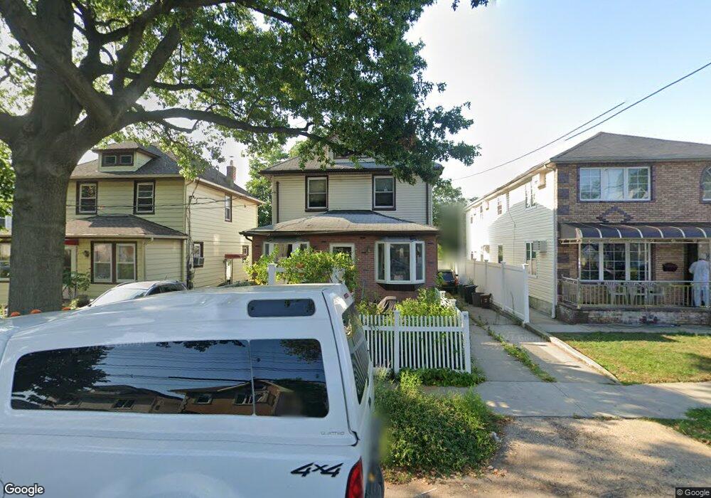
22217 Davenport Ave Queens Village, NY 11428
Queens Village NeighborhoodEstimated Value: $1,064,000 - $1,481,000
--
Bed
--
Bath
2,150
Sq Ft
$565/Sq Ft
Est. Value
About This Home
This home is located at 22217 Davenport Ave, Queens Village, NY 11428 and is currently estimated at $1,215,306, approximately $565 per square foot. 22217 Davenport Ave is a home located in Queens County with nearby schools including Independence Elementary School, P.S. 33 Edward M. Funk, and Jean Nuzzi Intermediate School.
Ownership History
Date
Name
Owned For
Owner Type
Purchase Details
Closed on
Apr 26, 2024
Sold by
Kingsland 786 Llc
Bought by
Wong Ming Ming
Current Estimated Value
Purchase Details
Closed on
Jul 27, 2023
Sold by
Furman Theodore
Bought by
Kingsland 786 Llc
Purchase Details
Closed on
Oct 27, 2010
Sold by
Furman Teresita and Furman Theodore P
Bought by
Furman Theodore
Create a Home Valuation Report for This Property
The Home Valuation Report is an in-depth analysis detailing your home's value as well as a comparison with similar homes in the area
Home Values in the Area
Average Home Value in this Area
Purchase History
| Date | Buyer | Sale Price | Title Company |
|---|---|---|---|
| Wong Ming Ming | $1,262,630 | -- | |
| Wong Ming Ming | $1,262,630 | -- | |
| Wong Ming Ming | $1,262,630 | -- | |
| Kingsland 786 Llc | $560,000 | -- | |
| Kingsland 786 Llc | $560,000 | -- | |
| Kingsland 786 Llc | $560,000 | -- | |
| Furman Theodore | -- | -- | |
| Furman Theodore | -- | -- |
Source: Public Records
Tax History Compared to Growth
Tax History
| Year | Tax Paid | Tax Assessment Tax Assessment Total Assessment is a certain percentage of the fair market value that is determined by local assessors to be the total taxable value of land and additions on the property. | Land | Improvement |
|---|---|---|---|---|
| 2025 | $6,189 | $43,174 | $9,722 | $33,452 |
| 2024 | $6,189 | $30,815 | $8,747 | $22,068 |
| 2023 | $5,839 | $29,071 | $8,245 | $20,826 |
| 2022 | $5,475 | $43,080 | $13,800 | $29,280 |
| 2021 | $5,446 | $40,020 | $13,800 | $26,220 |
| 2020 | $5,478 | $36,540 | $13,800 | $22,740 |
| 2019 | $5,371 | $33,120 | $13,800 | $19,320 |
| 2018 | $4,938 | $24,226 | $10,395 | $13,831 |
| 2017 | $4,659 | $22,856 | $9,506 | $13,350 |
| 2016 | $4,311 | $22,856 | $9,506 | $13,350 |
| 2015 | $2,381 | $21,565 | $10,868 | $10,697 |
| 2014 | $2,381 | $21,400 | $12,931 | $8,469 |
Source: Public Records
Map
Nearby Homes
- 22235 Davenport Ave
- 224-11 Edmore Ave
- 22417 Fairbury Ave
- 224-30 Edmore Ave
- 224-27 Fairbury Ave
- 237-12 92nd Rd
- 8948 Pontiac St
- 22114 Fairbury Ave
- 222-26 93rd Ave
- 8922 Moline St
- 22258 Braddock Ave
- 222-89 Braddock Ave Unit 4B
- 222-89 Braddock Ave Unit 2-E
- 222-89 Braddock Ave Unit 1G
- 222-89 Braddock Ave Unit 5A
- 222-89 Braddock Ave Unit 6-D
- 221-18 91st Rd
- 220-46 93rd Rd
- 22018 91st Rd
- 8830 Pontiac St Unit 2 Family
- 222-17 Davenport Ave
- 22219 Davenport Ave
- 22219 Davenport Ave
- 22215 Davenport Ave
- 22223 Davenport Ave
- 22216 92nd Rd
- 22218 92nd Rd
- 22214 92nd Rd
- 9235 222nd St
- 222-22 92nd Rd
- 22222 92nd Rd
- 9231 222nd St
- 9239 222nd St
- 22225 Davenport Ave
- 22225 Davenport Ave Unit 1
- 22210 92nd Rd
- 22225 Davenport Ave
- 22228 92nd Rd
- 22206 92nd Rd
- 222-12 Davenport Ave