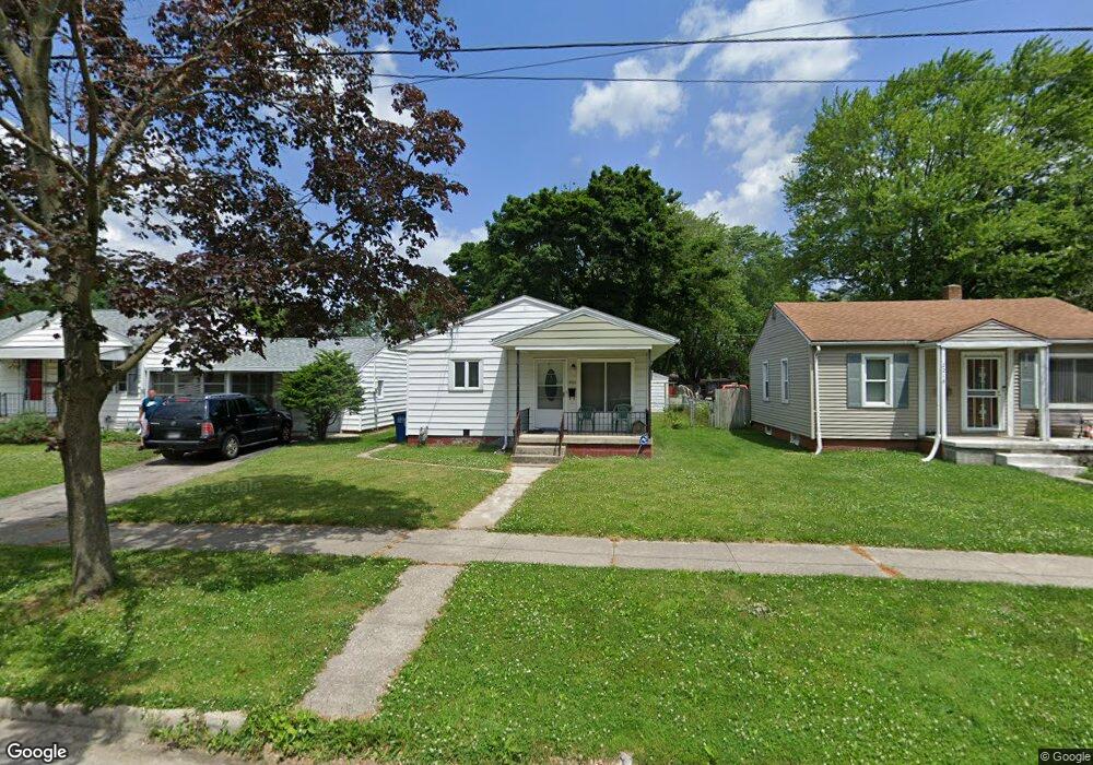
2222 Dunham St Toledo, OH 43609
Southside NeighborhoodEstimated Value: $39,000 - $86,000
2
Beds
1
Bath
925
Sq Ft
$72/Sq Ft
Est. Value
About This Home
This home is located at 2222 Dunham St, Toledo, OH 43609 and is currently estimated at $66,205, approximately $71 per square foot. 2222 Dunham St is a home located in Lucas County with nearby schools including Burroughs Elementary School, Bowsher High School, and Explorers Academy of Science and Technology.
Ownership History
Date
Name
Owned For
Owner Type
Purchase Details
Closed on
Jul 22, 2013
Sold by
Moll Doug
Bought by
Young Cheryl
Current Estimated Value
Purchase Details
Closed on
Sep 28, 2011
Sold by
Plymouth Park Tax Services Llc
Bought by
Young Cheryl and Moll Doug
Purchase Details
Closed on
Sep 14, 2010
Sold by
Abramczyk Mark
Bought by
Plymouth Park Tax Services Llc
Purchase Details
Closed on
Feb 22, 2002
Sold by
Majewski Michael A
Bought by
Abramczyk Mark
Purchase Details
Closed on
Jul 2, 1991
Sold by
Bowers Alice L
Purchase Details
Closed on
Jul 11, 1990
Sold by
Bowers Alice L
Create a Home Valuation Report for This Property
The Home Valuation Report is an in-depth analysis detailing your home's value as well as a comparison with similar homes in the area
Home Values in the Area
Average Home Value in this Area
Purchase History
| Date | Buyer | Sale Price | Title Company |
|---|---|---|---|
| Young Cheryl | -- | None Available | |
| Young Cheryl | $10,000 | Chicago Title | |
| Plymouth Park Tax Services Llc | $13,972 | None Available | |
| Abramczyk Mark | $65,000 | -- | |
| -- | $40,000 | -- | |
| -- | -- | -- |
Source: Public Records
Tax History Compared to Growth
Tax History
| Year | Tax Paid | Tax Assessment Tax Assessment Total Assessment is a certain percentage of the fair market value that is determined by local assessors to be the total taxable value of land and additions on the property. | Land | Improvement |
|---|---|---|---|---|
| 2024 | $333 | $7,735 | $6,090 | $1,645 |
| 2023 | $723 | $8,470 | $2,940 | $5,530 |
| 2022 | $713 | $8,470 | $2,940 | $5,530 |
| 2021 | $692 | $8,470 | $2,940 | $5,530 |
| 2020 | $744 | $7,805 | $2,695 | $5,110 |
| 2019 | $719 | $7,805 | $2,695 | $5,110 |
| 2018 | $713 | $7,805 | $2,695 | $5,110 |
| 2017 | $519 | $4,445 | $3,500 | $945 |
| 2016 | $499 | $12,700 | $10,000 | $2,700 |
| 2015 | $464 | $12,700 | $10,000 | $2,700 |
| 2014 | $288 | $4,450 | $3,500 | $950 |
| 2013 | $288 | $4,450 | $3,500 | $950 |
Source: Public Records
Map
Nearby Homes
- 304 Mayberry St
- 321 Mayberry St
- 2126 Airport Hwy
- 226 Somerset St
- 221 Somerset St
- 440 Somerset St
- 556 Apple Ave
- 224 S Fearing Blvd
- 531 Shasta Dr
- 142 S Detroit Ave
- 576 Bronx Dr
- 512 Woodsdale Ave
- 140 Whiting Ave
- 1754 Finch St
- 1777 South Ave
- 710 Durango Dr
- 649 Wright Ave
- 2828 South Ave
- 705 Wright Ave
- 885 National Ave
- 2218 Dunham St
- 2230 Dunham St
- 2216 Dunham St
- 2234 Dunham St
- 2212 Dunham St
- 2238 Dunham St
- 2208 Dunham St
- 2227 Airline Ave
- 2217 Dunham St
- 2219 Dunham St
- 2235 Airline Ave
- 2215 Airline Ave
- 2239 Airline Ave
- 2221 Dunham St
- 2225 Dunham St
- 2204 Dunham St
- 2231 Dunham St
- 2215 Dunham St
- 2245 Airline Ave
- 139 Kenmore Ave