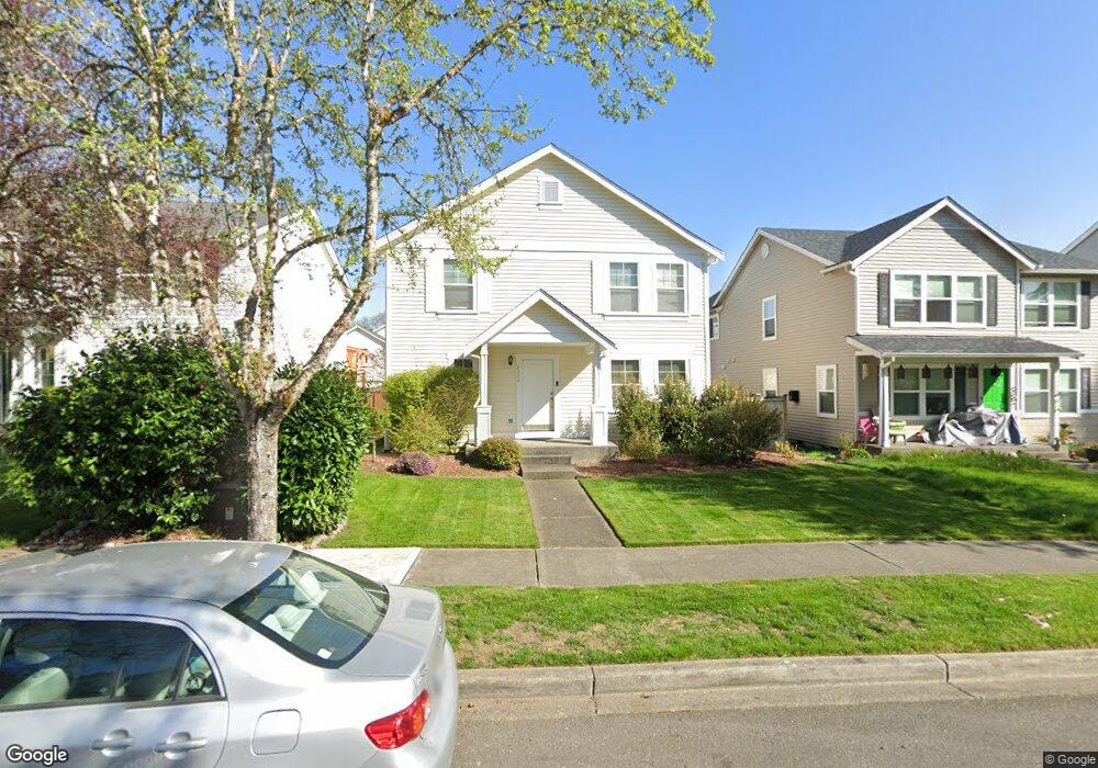
2222 Forrest St Dupont, WA 98327
Estimated Value: $549,155 - $596,000
3
Beds
3
Baths
2,085
Sq Ft
$274/Sq Ft
Est. Value
About This Home
This home is located at 2222 Forrest St, Dupont, WA 98327 and is currently estimated at $571,039, approximately $273 per square foot. 2222 Forrest St is a home located in Pierce County with nearby schools including Chloe Clark Elementary School, Saltars Point Elementary School, and Pioneer Middle School.
Ownership History
Date
Name
Owned For
Owner Type
Purchase Details
Closed on
Mar 20, 2000
Sold by
The Quadrant Corp
Bought by
Richards George A and Richards Gwendolyn M
Current Estimated Value
Home Financials for this Owner
Home Financials are based on the most recent Mortgage that was taken out on this home.
Original Mortgage
$182,437
Outstanding Balance
$62,052
Interest Rate
8.34%
Mortgage Type
VA
Estimated Equity
$508,987
Create a Home Valuation Report for This Property
The Home Valuation Report is an in-depth analysis detailing your home's value as well as a comparison with similar homes in the area
Home Values in the Area
Average Home Value in this Area
Purchase History
| Date | Buyer | Sale Price | Title Company |
|---|---|---|---|
| Richards George A | $208,085 | Chicago Title |
Source: Public Records
Mortgage History
| Date | Status | Borrower | Loan Amount |
|---|---|---|---|
| Open | Richards George A | $182,437 |
Source: Public Records
Tax History Compared to Growth
Tax History
| Year | Tax Paid | Tax Assessment Tax Assessment Total Assessment is a certain percentage of the fair market value that is determined by local assessors to be the total taxable value of land and additions on the property. | Land | Improvement |
|---|---|---|---|---|
| 2025 | $3,768 | $520,000 | $218,500 | $301,500 |
| 2024 | $3,768 | $496,400 | $210,500 | $285,900 |
| 2023 | $3,768 | $468,200 | $199,300 | $268,900 |
| 2022 | $3,739 | $476,300 | $199,300 | $277,000 |
| 2021 | $3,565 | $354,000 | $126,600 | $227,400 |
| 2019 | $3,163 | $321,900 | $105,500 | $216,400 |
| 2018 | $3,401 | $309,300 | $105,500 | $203,800 |
| 2017 | $3,051 | $291,300 | $90,400 | $200,900 |
| 2016 | $2,912 | $261,400 | $76,300 | $185,100 |
| 2014 | $2,796 | $258,700 | $76,300 | $182,400 |
| 2013 | $2,796 | $239,900 | $78,000 | $161,900 |
Source: Public Records
Map
Nearby Homes
- 2237 Tolmie St
- 2176 Palisade Blvd Unit F-3
- 2176 McDonald Ave
- 2147 Hammond Ave Unit B10
- 1373 Hudson St Unit 1373
- 1331 Rowan Ct Unit 1331
- 1285 Griggs St
- 1263 Hudson St
- 2699 Erwin Ave Unit 2699
- 1607 Kincaid St Unit E-8
- 1856 Spencer Ct Unit 12F
- 1680 Kennedy Place Unit A4
- 2055 Garry Oaks Ave Unit B
- 1975 Garry Oaks Ave Unit C
- 605 Louviers Ave
- 504 Dupont Ave
- 2420 Simmons St Unit B
- 403 Louviers Ave
- 205 Brandywine Ave
- 3114 Walker Rd
- 2224 Forrest St
- 2220 Forrest St
- 2228 Forrest St
- 2216 Forrest St
- 2221 Tolmie St
- 2238 Forrest St
- 2223 Tolmie St
- 2219 Forrest St
- 2223 Forrest St
- 2215 Tolmie St
- 2227 Tolmie St
- 2215 Forrest St
- 2227 Forrest St
- 2240 Forrest St
- 2419 Tolmie Ave
- 2429 Tolmie Ave
- 2439 Tolmie Ave
- 2239 Tolmie St
- 2449 Tolmie Ave
- 2237 Forrest St