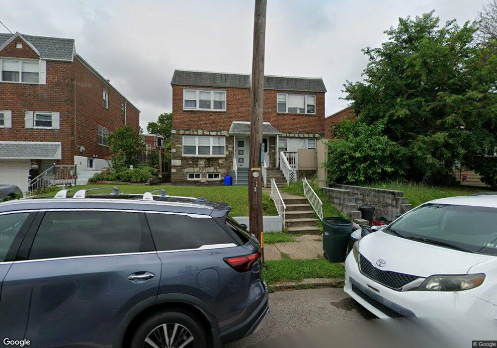
2222 Napfle St Philadelphia, PA 19152
Rhawnhurst NeighborhoodEstimated Value: $300,000 - $389,000
--
Bed
--
Bath
1,452
Sq Ft
$231/Sq Ft
Est. Value
About This Home
This home is located at 2222 Napfle St, Philadelphia, PA 19152 and is currently estimated at $335,969, approximately $231 per square foot. 2222 Napfle St is a home with nearby schools including Rhawnhurst School, Castor Gardens Middle School, and Northeast High School.
Ownership History
Date
Name
Owned For
Owner Type
Purchase Details
Closed on
Aug 5, 2014
Sold by
Rhode Maria
Bought by
Zaltsberg Igor and Zaltsberg Ilona
Current Estimated Value
Purchase Details
Closed on
Jun 25, 2004
Sold by
Panunto Michael A and Panunto Josephine
Bought by
Rhode Maria
Home Financials for this Owner
Home Financials are based on the most recent Mortgage that was taken out on this home.
Original Mortgage
$108,000
Interest Rate
5.75%
Mortgage Type
Commercial
Create a Home Valuation Report for This Property
The Home Valuation Report is an in-depth analysis detailing your home's value as well as a comparison with similar homes in the area
Home Values in the Area
Average Home Value in this Area
Purchase History
| Date | Buyer | Sale Price | Title Company |
|---|---|---|---|
| Zaltsberg Igor | $149,700 | None Available | |
| Rhode Maria | $135,000 | First American Title Ins Co |
Source: Public Records
Mortgage History
| Date | Status | Borrower | Loan Amount |
|---|---|---|---|
| Previous Owner | Rhode Maria | $108,000 |
Source: Public Records
Tax History Compared to Growth
Tax History
| Year | Tax Paid | Tax Assessment Tax Assessment Total Assessment is a certain percentage of the fair market value that is determined by local assessors to be the total taxable value of land and additions on the property. | Land | Improvement |
|---|---|---|---|---|
| 2025 | $3,617 | $374,700 | $74,940 | $299,760 |
| 2024 | $3,617 | $374,700 | $74,940 | $299,760 |
| 2023 | $3,617 | $258,400 | $51,680 | $206,720 |
| 2022 | $2,625 | $258,400 | $51,680 | $206,720 |
| 2021 | $2,625 | $0 | $0 | $0 |
| 2020 | $2,625 | $0 | $0 | $0 |
| 2019 | $2,458 | $0 | $0 | $0 |
| 2018 | $2,370 | $0 | $0 | $0 |
| 2017 | $2,370 | $0 | $0 | $0 |
| 2016 | $2,370 | $0 | $0 | $0 |
| 2015 | $2,269 | $0 | $0 | $0 |
| 2014 | -- | $169,300 | $43,107 | $126,193 |
| 2012 | -- | $24,768 | $3,994 | $20,774 |
Source: Public Records
Map
Nearby Homes
- 7815 Horrocks St
- 2120 Napfle St
- 2023 Hartel Ave
- 2123 Loney St
- 1919 Lansing St
- 2301 Ripley St
- 7525 Calvert St
- 7521 Calvert St
- 7722 Fairfield St
- 2029 Loney St
- 2302 Rhawn St
- 2345 Ripley St
- 7414 Castor Ave
- 2547 Shelmire Ave
- 1917 Griffith St
- 7528 Loretto Ave
- 1834 Lansing St
- 1826 Hartel Ave
- 1824 Afton St
- 1821 Afton St
- 2220 Napfle St
- 2224 Napfle St
- 2220 Napfle Ave Unit 2
- 2220 Napfle Ave Unit 1
- 2218 Napfle St
- 2226 Napfle St
- 2216 Napfle St
- 2228 Napfle St
- 2230 Napfle St
- 2235 Afton St
- 2214 Napfle St
- 2237 Afton St
- 2231 Afton St Unit 33
- 2239 Afton St
- 2232 Napfle St
- 2241 Afton St
- 2227 Afton St
- 2212 Napfle St
- 2234 Napfle St
- 2243 Afton St