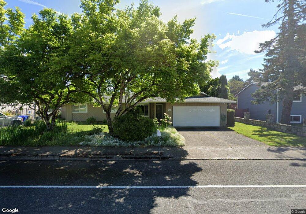
2222 NW 217th Ave Gresham, OR 97030
North Central NeighborhoodEstimated Value: $431,000 - $455,000
3
Beds
2
Baths
1,334
Sq Ft
$330/Sq Ft
Est. Value
About This Home
This home is located at 2222 NW 217th Ave, Gresham, OR 97030 and is currently estimated at $440,384, approximately $330 per square foot. 2222 NW 217th Ave is a home located in Multnomah County with nearby schools including North Gresham Elementary School, Clear Creek Middle School, and Gresham High School.
Ownership History
Date
Name
Owned For
Owner Type
Purchase Details
Closed on
May 2, 2008
Sold by
Pheister Bradley R
Bought by
Pheister Bradley R and Pheister Desiree L M
Current Estimated Value
Home Financials for this Owner
Home Financials are based on the most recent Mortgage that was taken out on this home.
Original Mortgage
$172,500
Outstanding Balance
$108,299
Interest Rate
5.8%
Mortgage Type
Stand Alone Refi Refinance Of Original Loan
Estimated Equity
$332,085
Purchase Details
Closed on
Apr 28, 2005
Sold by
Bost Gregory Alan
Bought by
Pheister Bradley R
Home Financials for this Owner
Home Financials are based on the most recent Mortgage that was taken out on this home.
Original Mortgage
$96,000
Interest Rate
5.99%
Mortgage Type
Fannie Mae Freddie Mac
Create a Home Valuation Report for This Property
The Home Valuation Report is an in-depth analysis detailing your home's value as well as a comparison with similar homes in the area
Home Values in the Area
Average Home Value in this Area
Purchase History
| Date | Buyer | Sale Price | Title Company |
|---|---|---|---|
| Pheister Bradley R | -- | Security Title | |
| Pheister Bradley R | $187,000 | Fidelity Natl Title Co Of Or |
Source: Public Records
Mortgage History
| Date | Status | Borrower | Loan Amount |
|---|---|---|---|
| Open | Pheister Bradley R | $172,500 | |
| Closed | Pheister Bradley R | $96,000 |
Source: Public Records
Tax History
| Year | Tax Paid | Tax Assessment Tax Assessment Total Assessment is a certain percentage of the fair market value that is determined by local assessors to be the total taxable value of land and additions on the property. | Land | Improvement |
|---|---|---|---|---|
| 2025 | $4,349 | $213,690 | -- | -- |
| 2024 | $4,163 | $207,470 | -- | -- |
| 2023 | $4,163 | $201,430 | -- | -- |
| 2022 | $3,687 | $195,570 | $0 | $0 |
| 2021 | $3,594 | $189,880 | $0 | $0 |
| 2020 | $3,381 | $184,350 | $0 | $0 |
| 2019 | $3,293 | $178,990 | $0 | $0 |
| 2018 | $3,140 | $173,780 | $0 | $0 |
| 2017 | $3,012 | $168,720 | $0 | $0 |
| 2016 | $2,656 | $163,810 | $0 | $0 |
| 2015 | $2,599 | $159,040 | $0 | $0 |
| 2014 | $2,535 | $154,410 | $0 | $0 |
Source: Public Records
Map
Nearby Homes
- 21033 SE Clay Ct
- 21532 SE Alder St
- 1035 SE 225th Ave
- 54 NW 13th St
- 21400 SE Stark St Unit 2
- 2013 NW Bella Vista Dr
- 1811 NW 19th St
- 21260 SE Stark St
- 21016 SE Stark St Unit 71
- 21016 SE Stark St Unit 69
- 349 NE 18th St
- 994 NW Wallula Ave
- 2730 NE Roberts Ave
- 450 NE 22nd St
- 21525 SE Oak St
- 1783 1791 NE Beech Place
- 1861 NW Wonderview Ave
- 210 SE 218th Ave
- 1325 NW 9th St
- 1596 NW Riverview Ave
- 2218 NW 217th Ave
- 2234 NW 217th Ave
- 2235 NW Norman Ave
- 2229 NW Norman Ave
- 1417 SE 217th Ave
- 2243 NW Norman Ave
- 2246 NW 217th Ave
- 1371 SE 217th Ave
- 621 NW Fariss Rd
- 1443 SE 217th Ave
- 2301 NW Norman Ave
- 21658 SE Main St
- 2219 NW Norman Ave
- 21643 SE Fariss Rd Unit 2
- 21643 SE Fariss Rd Unit 21645
- 2306 NW 217th Ave
- 609 NW Fariss Rd
- 2317 NW Norman Ave
- 1414 SE 216th Ave
- 21644 SE Main St
Your Personal Tour Guide
Ask me questions while you tour the home.