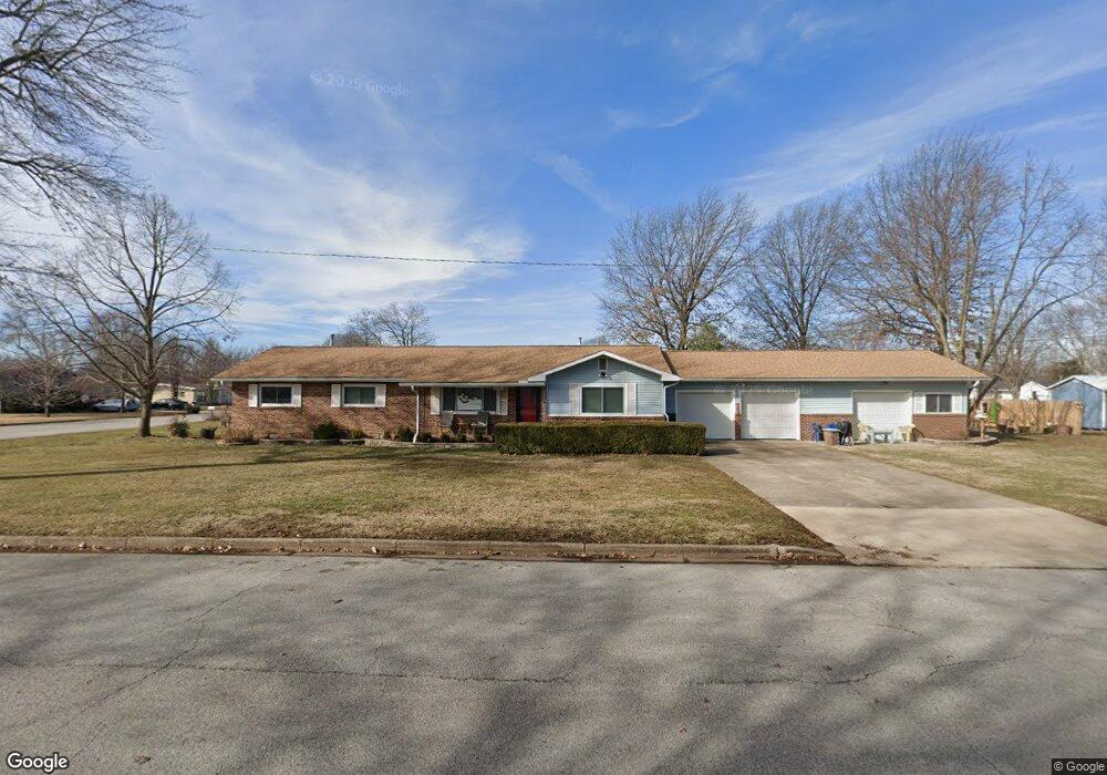
2223 Grover St Carthage, MO 64836
Estimated Value: $198,000 - $248,000
3
Beds
2
Baths
1,763
Sq Ft
$129/Sq Ft
Est. Value
About This Home
This home is located at 2223 Grover St, Carthage, MO 64836 and is currently estimated at $227,681, approximately $129 per square foot. 2223 Grover St is a home located in Jasper County with nearby schools including Carthage High School, St. Ann's Catholic School, and Victory Academy.
Ownership History
Date
Name
Owned For
Owner Type
Purchase Details
Closed on
Aug 29, 2013
Sold by
Endicott Jacob R and Endicott Rebecca A
Bought by
Beckett Larry R and Beckett Iris A
Current Estimated Value
Purchase Details
Closed on
Jul 19, 2006
Sold by
Raschke Harry M
Bought by
Endicott Jacob R and Endicott Rebecca A
Home Financials for this Owner
Home Financials are based on the most recent Mortgage that was taken out on this home.
Original Mortgage
$94,400
Interest Rate
6.6%
Mortgage Type
Purchase Money Mortgage
Create a Home Valuation Report for This Property
The Home Valuation Report is an in-depth analysis detailing your home's value as well as a comparison with similar homes in the area
Home Values in the Area
Average Home Value in this Area
Purchase History
| Date | Buyer | Sale Price | Title Company |
|---|---|---|---|
| Beckett Larry R | -- | None Available | |
| Endicott Jacob R | -- | Jct |
Source: Public Records
Mortgage History
| Date | Status | Borrower | Loan Amount |
|---|---|---|---|
| Previous Owner | Endicott Jacob R | $94,400 |
Source: Public Records
Tax History Compared to Growth
Tax History
| Year | Tax Paid | Tax Assessment Tax Assessment Total Assessment is a certain percentage of the fair market value that is determined by local assessors to be the total taxable value of land and additions on the property. | Land | Improvement |
|---|---|---|---|---|
| 2025 | $1,259 | $27,380 | $4,450 | $22,930 |
| 2024 | $1,259 | $24,450 | $4,450 | $20,000 |
| 2023 | $1,259 | $24,450 | $4,450 | $20,000 |
| 2022 | $1,261 | $24,570 | $4,450 | $20,120 |
| 2021 | $1,247 | $24,570 | $4,450 | $20,120 |
| 2020 | $1,208 | $22,820 | $4,450 | $18,370 |
| 2019 | $1,211 | $22,820 | $4,450 | $18,370 |
| 2018 | $1,044 | $19,740 | $0 | $0 |
| 2017 | $1,047 | $19,740 | $0 | $0 |
| 2016 | $1,044 | $19,740 | $0 | $0 |
| 2015 | $869 | $17,680 | $0 | $0 |
| 2014 | $869 | $17,790 | $0 | $0 |
Source: Public Records
Map
Nearby Homes
- 2141 Carrie St
- 1004 Gene Taylor Dr
- 909 Durward Hall Dr
- 837 Modern Way
- 839 Modern Way
- 1211 E Airport Dr
- NE COR Airport Dr & River
- 1341 E Airport Dr
- 739 Sheridan St
- 1922 Southwood Ln
- 1106 Southern Hills
- TBD Lexie Ln
- 1823 S River St
- 2206 Benjamin Dr
- 1743 S River St
- 1431 Quail Place
- 619 Belle Air Place
- 1131 Belle Air Place
- 2512 Holman Ct
- 1320 Belle Air Place