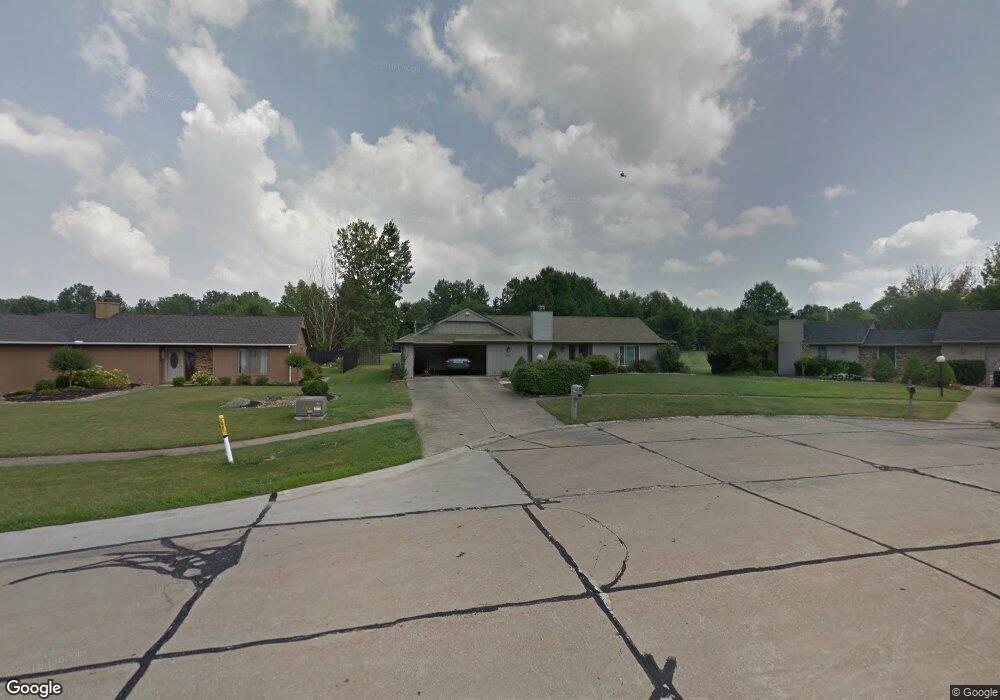
22236 Rock Creek Cir Strongsville, OH 44149
Estimated Value: $331,166 - $377,000
3
Beds
3
Baths
2,014
Sq Ft
$174/Sq Ft
Est. Value
About This Home
This home is located at 22236 Rock Creek Cir, Strongsville, OH 44149 and is currently estimated at $349,792, approximately $173 per square foot. 22236 Rock Creek Cir is a home located in Cuyahoga County with nearby schools including Strongsville High School, St Mary School, and Sts Joseph & John Interparochial School.
Ownership History
Date
Name
Owned For
Owner Type
Purchase Details
Closed on
Apr 14, 1994
Sold by
Parker David A
Bought by
Amin Mehdi M
Current Estimated Value
Purchase Details
Closed on
Mar 16, 1990
Sold by
Krute Richard J
Bought by
Parker David A
Purchase Details
Closed on
May 3, 1984
Sold by
Krute Richard J
Bought by
Krute Richard J
Purchase Details
Closed on
Dec 5, 1983
Bought by
Krute Richard J
Purchase Details
Closed on
Jul 10, 1978
Sold by
Schmitt Robert F
Bought by
Bob Schmitt Homes Inc
Purchase Details
Closed on
Jun 20, 1978
Bought by
Schmitt Robert F
Purchase Details
Closed on
Jan 1, 1978
Bought by
Bob Schmitt Homes Inc
Create a Home Valuation Report for This Property
The Home Valuation Report is an in-depth analysis detailing your home's value as well as a comparison with similar homes in the area
Home Values in the Area
Average Home Value in this Area
Purchase History
| Date | Buyer | Sale Price | Title Company |
|---|---|---|---|
| Amin Mehdi M | $136,900 | -- | |
| Parker David A | $122,000 | -- | |
| Krute Richard J | -- | -- | |
| Krute Richard J | $91,000 | -- | |
| Bob Schmitt Homes Inc | -- | -- | |
| Schmitt Robert F | -- | -- | |
| Bob Schmitt Homes Inc | -- | -- |
Source: Public Records
Tax History Compared to Growth
Tax History
| Year | Tax Paid | Tax Assessment Tax Assessment Total Assessment is a certain percentage of the fair market value that is determined by local assessors to be the total taxable value of land and additions on the property. | Land | Improvement |
|---|---|---|---|---|
| 2024 | $4,157 | $98,350 | $20,510 | $77,840 |
| 2023 | $4,118 | $74,940 | $17,890 | $57,050 |
| 2022 | $4,114 | $74,940 | $17,890 | $57,050 |
| 2021 | $4,082 | $74,940 | $17,890 | $57,050 |
| 2020 | $3,972 | $65,730 | $15,680 | $50,050 |
| 2019 | $3,856 | $187,800 | $44,800 | $143,000 |
| 2018 | $3,499 | $65,730 | $15,680 | $50,050 |
| 2017 | $3,481 | $61,220 | $13,970 | $47,250 |
| 2016 | $3,453 | $61,220 | $13,970 | $47,250 |
| 2015 | $3,383 | $61,220 | $13,970 | $47,250 |
| 2014 | $3,383 | $59,440 | $13,550 | $45,890 |
Source: Public Records
Map
Nearby Homes
- 22300 Rock Creek Cir
- 0 Priem Rd
- 9829 Plum Brook Ln
- 9598 Pebble Brook Ln
- 10353 Oak Branch Trail
- 10842 Fence Row Dr
- 10824 Watercress Rd
- 10001 N Marks Rd
- 11030 Southwind Ct
- 10800 Meadow Trail
- 8746 Barton Dr
- 21292 Creekside Dr
- 8902 Lincolnshire Blvd
- 21176 Hickory Branch Trail
- 9384 N Marks Rd
- 21359 Briar Bush Ln
- 10839 Prospect Rd
- 8627 Courtland Dr
- 20684 Albion Rd
- 12515 Countryside Dr
- 22268 Rock Creek Cir
- 22214 Rock Creek Cir
- 10021 Plum Brook Ln
- 22209 Rock Creek Cir
- 22243 Rock Creek Cir
- 22287 Rock Creek Cir
- 22221 Rock Creek Cir
- 9989 Plum Brook Ln
- 22309 Rock Creek Cir
- 22342 Rock Creek Cir
- 22194 Meadownorth Ct
- 22182 Meadownorth Ct
- 22170 Meadownorth Ct
- 9957 Plum Brook Ln
- 22331 Rock Creek Cir
- 22206 Meadownorth Ct
- 22158 Meadownorth Ct
- 22134 Meadownorth Ct
- 22364 Rock Creek Cir
- 22230 Meadownorth Ct