Estimated Value: $190,251 - $218,000
3
Beds
2
Baths
1,118
Sq Ft
$187/Sq Ft
Est. Value
About This Home
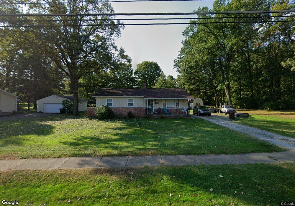
This home is located at 2224 Arndale Rd, Stow, OH 44224 and is currently estimated at $208,813, approximately $186 per square foot. 2224 Arndale Rd is a home located in Summit County with nearby schools including Stow-Munroe Falls High School and Holy Family Elementary School.
Ownership History
Date
Name
Owned For
Owner Type
Purchase Details
Closed on
Aug 28, 1995
Sold by
Parks Janice M
Bought by
Hrusovsky Michael and Hrusovsky Janet L
Current Estimated Value
Home Financials for this Owner
Home Financials are based on the most recent Mortgage that was taken out on this home.
Original Mortgage
$94,121
Interest Rate
7.43%
Mortgage Type
FHA
Purchase Details
Closed on
Feb 28, 1995
Sold by
Eckenwiler Paula L
Bought by
Parks Janice M and Owen Benjamin H
Create a Home Valuation Report for This Property
The Home Valuation Report is an in-depth analysis detailing your home's value as well as a comparison with similar homes in the area
Home Values in the Area
Average Home Value in this Area
Purchase History
| Date | Buyer | Sale Price | Title Company |
|---|---|---|---|
| Hrusovsky Michael | $95,000 | -- | |
| Parks Janice M | $90,000 | -- |
Source: Public Records
Mortgage History
| Date | Status | Borrower | Loan Amount |
|---|---|---|---|
| Previous Owner | Hrusovsky Michael | $94,121 |
Source: Public Records
Tax History Compared to Growth
Tax History
| Year | Tax Paid | Tax Assessment Tax Assessment Total Assessment is a certain percentage of the fair market value that is determined by local assessors to be the total taxable value of land and additions on the property. | Land | Improvement |
|---|---|---|---|---|
| 2025 | $2,863 | $49,134 | $8,803 | $40,331 |
| 2024 | $2,863 | $49,134 | $8,803 | $40,331 |
| 2023 | $2,863 | $49,134 | $8,803 | $40,331 |
| 2022 | $2,564 | $38,805 | $6,930 | $31,875 |
| 2021 | $2,305 | $38,805 | $6,930 | $31,875 |
| 2020 | $2,267 | $38,810 | $6,930 | $31,880 |
| 2019 | $2,514 | $40,350 | $6,930 | $33,420 |
| 2018 | $2,475 | $40,350 | $6,930 | $33,420 |
| 2017 | $2,333 | $40,350 | $6,930 | $33,420 |
| 2016 | $2,398 | $36,890 | $6,930 | $29,960 |
| 2015 | $2,333 | $36,890 | $6,930 | $29,960 |
| 2014 | $2,335 | $36,890 | $6,930 | $29,960 |
| 2013 | $2,421 | $38,530 | $6,930 | $31,600 |
Source: Public Records
Map
Nearby Homes
- 2140 Woodlawn Cir Unit 2144
- 4903 Fishcreek Rd Unit 11B
- 2418 Wrens Dr S Unit G
- 2028 Willowdale Dr
- 0 Stow Rd Unit 5102979
- 1995 Willowdale Dr
- 2444 Port Charles Dr
- 4120 Klein Ave
- 2380 Port Williams Dr Unit 2380
- 4731 Haughton Ct
- 2327 Crockett Cir
- 1937 Leisure Ln
- 4901 Independence Cir Unit B
- 4131 Burton Dr
- 2043 Conwill Rd
- 4621 Graford Ln
- 1627 Cypress Ct
- 3961 Klein Ave
- 2140 Uniondale Dr
- 4917 Independence Cir Unit B
- 2234 Arndale Rd
- 2216 Arndale Rd
- 4410 Stow Rd
- 2213 Arndale Rd
- 4428 Stow Rd
- 2203 Arndale Rd
- 2211 Frankie Ln
- 2209 Frankie Ln
- 2190 Arndale Rd
- 2202 Frankie Ln
- 2204 Frankie Ln
- 2193 Arndale Rd
- 2182 Arndale Rd
- 4425 Stow Rd
- 4344 Stow Rd
- 4377 Stow Rd
- 2174 Arndale Rd
- 2181 Woodlawn Cir
- 2173 Woodlawn Cir
- 4447 Stow Rd