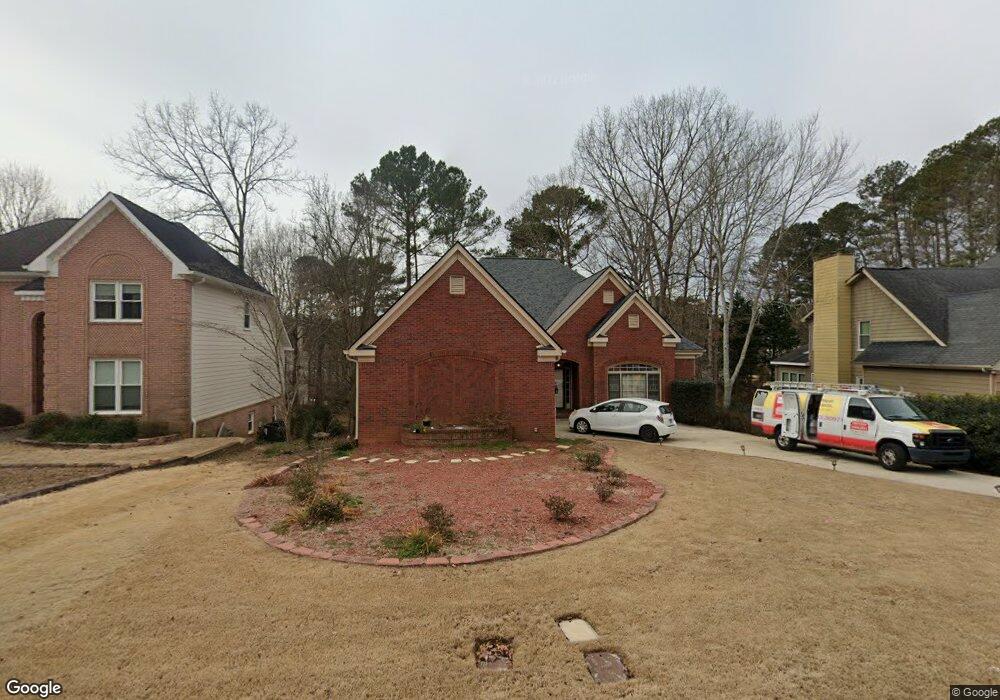
2224 Cape Liberty Dr Unit 1 Suwanee, GA 30024
Estimated Value: $517,698 - $543,000
3
Beds
3
Baths
3,536
Sq Ft
$151/Sq Ft
Est. Value
About This Home
This home is located at 2224 Cape Liberty Dr Unit 1, Suwanee, GA 30024 and is currently estimated at $532,675, approximately $150 per square foot. 2224 Cape Liberty Dr Unit 1 is a home located in Gwinnett County with nearby schools including Walnut Grove Elementary School, Creekland Middle School, and Collins Hill High School.
Ownership History
Date
Name
Owned For
Owner Type
Purchase Details
Closed on
Mar 10, 1998
Sold by
Vanhoorn John W and Vanhoorn Barbara A
Bought by
Moore John C and Moore Martha R
Current Estimated Value
Home Financials for this Owner
Home Financials are based on the most recent Mortgage that was taken out on this home.
Original Mortgage
$161,000
Outstanding Balance
$27,572
Interest Rate
6.99%
Mortgage Type
New Conventional
Estimated Equity
$505,103
Create a Home Valuation Report for This Property
The Home Valuation Report is an in-depth analysis detailing your home's value as well as a comparison with similar homes in the area
Home Values in the Area
Average Home Value in this Area
Purchase History
| Date | Buyer | Sale Price | Title Company |
|---|---|---|---|
| Moore John C | $211,000 | -- |
Source: Public Records
Mortgage History
| Date | Status | Borrower | Loan Amount |
|---|---|---|---|
| Open | Moore John C | $161,000 |
Source: Public Records
Tax History Compared to Growth
Tax History
| Year | Tax Paid | Tax Assessment Tax Assessment Total Assessment is a certain percentage of the fair market value that is determined by local assessors to be the total taxable value of land and additions on the property. | Land | Improvement |
|---|---|---|---|---|
| 2025 | $1,205 | $235,120 | $28,000 | $207,120 |
| 2024 | $1,194 | $208,400 | $38,400 | $170,000 |
| 2023 | $1,194 | $213,040 | $41,600 | $171,440 |
| 2022 | $1,156 | $187,680 | $37,200 | $150,480 |
| 2021 | $1,143 | $147,320 | $26,800 | $120,520 |
| 2020 | $1,140 | $147,320 | $26,800 | $120,520 |
| 2019 | $1,057 | $134,440 | $24,640 | $109,800 |
| 2018 | $1,038 | $121,840 | $24,640 | $97,200 |
| 2016 | $1,077 | $109,320 | $19,600 | $89,720 |
| 2015 | $1,097 | $105,440 | $19,600 | $85,840 |
| 2014 | -- | $105,440 | $19,600 | $85,840 |
Source: Public Records
Map
Nearby Homes
- 2372 Merrymount Dr Unit 2
- 2265 Wildwood Lake Dr
- 2167 Merrymount Dr
- 2370 Cape Courage Way
- 2067 York River Way
- 2140 Deer Trail
- 2315 Prosperity Way Unit 2
- 1924 Sidneys Cove
- 1932 Riverton Dr
- 2140 Wildcat Cliffs Way
- 2061 Wildcat Cliffs Ln
- 267 Arbour Way
- 318 Arbour Way Unit 4
- 318 Lee Miller Dr
- 327 Lee Miller Dr
- 1839 Stonebrook Way
- 232 Clarion Rd
- 205 Camden Creek Ct
- 330 Allatoona Rd
- 2512 Herndon Rd
- 2214 Cape Liberty Dr
- 2234 Cape Liberty Dr
- 2204 Cape Liberty Dr
- 2287 Merrymount Dr
- 2200 Cape Courage Way
- 2244 Cape Liberty Dr Unit 1
- 2277 Merrymount Dr
- 2297 Merrymount Dr Unit 2
- 2205 Cape Courage Way
- 261 Waterford Cove Dr
- 2307 Merrymount Dr
- 2267 Merrymount Dr Unit 2
- 2254 Cape Liberty Dr Unit 1
- 2210 Cape Courage Way
- 2243 Cape Liberty Dr
- 2327 Merrymount Dr
- 2215 Cape Courage Way
- 2282 Merrymount Dr Unit 2
- 2264 Cape Liberty Dr
- 2253 Cape Liberty Dr Unit 1