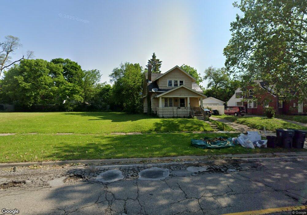
2224 Mackin Rd Flint, MI 48504
Metawanne Hills NeighborhoodEstimated Value: $39,000 - $137,000
4
Beds
1
Bath
1,461
Sq Ft
$51/Sq Ft
Est. Value
About This Home
This home is located at 2224 Mackin Rd, Flint, MI 48504 and is currently estimated at $73,973, approximately $50 per square foot. 2224 Mackin Rd is a home located in Genesee County with nearby schools including Brownell STEM Academy, St John Vianney Catholic School, and St. Paul Lutheran School.
Ownership History
Date
Name
Owned For
Owner Type
Purchase Details
Closed on
Jul 8, 2021
Sold by
Genesee County Land Bank Authority
Bought by
Wilson Rose
Current Estimated Value
Purchase Details
Closed on
Sep 21, 2011
Sold by
The Genesee County Land Bank Authority
Bought by
Lewis Latanya
Purchase Details
Closed on
Dec 22, 2010
Sold by
Genesee County Treasurer
Bought by
Genesee County Land Bank
Purchase Details
Closed on
Jan 4, 2010
Sold by
Archer Scott
Bought by
Watkins Ronzeld
Purchase Details
Closed on
Nov 10, 2006
Sold by
Bobrowski Eleanor J
Bought by
Stephen Jacquetta L
Home Financials for this Owner
Home Financials are based on the most recent Mortgage that was taken out on this home.
Original Mortgage
$54,000
Interest Rate
11.29%
Mortgage Type
Purchase Money Mortgage
Create a Home Valuation Report for This Property
The Home Valuation Report is an in-depth analysis detailing your home's value as well as a comparison with similar homes in the area
Home Values in the Area
Average Home Value in this Area
Purchase History
| Date | Buyer | Sale Price | Title Company |
|---|---|---|---|
| Wilson Rose | -- | None Available | |
| Lewis Latanya | $2,500 | None Available | |
| Genesee County Land Bank | -- | None Available | |
| Watkins Ronzeld | -- | Cislo Title Company | |
| Stephen Jacquetta L | $60,000 | Titlequest Agency |
Source: Public Records
Mortgage History
| Date | Status | Borrower | Loan Amount |
|---|---|---|---|
| Previous Owner | Stephen Jacquetta L | $54,000 | |
| Closed | Lewis Latanya | $0 |
Source: Public Records
Tax History Compared to Growth
Tax History
| Year | Tax Paid | Tax Assessment Tax Assessment Total Assessment is a certain percentage of the fair market value that is determined by local assessors to be the total taxable value of land and additions on the property. | Land | Improvement |
|---|---|---|---|---|
| 2025 | $156 | $2,500 | $0 | $0 |
| 2024 | $144 | $2,100 | $0 | $0 |
| 2023 | $151 | $1,800 | $0 | $0 |
| 2022 | $0 | $1,600 | $0 | $0 |
| 2021 | $0 | $0 | $0 | $0 |
| 2020 | $0 | $0 | $0 | $0 |
| 2019 | $0 | $0 | $0 | $0 |
| 2018 | $0 | $0 | $0 | $0 |
| 2017 | $0 | $0 | $0 | $0 |
| 2016 | $0 | $0 | $0 | $0 |
| 2015 | -- | $0 | $0 | $0 |
| 2014 | -- | $0 | $0 | $0 |
| 2012 | -- | $13,800 | $0 | $0 |
Source: Public Records
Map
Nearby Homes
- 2425 Clement St
- 2001 Mackin Rd
- 2302 Mallery St
- 2606 Stevenson St
- 1802 Mackin Rd
- 2526 Concord St
- 2424 Begole St
- 2612 Concord St
- 2410 Sloan St
- 2622 Concord St
- 1220 Forest Hill Ave
- 1813 Stevenson St
- 2714 Barth St
- 1717 Wolcott St
- 2709 Mallery St
- 2725 Prospect St
- 2730 Berkley St
- 1315 Welch Blvd
- 1645 Seminole St
- 2812 Concord St