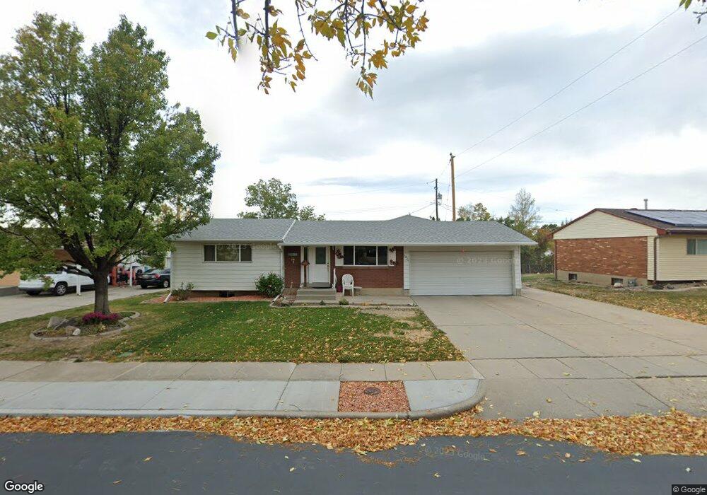
2224 Sorrento Dr Woods Cross, UT 84087
Estimated Value: $497,000 - $528,000
4
Beds
2
Baths
2,631
Sq Ft
$194/Sq Ft
Est. Value
About This Home
This home is located at 2224 Sorrento Dr, Woods Cross, UT 84087 and is currently estimated at $511,422, approximately $194 per square foot. 2224 Sorrento Dr is a home located in Davis County with nearby schools including Woods Cross Elementary School, South Davis Junior High School, and Woods Cross High School.
Ownership History
Date
Name
Owned For
Owner Type
Purchase Details
Closed on
Oct 29, 2024
Sold by
Karen Gay Davis Family Trust and Davis Karen Gay
Bought by
Hern Diaz Jose Antonio and Casiano Diaz Luis
Current Estimated Value
Home Financials for this Owner
Home Financials are based on the most recent Mortgage that was taken out on this home.
Original Mortgage
$450,000
Outstanding Balance
$431,492
Interest Rate
5.27%
Mortgage Type
Balloon
Estimated Equity
$79,930
Create a Home Valuation Report for This Property
The Home Valuation Report is an in-depth analysis detailing your home's value as well as a comparison with similar homes in the area
Home Values in the Area
Average Home Value in this Area
Purchase History
| Date | Buyer | Sale Price | Title Company |
|---|---|---|---|
| Hern Diaz Jose Antonio | -- | Cottonwood Title |
Source: Public Records
Mortgage History
| Date | Status | Borrower | Loan Amount |
|---|---|---|---|
| Open | Hern Diaz Jose Antonio | $450,000 |
Source: Public Records
Tax History Compared to Growth
Tax History
| Year | Tax Paid | Tax Assessment Tax Assessment Total Assessment is a certain percentage of the fair market value that is determined by local assessors to be the total taxable value of land and additions on the property. | Land | Improvement |
|---|---|---|---|---|
| 2025 | $3,294 | $266,750 | $113,369 | $153,381 |
| 2024 | $418 | $262,900 | $121,213 | $141,687 |
| 2023 | $392 | $468,000 | $160,874 | $307,126 |
| 2022 | $2,733 | $248,600 | $69,900 | $178,700 |
| 2021 | $463 | $339,000 | $102,699 | $236,301 |
| 2020 | $2,103 | $299,000 | $97,789 | $201,211 |
| 2019 | $2,084 | $292,000 | $91,108 | $200,892 |
| 2018 | $1,944 | $270,000 | $89,565 | $180,435 |
| 2016 | $250 | $129,250 | $38,596 | $90,654 |
| 2015 | $1,612 | $118,635 | $38,596 | $80,039 |
| 2014 | $394 | $121,654 | $38,596 | $83,058 |
| 2013 | -- | $95,429 | $21,811 | $73,618 |
Source: Public Records
Map
Nearby Homes
- 2008 S 700 W
- 770 W 1900 S
- 913 W 2025 S
- 916 W 2025 S
- 553 W 1880 S
- 2024 S 925 W
- 260 E 1100 N
- 260 E 1100 N Unit A14
- 2095 S Main St Unit 17
- 2095 S Main St Unit 23
- 1623 S 925 W
- 1820 S 440 W
- 1552 S 850 W
- 1602 S 550 W
- 730 W 1400 S
- 1950 S 200 W Unit 32
- 1289 S 675 W
- 298 Percival St Unit 354
- 785 Percival St
- 259 Lionel St Unit 373