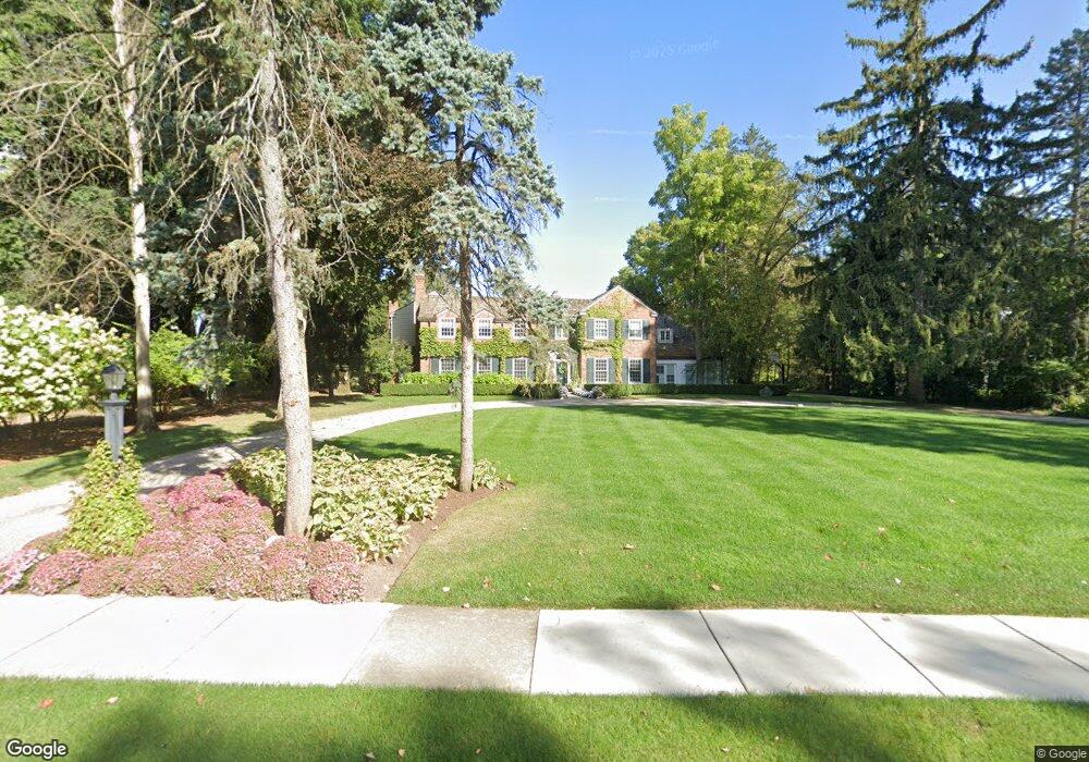
2224 Yarmouth Rd Bloomfield Hills, MI 48301
Estimated Value: $2,257,187 - $3,164,000
5
Beds
5
Baths
5,388
Sq Ft
$498/Sq Ft
Est. Value
About This Home
This home is located at 2224 Yarmouth Rd, Bloomfield Hills, MI 48301 and is currently estimated at $2,681,047, approximately $497 per square foot. 2224 Yarmouth Rd is a home located in Oakland County with nearby schools including Quarton Elementary, Derby Middle School, and Ernest W. Seaholm High School.
Ownership History
Date
Name
Owned For
Owner Type
Purchase Details
Closed on
Sep 9, 2011
Sold by
Stoddard Staford D and Stoddard Justine S
Bought by
Beauregard Michael and Beauregard Mary
Current Estimated Value
Purchase Details
Closed on
Aug 18, 2009
Sold by
Stoddard Stanford C and Stoddard Ann D
Bought by
Stoddard Stanford D and Stoddard Justine S
Home Financials for this Owner
Home Financials are based on the most recent Mortgage that was taken out on this home.
Original Mortgage
$356,000
Interest Rate
5.12%
Mortgage Type
New Conventional
Create a Home Valuation Report for This Property
The Home Valuation Report is an in-depth analysis detailing your home's value as well as a comparison with similar homes in the area
Home Values in the Area
Average Home Value in this Area
Purchase History
| Date | Buyer | Sale Price | Title Company |
|---|---|---|---|
| Beauregard Michael | $1,375,000 | Capital Title Ins Agency | |
| Stoddard Stanford D | -- | None Available |
Source: Public Records
Mortgage History
| Date | Status | Borrower | Loan Amount |
|---|---|---|---|
| Previous Owner | Stoddard Stanford D | $356,000 |
Source: Public Records
Tax History Compared to Growth
Tax History
| Year | Tax Paid | Tax Assessment Tax Assessment Total Assessment is a certain percentage of the fair market value that is determined by local assessors to be the total taxable value of land and additions on the property. | Land | Improvement |
|---|---|---|---|---|
| 2024 | $18,679 | $1,044,040 | $0 | $0 |
| 2023 | $17,926 | $940,440 | $0 | $0 |
| 2022 | $31,605 | $907,840 | $0 | $0 |
| 2021 | $31,868 | $865,150 | $0 | $0 |
| 2020 | $17,219 | $832,630 | $0 | $0 |
| 2019 | $31,770 | $904,750 | $0 | $0 |
| 2018 | $31,431 | $832,430 | $0 | $0 |
| 2017 | $31,486 | $815,420 | $0 | $0 |
| 2016 | $31,610 | $843,270 | $0 | $0 |
| 2015 | -- | $817,370 | $0 | $0 |
| 2014 | -- | $753,040 | $0 | $0 |
| 2011 | -- | $594,240 | $0 | $0 |
Source: Public Records
Map
Nearby Homes
- 1019 N Cranbrook Rd
- 956 Westwood Dr
- 1120 Lyonhurst St
- 1260 Lyonhurst St
- 2579 Amberly Rd
- 1882 Melbourne St
- 345 Kimberly St
- 1834 Fairview St
- 375 Dunston Rd
- 586 Fairfax St
- 270 Martell Dr
- 1056 Pilgrim Ave
- 120 Westchester Way
- 1537 Ashford Ln
- 1348 Charrington Rd
- 397 S Cranbrook Rd
- 394 S Glenhurst Dr
- 1287 Charrington Rd
- 100 Overhill Rd
- 3320 Morningview Terrace
- 2192 Yarmouth Rd
- 1144 N Cranbrook Rd
- 1216 N Cranbrook Rd
- 2168 Yarmouth Rd
- 1085 Waddington St
- 1080 N Cranbrook Rd
- 1084 Waddington St
- 2243 Tottenham Rd Unit Bldg-Unit
- 2243 Tottenham Rd
- 1280 N Cranbrook Rd
- 1048 N Cranbrook Rd
- 2215 Tottenham Rd
- 1336 N Cranbrook Rd
- 1053 Waddington St
- 1052 Waddington St
- 2140 Yarmouth Rd
- 2147 Yarmouth Rd
- 1187 N Cranbrook Rd
- 1133 N Cranbrook Rd
- 1099 N Cranbrook Rd