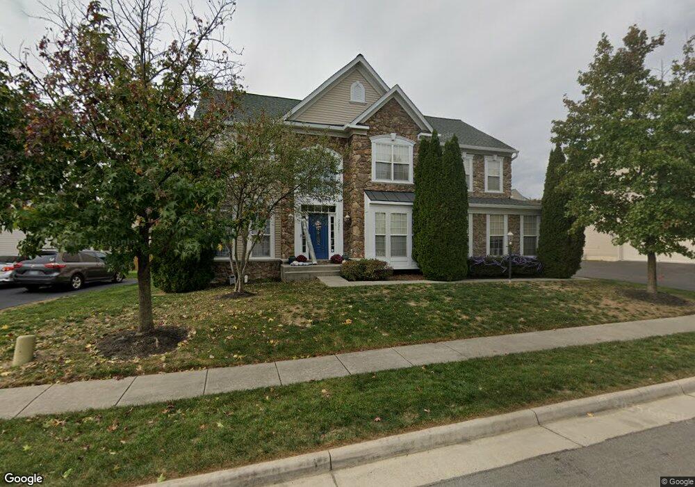
22241 Splitrock Way Ashburn, VA 20148
Estimated Value: $1,028,512 - $1,200,000
4
Beds
4
Baths
3,016
Sq Ft
$362/Sq Ft
Est. Value
About This Home
This home is located at 22241 Splitrock Way, Ashburn, VA 20148 and is currently estimated at $1,091,878, approximately $362 per square foot. 22241 Splitrock Way is a home located in Loudoun County with nearby schools including Moorefield Station Elementary School, Rock Ridge High School, and Golden Pond School - Golden Pond.
Ownership History
Date
Name
Owned For
Owner Type
Purchase Details
Closed on
Jun 27, 2007
Sold by
Richmond American Homes O
Bought by
Sherwood Robert and Katz,Lauren
Current Estimated Value
Home Financials for this Owner
Home Financials are based on the most recent Mortgage that was taken out on this home.
Original Mortgage
$546,628
Outstanding Balance
$336,993
Interest Rate
6.24%
Mortgage Type
New Conventional
Estimated Equity
$754,885
Create a Home Valuation Report for This Property
The Home Valuation Report is an in-depth analysis detailing your home's value as well as a comparison with similar homes in the area
Home Values in the Area
Average Home Value in this Area
Purchase History
| Date | Buyer | Sale Price | Title Company |
|---|---|---|---|
| Sherwood Robert | $683,286 | -- |
Source: Public Records
Mortgage History
| Date | Status | Borrower | Loan Amount |
|---|---|---|---|
| Open | Sherwood Robert | $546,628 |
Source: Public Records
Tax History Compared to Growth
Tax History
| Year | Tax Paid | Tax Assessment Tax Assessment Total Assessment is a certain percentage of the fair market value that is determined by local assessors to be the total taxable value of land and additions on the property. | Land | Improvement |
|---|---|---|---|---|
| 2025 | $8,504 | $1,056,400 | $323,800 | $732,600 |
| 2024 | $8,562 | $989,830 | $308,800 | $681,030 |
| 2023 | $8,153 | $931,800 | $308,800 | $623,000 |
| 2022 | $7,864 | $883,630 | $288,800 | $594,830 |
| 2021 | $7,290 | $743,900 | $243,800 | $500,100 |
| 2020 | $7,237 | $699,240 | $223,800 | $475,440 |
| 2019 | $6,989 | $668,840 | $198,800 | $470,040 |
| 2018 | $7,318 | $674,480 | $178,800 | $495,680 |
| 2017 | $7,052 | $626,830 | $178,800 | $448,030 |
| 2016 | $6,935 | $605,690 | $0 | $0 |
| 2015 | $7,216 | $456,960 | $0 | $456,960 |
| 2014 | $7,159 | $441,000 | $0 | $441,000 |
Source: Public Records
Map
Nearby Homes
- 22275 Sims Terrace
- 43400 Apple Orchard Square
- 43157 Clarendon Square
- 43360 Southland St
- 43466 Grandmoore St
- 22317 Seabring Terrace
- 43361 Radford Divide Terrace
- 22613 Naugatuck Square
- 22260 Cornerstone Crossing Terrace
- 22477 Foundation Dr
- 43437 Monroe Crest Terrace
- 22131 Little Mount Terrace
- 43495 Monroe Crest Terrace
- 22141 Midmoore Dr
- 22143 Little Mount Terrace
- 22153 Midmoore Dr
- 22116 Little Mount Terrace
- 22122 Little Mount Terrace
- 22133 Little Mount Terrace
- 22130 Little Mount Terrace
- 22237 Splitrock Way
- 22245 Splitrock Way
- 22240 Fairlawn Dr
- 22236 Fairlawn Dr
- 43186 Amberleigh Farm Dr
- 22244 Splitrock Way
- 22233 Splitrock Way
- 22240 Splitrock Way
- 22232 Fairlawn Dr
- 43198 Amberleigh Farm Dr
- 22236 Splitrock Way
- 22232 Splitrock Way
- 22229 Splitrock Way
- 22340 Lost Branch Cir
- 43191 Summersweet Place
- 43187 Amberleigh Farm Dr
- 22228 Fairlawn Dr
- 22241 Fairlawn Dr
- 22237 Fairlawn Dr
- 22251 Waterberry Terrace