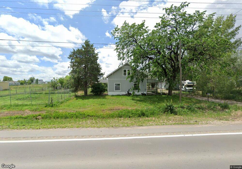
22246 Highway 52 Hudson, CO 80642
Estimated Value: $437,000 - $775,692
3
Beds
2
Baths
1,149
Sq Ft
$563/Sq Ft
Est. Value
About This Home
This home is located at 22246 Highway 52, Hudson, CO 80642 and is currently estimated at $646,673, approximately $562 per square foot. 22246 Highway 52 is a home located in Weld County with nearby schools including Weld Central Senior High School.
Ownership History
Date
Name
Owned For
Owner Type
Purchase Details
Closed on
Oct 6, 2025
Sold by
Voss Joshua
Bought by
Kamphausen Buck
Current Estimated Value
Purchase Details
Closed on
Jan 29, 2024
Sold by
Kelly Robert D and Robert D Kelly Pc
Bought by
Kelly Robert D
Purchase Details
Closed on
Dec 15, 2022
Sold by
Rael Leroy
Bought by
Kamphausen Buck and Voss Joshua W
Home Financials for this Owner
Home Financials are based on the most recent Mortgage that was taken out on this home.
Original Mortgage
$600,000
Interest Rate
6.95%
Mortgage Type
Construction
Purchase Details
Closed on
Feb 26, 2007
Sold by
Rael Manuel L and Rael Raymond E
Bought by
Rael Leroy
Purchase Details
Closed on
Sep 8, 2004
Sold by
Rael Delores
Bought by
Rael Manuel L and Rael Raymond E
Purchase Details
Closed on
Aug 6, 1998
Sold by
Rael Tommy G
Bought by
Rael Manuel L and Rael Delores
Purchase Details
Closed on
Dec 11, 1996
Sold by
Rael Carolyn E
Bought by
Rael Tommy G
Purchase Details
Closed on
Oct 8, 1980
Create a Home Valuation Report for This Property
The Home Valuation Report is an in-depth analysis detailing your home's value as well as a comparison with similar homes in the area
Home Values in the Area
Average Home Value in this Area
Purchase History
| Date | Buyer | Sale Price | Title Company |
|---|---|---|---|
| Kamphausen Buck | -- | None Listed On Document | |
| Kelly Robert D | -- | None Listed On Document | |
| Kamphausen Buck | $750,000 | -- | |
| Rael Leroy | -- | None Available | |
| Rael Manuel L | -- | -- | |
| Rael Manuel L | -- | -- | |
| Rael Tommy G | -- | -- | |
| -- | -- | -- |
Source: Public Records
Mortgage History
| Date | Status | Borrower | Loan Amount |
|---|---|---|---|
| Previous Owner | Kamphausen Buck | $600,000 |
Source: Public Records
Tax History Compared to Growth
Tax History
| Year | Tax Paid | Tax Assessment Tax Assessment Total Assessment is a certain percentage of the fair market value that is determined by local assessors to be the total taxable value of land and additions on the property. | Land | Improvement |
|---|---|---|---|---|
| 2025 | $1,366 | $30,240 | $10,640 | $19,600 |
| 2024 | $1,366 | $30,240 | $10,640 | $19,600 |
| 2023 | $1,283 | $29,180 | $11,020 | $18,160 |
| 2022 | $1,250 | $22,960 | $7,300 | $15,660 |
| 2021 | $1,358 | $23,620 | $7,510 | $16,110 |
| 2020 | $1,200 | $22,060 | $6,410 | $15,650 |
| 2019 | $1,261 | $22,060 | $6,410 | $15,650 |
| 2018 | $1,105 | $18,740 | $5,800 | $12,940 |
| 2017 | $1,042 | $18,740 | $5,800 | $12,940 |
| 2016 | $1,002 | $17,800 | $5,190 | $12,610 |
| 2015 | $824 | $17,800 | $5,190 | $12,610 |
| 2014 | $506 | $10,730 | $5,170 | $5,560 |
Source: Public Records
Map
Nearby Homes
- 22385 Highway 52
- 458 Cherry St
- 506 Ash St
- 318 Ash St
- 608 Cedar St
- 1st 1st Ave
- 218 Grape St Unit 29
- 218 Grape St Unit 28
- 218 Grape St Unit 1
- 218 Grape St Unit 3
- 141 Main St
- 505 Foxtail Dr
- 508 Hickory St
- 11 Sunset Ct
- 210 Dawn Dr
- 240 Buckboard Dr
- 210 Buckboard Dr
- 250 Buckboard Dr
- 230 Buckboard Dr
- 220 Buckboard Dr
- 22249 Highway 52
- 22249 Highway 52
- 22186 Highway 52
- 19489 State Highway 52
- 22324 Highway 52
- 22325 Highway 52
- 557 Evergreen St
- 22184 Evergreen St
- 22188 Evergreen St
- 22188 Highway 52
- 22190 Evergreen St
- 505 Evergreen St
- 1190 5th Ave
- 1190 5th Ave
- 526 Date St
- 504 Date St
- 555 Holly St
- 22423 Highway 52
- 590 Holly St
- 570 Holly St