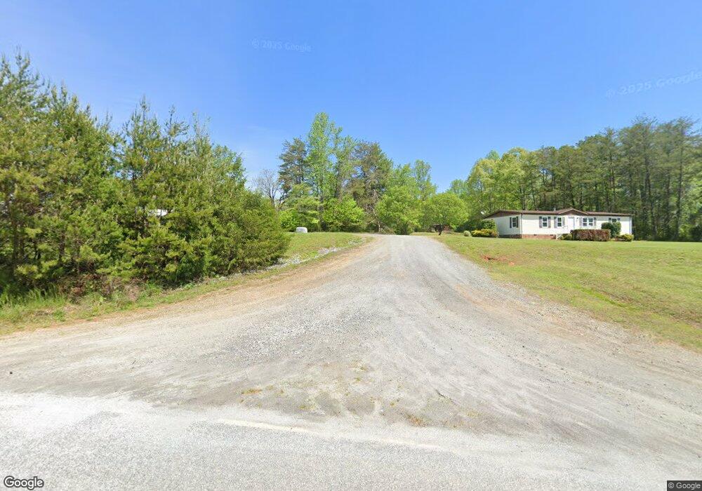
2225 Abrams and Moore Rd Rutherfordton, NC 28139
Estimated Value: $337,000 - $468,000
3
Beds
1
Bath
1,340
Sq Ft
$285/Sq Ft
Est. Value
About This Home
This home is located at 2225 Abrams and Moore Rd, Rutherfordton, NC 28139 and is currently estimated at $381,333, approximately $284 per square foot. 2225 Abrams and Moore Rd is a home located in Polk County.
Ownership History
Date
Name
Owned For
Owner Type
Purchase Details
Closed on
Apr 1, 2019
Sold by
Rowe Jonathan E and Rowe Sarah M
Bought by
Wright Leonard and Wright Lanette
Current Estimated Value
Home Financials for this Owner
Home Financials are based on the most recent Mortgage that was taken out on this home.
Original Mortgage
$165,000
Outstanding Balance
$106,249
Interest Rate
4.3%
Mortgage Type
Stand Alone Refi Refinance Of Original Loan
Estimated Equity
$275,084
Purchase Details
Closed on
Mar 2, 2018
Sold by
Rowe David C and Rowe Andrea P
Bought by
Rowe Jonathan E and Rowe Sarah M
Purchase Details
Closed on
Mar 30, 1962
Bought by
Rowe David C
Create a Home Valuation Report for This Property
The Home Valuation Report is an in-depth analysis detailing your home's value as well as a comparison with similar homes in the area
Home Values in the Area
Average Home Value in this Area
Purchase History
| Date | Buyer | Sale Price | Title Company |
|---|---|---|---|
| Wright Leonard | $165,000 | -- | |
| Rowe Jonathan E | $195,000 | -- | |
| Rowe David C | -- | -- |
Source: Public Records
Mortgage History
| Date | Status | Borrower | Loan Amount |
|---|---|---|---|
| Open | Wright Leonard | $165,000 |
Source: Public Records
Tax History Compared to Growth
Tax History
| Year | Tax Paid | Tax Assessment Tax Assessment Total Assessment is a certain percentage of the fair market value that is determined by local assessors to be the total taxable value of land and additions on the property. | Land | Improvement |
|---|---|---|---|---|
| 2025 | $973 | $190,597 | $42,117 | $148,480 |
| 2024 | $957 | $149,660 | $31,550 | $118,110 |
| 2023 | $957 | $149,660 | $31,550 | $118,110 |
| 2022 | $918 | $149,660 | $31,550 | $118,110 |
| 2021 | $907 | $149,660 | $31,550 | $118,110 |
| 2020 | $505 | $74,559 | $25,240 | $49,319 |
| 2019 | $505 | $74,559 | $25,240 | $49,319 |
| 2018 | $490 | $74,559 | $25,240 | $49,319 |
| 2017 | $479 | $82,231 | $22,585 | $59,646 |
| 2016 | $514 | $82,231 | $22,585 | $59,646 |
| 2015 | $504 | $0 | $0 | $0 |
| 2014 | $507 | $0 | $0 | $0 |
| 2013 | -- | $0 | $0 | $0 |
Source: Public Records
Map
Nearby Homes
- 0 Abrams & Moore Rd Unit CAR4191437
- 99999 Abrams & Moore Rd
- 99999 Sunny View Dr
- 782 County Line Rd S
- 250 Valley Dr
- 99999 Pea Ridge Rd
- 2784 Pea Ridge Rd
- 0 Zachary Ln Unit 39
- 0000 Zachary Ln Unit 37
- 0000 Elliott Ln Unit 45 & 48
- Tract 3 County Line Rd
- 190 Elliott Ln
- 00 Zachary Ln
- 0000 S County Line Rd
- 999 Rivercrest Pkwy Unit 28
- 1178 Pea Ridge Rd
- 536-4 Pea Ridge Rd
- 536-2 Pea Ridge Rd
- 536-1 Pea Ridge Rd
- 536 Pea Ridge Rd
- 2225 Abrams and Moore Rd
- 2199 Abrams and Moore Rd
- 2225 Abrams & Moore Rd
- 131 Prices Dr
- 77 Living Water Ln
- 196 the Gathering Place
- 130 Living Water Ln
- 2346 Manus Chapel Rd
- 2178 Manus Chapel Rd
- TBD Abrams & Moore Rd
- 00 Abrams & Moore Rd
- 2156 Manus Chapel Rd
- 127 Raceway Dr
- 000 Abrams & Moore Rd
- 2771 Abrams Moore Rd
- 2015 Manus Chapel Rd
- 000 Ponder Rd
- 224 Raceway Dr
- 400 Manus Chapel Rd
- 3546 Abrams and Moore Rd