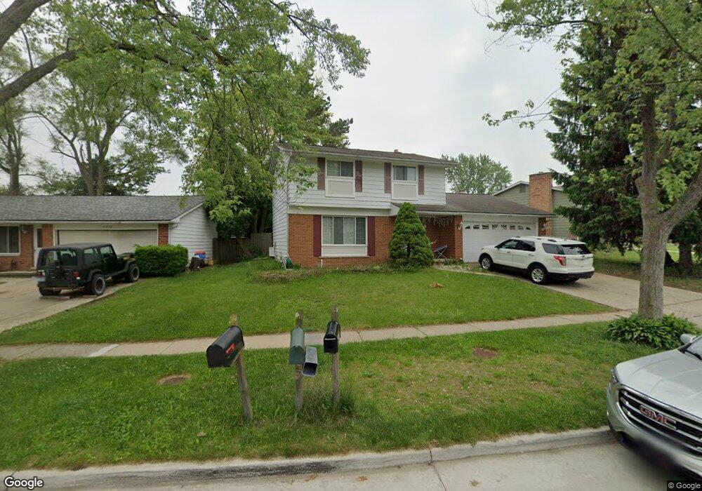
2226 Hempstead Rd Auburn Hills, MI 48326
Estimated Value: $303,801 - $321,000
3
Beds
3
Baths
1,578
Sq Ft
$197/Sq Ft
Est. Value
About This Home
This home is located at 2226 Hempstead Rd, Auburn Hills, MI 48326 and is currently estimated at $310,950, approximately $197 per square foot. 2226 Hempstead Rd is a home located in Oakland County with nearby schools including R. Grant Graham Elementary School, Avondale Middle School, and Avondale High School.
Ownership History
Date
Name
Owned For
Owner Type
Purchase Details
Closed on
Jun 16, 2009
Sold by
Secretary Of Housing & Urban Development
Bought by
Orozco J Carlos
Current Estimated Value
Purchase Details
Closed on
Dec 13, 2006
Sold by
Everhome Mortgage Co
Bought by
Hud
Purchase Details
Closed on
Jun 6, 2006
Sold by
Fair John and Fair Natasha
Bought by
Everhome Mortgage Co
Purchase Details
Closed on
Dec 4, 2003
Sold by
Howard Rodney W and Howard Sheila M
Bought by
Fair John and Fair Natasha
Purchase Details
Closed on
Aug 15, 2000
Sold by
Krentz Kathleen
Bought by
Howard Rodney W
Create a Home Valuation Report for This Property
The Home Valuation Report is an in-depth analysis detailing your home's value as well as a comparison with similar homes in the area
Home Values in the Area
Average Home Value in this Area
Purchase History
| Date | Buyer | Sale Price | Title Company |
|---|---|---|---|
| Orozco J Carlos | $32,000 | None Available | |
| Hud | -- | None Available | |
| Everhome Mortgage Co | $200,660 | None Available | |
| Fair John | $190,000 | Metropolitan Title Company | |
| Howard Rodney W | $172,000 | -- |
Source: Public Records
Mortgage History
| Date | Status | Borrower | Loan Amount |
|---|---|---|---|
| Closed | Howard Rodney W | -- |
Source: Public Records
Tax History Compared to Growth
Tax History
| Year | Tax Paid | Tax Assessment Tax Assessment Total Assessment is a certain percentage of the fair market value that is determined by local assessors to be the total taxable value of land and additions on the property. | Land | Improvement |
|---|---|---|---|---|
| 2024 | $1,890 | $129,130 | $0 | $0 |
| 2023 | $1,802 | $111,500 | $0 | $0 |
| 2022 | $3,447 | $101,830 | $0 | $0 |
| 2021 | $3,345 | $89,410 | $0 | $0 |
| 2020 | $1,647 | $88,970 | $0 | $0 |
| 2019 | $3,333 | $86,960 | $0 | $0 |
| 2018 | $2,194 | $81,260 | $0 | $0 |
| 2017 | $2,003 | $79,470 | $0 | $0 |
| 2016 | $1,989 | $65,990 | $0 | $0 |
| 2015 | -- | $56,300 | $0 | $0 |
| 2014 | -- | $53,960 | $0 | $0 |
| 2011 | -- | $56,340 | $0 | $0 |
Source: Public Records
Map
Nearby Homes
- 0 Oaknoll St
- 2551 Crofthill Dr
- 1564 Georgetown Place
- 1524 Georgetown Dr Unit 32
- 1522 Tannahill Ln
- 2667 Williamsburg Cir Unit 31
- 833 Bloomfield Village Blvd Unit A
- 833 Bloomfield Village Blvd Unit D
- 833 Bloomfield Village Blvd Unit B
- 466 Rolling Rock Rd
- 870 Huntclub Blvd
- 1545 S Hill Blvd
- 1987 Hunters Ridge Dr
- 1737 S Hill Blvd
- 1696 S Hill Blvd Unit 46
- 2931 Auburn Rd
- 1717 Brandywine Dr
- 3075 Waukegan St
- 34 Cross St
- 3176 Margaret St
- 2238 Hempstead Rd
- 599 Provincetown Rd
- 2250 Hempstead Rd
- 2219 Liverpool St
- 2231 Liverpool St
- 603 Provincetown Rd
- 2310 Hempstead Rd
- 2243 Liverpool St
- 2311 Liverpool St
- 609 Provincetown Rd
- 594 Provincetown Rd
- 2324 Hempstead Rd
- 2221 Hempstead Rd
- 2235 Hempstead Rd
- 2168 Hempstead Rd
- 2247 Hempstead Rd
- 2323 Liverpool St
- 2175 Hempstead Rd
- 2305 Hempstead Rd
- 2163 Hempstead Rd