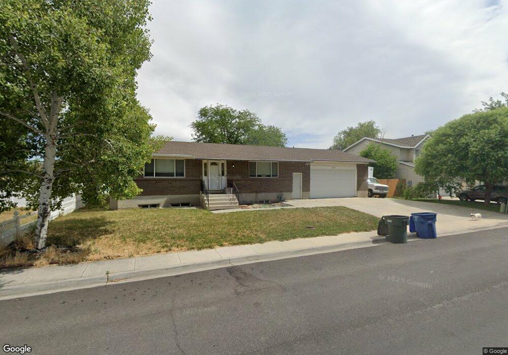
2226 Red Robin Rd Salt Lake City, UT 84119
Redwood NeighborhoodEstimated Value: $466,000 - $504,107
4
Beds
2
Baths
1,218
Sq Ft
$400/Sq Ft
Est. Value
About This Home
This home is located at 2226 Red Robin Rd, Salt Lake City, UT 84119 and is currently estimated at $486,777, approximately $399 per square foot. 2226 Red Robin Rd is a home located in Salt Lake County with nearby schools including Taylorsville Elementary School, Eisenhower Jr High School, and Taylorsville High School.
Ownership History
Date
Name
Owned For
Owner Type
Purchase Details
Closed on
Nov 25, 2013
Sold by
Blair Russell Kay and Blair Diane
Bought by
Benson Thanomsri and Benson Edward G
Current Estimated Value
Home Financials for this Owner
Home Financials are based on the most recent Mortgage that was taken out on this home.
Original Mortgage
$150,400
Interest Rate
4.18%
Mortgage Type
New Conventional
Create a Home Valuation Report for This Property
The Home Valuation Report is an in-depth analysis detailing your home's value as well as a comparison with similar homes in the area
Home Values in the Area
Average Home Value in this Area
Purchase History
| Date | Buyer | Sale Price | Title Company |
|---|---|---|---|
| Benson Thanomsri | -- | Monument Title Ins Co |
Source: Public Records
Mortgage History
| Date | Status | Borrower | Loan Amount |
|---|---|---|---|
| Closed | Benson Thanomsri | $150,400 |
Source: Public Records
Tax History Compared to Growth
Tax History
| Year | Tax Paid | Tax Assessment Tax Assessment Total Assessment is a certain percentage of the fair market value that is determined by local assessors to be the total taxable value of land and additions on the property. | Land | Improvement |
|---|---|---|---|---|
| 2025 | $2,817 | $450,900 | $125,300 | $325,600 |
| 2024 | $2,817 | $431,600 | $119,100 | $312,500 |
| 2023 | $2,638 | $387,000 | $114,500 | $272,500 |
| 2022 | $2,586 | $380,300 | $112,200 | $268,100 |
| 2021 | $2,311 | $305,500 | $86,300 | $219,200 |
| 2020 | $2,190 | $273,200 | $78,500 | $194,700 |
| 2019 | $2,261 | $272,100 | $78,500 | $193,600 |
| 2018 | $2,213 | $256,600 | $78,500 | $178,100 |
| 2017 | $1,966 | $231,900 | $75,900 | $156,000 |
| 2016 | $1,804 | $213,100 | $75,900 | $137,200 |
| 2015 | $1,727 | $194,300 | $74,400 | $119,900 |
| 2014 | $1,694 | $186,700 | $72,100 | $114,600 |
Source: Public Records
Map
Nearby Homes
- 2140 W 3860 S
- 3583 S Byde-A-while Rd
- 3685 S 2200 W Unit 79
- 3671 S 2200 W Unit 1
- 3673 S 2200 W Unit 15
- 2595 W 3800 S
- 2121 W 4100 S
- 1854 W 4100 S
- 4077 Tralee Cir
- 2221 W Davenshire Ln
- 2409 W Hardrock Dr
- 1995 W Stone Creek Dr
- 4107 S Greyhackle Ln
- 2258 W 4185 S
- 4111 S Greyhackle Ln
- 3606 S 2045 W
- 2451 Hard Rock Cir S
- 2754 W 3835 S
- 1911 W Homestead Farms Ln Unit 2
- 2318 W 4220 S
- 2226 W 3910 S
- 2250 W Red Robin Rd
- 2250 Red Robin Rd
- 3890 S 2200 W
- 2212 Red Robin Rd
- 2212 W Red Robin Rd
- 2268 W Red Robin Rd
- 2268 Red Robin Rd
- 3918 S 2200 W
- 3918 S 2200 W
- 2255 W Red Robin Rd
- 2247 W August Field Dr
- 3888 S 2200 W
- 2255 Red Robin Rd
- 2284 W Red Robin Rd
- 2284 Red Robin Rd
- 2263 W August Farms Cir
- 2273 Red Robin Rd
- 3911 S 2200 W
- 3911 S 2200 W