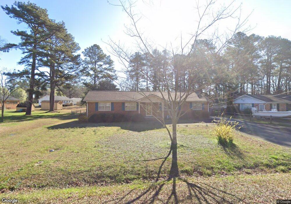
2226 Sparger Rd Durham, NC 27705
West Durham NeighborhoodEstimated Value: $334,000 - $372,092
3
Beds
2
Baths
1,600
Sq Ft
$220/Sq Ft
Est. Value
About This Home
This home is located at 2226 Sparger Rd, Durham, NC 27705 and is currently estimated at $352,523, approximately $220 per square foot. 2226 Sparger Rd is a home located in Durham County with nearby schools including Morehead Montessori, Brogden Middle, and Riverside High School.
Ownership History
Date
Name
Owned For
Owner Type
Purchase Details
Closed on
Jun 16, 2003
Sold by
Perryman Geraldine F and Mcneil Gary
Bought by
Green William and Schuck Debra
Current Estimated Value
Home Financials for this Owner
Home Financials are based on the most recent Mortgage that was taken out on this home.
Original Mortgage
$156,300
Outstanding Balance
$67,970
Interest Rate
5.68%
Mortgage Type
VA
Estimated Equity
$284,553
Create a Home Valuation Report for This Property
The Home Valuation Report is an in-depth analysis detailing your home's value as well as a comparison with similar homes in the area
Home Values in the Area
Average Home Value in this Area
Purchase History
| Date | Buyer | Sale Price | Title Company |
|---|---|---|---|
| Green William | $154,000 | -- |
Source: Public Records
Mortgage History
| Date | Status | Borrower | Loan Amount |
|---|---|---|---|
| Open | Green William | $156,300 |
Source: Public Records
Tax History Compared to Growth
Tax History
| Year | Tax Paid | Tax Assessment Tax Assessment Total Assessment is a certain percentage of the fair market value that is determined by local assessors to be the total taxable value of land and additions on the property. | Land | Improvement |
|---|---|---|---|---|
| 2025 | $3,412 | $377,130 | $146,000 | $231,130 |
| 2024 | $3,039 | $217,845 | $43,830 | $174,015 |
| 2023 | $2,854 | $217,845 | $43,830 | $174,015 |
| 2022 | $2,788 | $217,845 | $43,830 | $174,015 |
| 2021 | $2,775 | $217,845 | $43,830 | $174,015 |
| 2020 | $2,710 | $217,845 | $43,830 | $174,015 |
| 2019 | $2,710 | $217,845 | $43,830 | $174,015 |
| 2018 | $2,052 | $151,256 | $29,220 | $122,036 |
| 2017 | $2,037 | $151,256 | $29,220 | $122,036 |
| 2016 | $1,968 | $151,256 | $29,220 | $122,036 |
| 2015 | $1,921 | $138,793 | $32,188 | $106,605 |
| 2014 | $1,921 | $138,793 | $32,188 | $106,605 |
Source: Public Records
Map
Nearby Homes
- 4709 Stafford Dr
- 4825 Stafford Dr
- 2416 Dellwood Dr
- 4704 Cumberland Dr
- 1013 Coldspring Cir
- Townhome B Exterior Plan at Croasdaile Farm - Bronze Leaf Townhomes
- Custom Plan at Croasdaile Farm - Bronze Leaf Townhomes
- Townhome B Interior Plan at Croasdaile Farm - Bronze Leaf Townhomes
- Townhome A Exterior Plan at Croasdaile Farm - Bronze Leaf Townhomes
- Townhome A Interior Plan at Croasdaile Farm - Bronze Leaf Townhomes
- 2606 Newquay St
- 108 Panamint Dr
- 2625 Cohnwood Dr
- 4219 Berini Dr
- 2708 Ferrand Dr
- 4408 Cheshire Ct
- 4411 Sunny Ct
- 524 Soapstone Dr Unit 114
- 2900 Beech Grove Dr
- 4420 Dula St
- 2222 Sparger Rd
- 4633 Bennett Memorial Rd
- 4625 Bennett Memorial Rd
- 2227 Conestoga Dr
- 2218 Sparger Rd
- 2221 Conestoga Dr
- 4621 Bennett Memorial Rd
- 2223 Sparger Rd
- 2225 Sparger Rd
- 4701 Bennett Memorial Rd
- 2214 Sparger Rd
- 2219 Sparger Rd
- 2217 Conestoga Dr
- 2215 Sparger Rd
- 4705 Bennett Memorial Rd
- 2210 Sparger Rd
- LOT Conestoga Dr
- 4615 Bennett Memorial Rd
- 2211 Sparger Rd
- 2213 Conestoga Dr