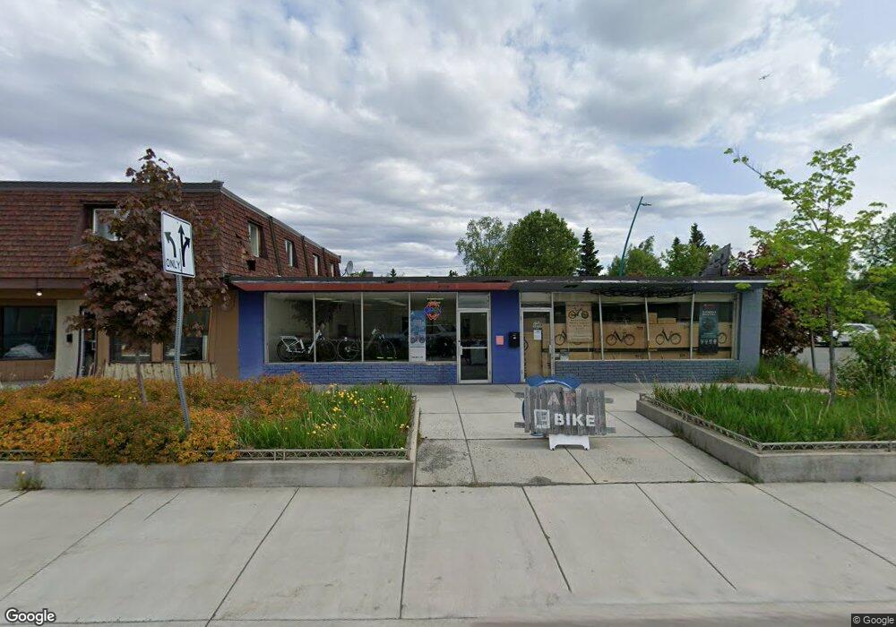
2227 Spenard Rd Anchorage, AK 99503
North Star Neighborhood
--
Bed
--
Bath
3,176
Sq Ft
5,663
Sq Ft Lot
About This Home
This home is located at 2227 Spenard Rd, Anchorage, AK 99503. 2227 Spenard Rd is a home located in Anchorage Municipality with nearby schools including North Star Elementary School, Romig Middle School, and West High School.
Ownership History
Date
Name
Owned For
Owner Type
Purchase Details
Closed on
Feb 9, 2012
Sold by
Municipality Of Anchorage
Bought by
Stellar Llc
Purchase Details
Closed on
Nov 16, 2011
Sold by
Lee Cynthia
Bought by
Municipality Of Anchorage
Purchase Details
Closed on
Jan 26, 2009
Sold by
Municipality Of Anchorage
Bought by
Stellar Llc
Create a Home Valuation Report for This Property
The Home Valuation Report is an in-depth analysis detailing your home's value as well as a comparison with similar homes in the area
Home Values in the Area
Average Home Value in this Area
Purchase History
| Date | Buyer | Sale Price | Title Company |
|---|---|---|---|
| Stellar Llc | -- | None Available | |
| Municipality Of Anchorage | -- | None Available | |
| Stellar Llc | -- | None Available |
Source: Public Records
Tax History Compared to Growth
Tax History
| Year | Tax Paid | Tax Assessment Tax Assessment Total Assessment is a certain percentage of the fair market value that is determined by local assessors to be the total taxable value of land and additions on the property. | Land | Improvement |
|---|---|---|---|---|
| 2025 | $3,118 | $221,600 | $108,700 | $112,900 |
| 2024 | $3,118 | $193,100 | $108,700 | $84,400 |
| 2023 | $3,149 | $184,900 | $104,500 | $80,400 |
| 2022 | $3,016 | $179,100 | $91,500 | $87,600 |
| 2021 | $3,449 | $191,400 | $89,800 | $101,600 |
| 2020 | $3,478 | $204,600 | $88,000 | $116,600 |
| 2019 | $3,328 | $203,400 | $86,200 | $117,200 |
| 2018 | $3,272 | $199,500 | $86,200 | $113,300 |
| 2017 | $3,085 | $197,000 | $86,200 | $110,800 |
| 2016 | $2,809 | $188,100 | $82,300 | $105,800 |
| 2015 | $2,809 | $190,100 | $82,300 | $107,800 |
| 2014 | $2,809 | $186,100 | $82,300 | $103,800 |
Source: Public Records
Map
Nearby Homes
- 2201 Romig Place Unit 105
- 1113 W Fireweed Ln Unit 505
- 1113 W Fireweed Ln Unit 204
- 1327 W 25th Ave Unit 218
- 1945 Spenard Rd
- 1435 W 25th Ave
- 1024 Potlatch Cir Unit 23
- 1001 W Fireweed Ln
- 1441 W 26th Ave Unit B3
- 1471 W 26th Ave
- 1016 W 25th Ave
- 827 W 20th Ave
- 2607 Arctic Blvd
- 2400 Belmont Dr
- 1102 W 29th Ave
- 1010 W 29th Place
- 2201 Belmont Dr
- 1501 P St
- 2140 Dawson St
- 710 W 16th Ave
- 2223 Spenard Rd
- 2207 Spenard Rd
- 2142 Hillcrest Place
- 2142 Solstice Cir
- 2263 Spenard Rd
- 2419 Spenard Rd
- 2201 Hillcrest Place Unit 106
- 2124 Hillcrest Place
- 2124 Hillcrest Place
- 2120 Hillcrest Place
- 2147 Hillcrest Place
- 2301 Spenard Rd
- 1340 Hillcrest Dr
- 1319 Hillcrest Dr
- 2139 Hillcrest Place
- 1341 Hillcrest Dr
- 1341 Hillcrest Dr
- 2201 Anton Way
- 1313 Hillcrest Dr Unit 6
- 2127 Solstice Cir