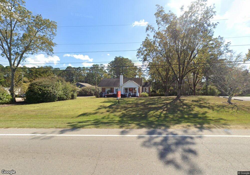
2227 West Point Rd Lagrange, GA 30240
Estimated Value: $176,000
4
Beds
2
Baths
1,683
Sq Ft
$105/Sq Ft
Est. Value
About This Home
This home is located at 2227 West Point Rd, Lagrange, GA 30240 and is currently priced at $176,000, approximately $104 per square foot. 2227 West Point Rd is a home located in Troup County with nearby schools including Ethel W. Kight Elementary School, Hollis Hand Elementary School, and Franklin Forest Elementary School.
Ownership History
Date
Name
Owned For
Owner Type
Purchase Details
Closed on
Oct 15, 2025
Sold by
Kelton Billy Wayne
Bought by
Kelton Ann Teal
Current Estimated Value
Purchase Details
Closed on
Oct 5, 1999
Sold by
Joyce Elizabeth R Birdyshaw
Bought by
Kelton Billy W and Kelton Ann T
Purchase Details
Closed on
May 24, 1975
Bought by
Joyce Elizabeth R Birdyshaw
Purchase Details
Closed on
Jan 1, 1961
Create a Home Valuation Report for This Property
The Home Valuation Report is an in-depth analysis detailing your home's value as well as a comparison with similar homes in the area
Purchase History
| Date | Buyer | Sale Price | Title Company |
|---|---|---|---|
| Kelton Ann Teal | -- | -- | |
| Kelton Billy W | $160,000 | -- | |
| Joyce Elizabeth R Birdyshaw | -- | -- | |
| -- | -- | -- |
Source: Public Records
Tax History
| Year | Tax Paid | Tax Assessment Tax Assessment Total Assessment is a certain percentage of the fair market value that is determined by local assessors to be the total taxable value of land and additions on the property. | Land | Improvement |
|---|---|---|---|---|
| 2025 | $4,603 | $168,776 | $92,000 | $76,776 |
| 2024 | $4,187 | $153,536 | $92,000 | $61,536 |
| 2023 | $4,110 | $150,696 | $92,000 | $58,696 |
| 2022 | $4,104 | $147,056 | $92,000 | $55,056 |
| 2021 | $3,101 | $102,832 | $55,200 | $47,632 |
| 2020 | $3,101 | $102,832 | $55,200 | $47,632 |
| 2019 | $3,088 | $102,392 | $55,200 | $47,192 |
| 2018 | $2,959 | $98,112 | $55,200 | $42,912 |
| 2017 | $2,959 | $98,112 | $55,200 | $42,912 |
| 2016 | $2,914 | $96,614 | $55,200 | $41,414 |
| 2015 | $2,444 | $80,904 | $55,200 | $25,704 |
| 2014 | $2,448 | $80,904 | $55,200 | $25,704 |
| 2013 | -- | $80,904 | $55,200 | $25,704 |
Source: Public Records
Map
Nearby Homes
- 3 Reed Dr
- 0 Unit 10514554
- 0 Bradfield Dr Unit 10568803
- 8 Horace Carter Rd
- 427 Fling Rd
- 120 Laurel Ridge Ave E
- 101 Crown St Unit LOT 5
- 102 Crown St Unit LOT 1
- 205 Grady St
- 808 S Fling Rd
- 509 Connie Dr
- 608 Wilburn Ave
- 610 Wilburn Ave
- 107 Clark St
- 223 Pinehaven Dr
- 211 Moores Hill
- 0 Moores Hill
- 202 Parker Ln
- 336 Whitaker Rd
- 109 Garfield St
- 2221 W Point Rd
- 2221 West Point Rd
- 2231 W Point Rd
- 2222 West Point Rd
- 2222 W Point Rd
- 2282 West Point Rd Unit 2282-2302
- 2282 West Point Rd Unit 2282-2302
- 2169 W Point Rd
- 2289 West Point Rd
- 2289 W Point Rd
- 104 Sage Commercial Dr Unit SUITE 2
- 104 Sage Commercial Dr Unit 2
- 104 Sage Commercial Dr
- 2169 West Point Rd
- 106 Sage Commercial Dr
- 2302 West Point Rd
- 204 Westside Ct
- 202 Westside Ct
- 2270 West Point Rd
- 114 Westside Dr
Your Personal Tour Guide
Ask me questions while you tour the home.