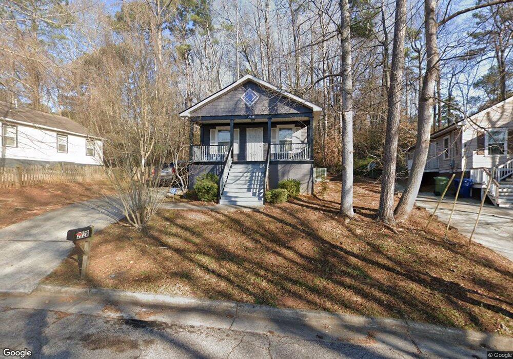
2228 Lang Dr SW Atlanta, GA 30315
Polar Rock NeighborhoodEstimated Value: $202,000 - $215,000
3
Beds
1
Bath
1,056
Sq Ft
$197/Sq Ft
Est. Value
About This Home
This home is located at 2228 Lang Dr SW, Atlanta, GA 30315 and is currently estimated at $208,390, approximately $197 per square foot. 2228 Lang Dr SW is a home located in Fulton County with nearby schools including Slater Elementary School, Price Middle School, and Carver High School.
Ownership History
Date
Name
Owned For
Owner Type
Purchase Details
Closed on
Sep 13, 2007
Sold by
Habitat Of Humanity/Atlanta In
Bought by
Mccrimmon Shlonda A
Current Estimated Value
Home Financials for this Owner
Home Financials are based on the most recent Mortgage that was taken out on this home.
Original Mortgage
$5,000
Interest Rate
6.57%
Mortgage Type
New Conventional
Create a Home Valuation Report for This Property
The Home Valuation Report is an in-depth analysis detailing your home's value as well as a comparison with similar homes in the area
Home Values in the Area
Average Home Value in this Area
Purchase History
| Date | Buyer | Sale Price | Title Company |
|---|---|---|---|
| Mccrimmon Shlonda A | -- | -- | |
| Mccrimmon Shlonda A | $105,600 | -- |
Source: Public Records
Mortgage History
| Date | Status | Borrower | Loan Amount |
|---|---|---|---|
| Closed | Mccrimmon Shlonda A | $5,000 | |
| Open | Mccrimmon Shlonda A | $101,857 |
Source: Public Records
Tax History Compared to Growth
Tax History
| Year | Tax Paid | Tax Assessment Tax Assessment Total Assessment is a certain percentage of the fair market value that is determined by local assessors to be the total taxable value of land and additions on the property. | Land | Improvement |
|---|---|---|---|---|
| 2025 | $1,209 | $72,480 | $21,160 | $51,320 |
| 2023 | $3,431 | $82,880 | $23,200 | $59,680 |
| 2022 | $615 | $61,640 | $12,720 | $48,920 |
| 2021 | $471 | $47,560 | $7,680 | $39,880 |
| 2020 | $472 | $47,000 | $7,600 | $39,400 |
| 2019 | $487 | $32,560 | $5,800 | $26,760 |
| 2018 | $13 | $18,000 | $2,960 | $15,040 |
| 2017 | $10 | $6,000 | $2,560 | $3,440 |
| 2016 | $11 | $6,000 | $2,560 | $3,440 |
| 2015 | $487 | $6,000 | $2,560 | $3,440 |
| 2014 | $10 | $6,000 | $2,560 | $3,440 |
Source: Public Records
Map
Nearby Homes
- 2159 Macon Dr SW
- 2150 Macon Dr SE
- 2242 Polar Rock Place SW
- 193 Polar Rock Rd SW
- 2308 Lakewood Ave SW
- 2210 Polar Rock Ave SW
- 2240 Polar Rock Ave SW
- 00 Lakewood Ave
- 00 Swallow Cir SE
- 2362 Macon Dr SW
- 2318 Polar Rock Terrace SW
- 0 Swallow Cir SE
- 0 Hilltop Dr SW Unit 10606623
- 2456 Swallow Cir SE
- 2336 Polar Rock Ave SW
- 2187 Baywood Dr SE
- 2383 Baywood Dr SE
- 2410 Macon Dr SW
- 2218 Bagwell Dr SW
- 2234 Lang Dr SW
- 2226 Lang Dr SW
- 0 Lang Dr SW Unit 8822933
- 0 Lang Dr SW Unit 8273087
- 0 Lang Dr SW Unit 7576624
- 0 Lang Dr SW Unit 8172329
- 0 Lang Dr SW Unit 8727949
- 0 Lang Dr SW Unit 8524734
- 0 Lang Dr SW Unit 8137608
- 0 Lang Dr SW Unit 8111743
- 0 Lang Dr SW Unit 8013270
- 0 Lang Dr SW Unit 7620263
- 0 Lang Dr SW Unit 7452257
- 0 Lang Dr SW
- 2206 Lang Dr SW
- 2240 Lang Dr SW
- 2172 Lang Dr SW
- 2229 Lang Dr SW
- 2166 Lang Dr SW
- 2180 Lang Dr SW