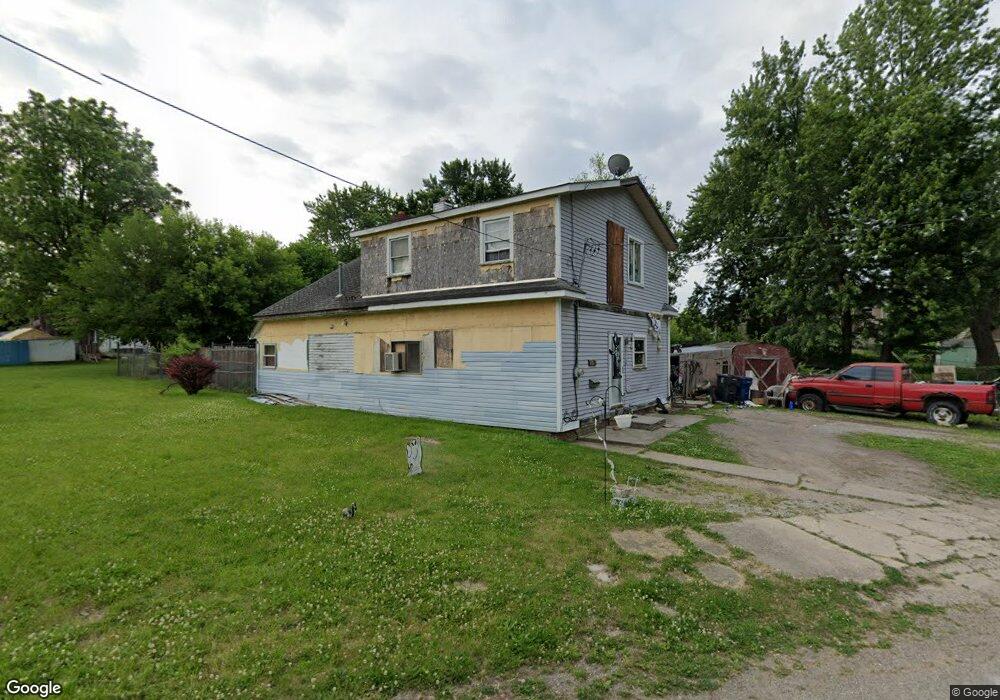
2228 Riverside Dr Flint, MI 48506
Eastside NeighborhoodEstimated Value: $52,000 - $68,308
3
Beds
2
Baths
1,748
Sq Ft
$33/Sq Ft
Est. Value
About This Home
This home is located at 2228 Riverside Dr, Flint, MI 48506 and is currently estimated at $57,077, approximately $32 per square foot. 2228 Riverside Dr is a home located in Genesee County with nearby schools including Potter School, Flint Cultural Center Academy, and WAY Academy of Flint.
Ownership History
Date
Name
Owned For
Owner Type
Purchase Details
Closed on
Jan 30, 2024
Sold by
Genesee Cnty Land Bk Authority
Bought by
Brown Brandy Lynn
Current Estimated Value
Purchase Details
Closed on
Dec 20, 2022
Sold by
Genesee County Treasurer
Bought by
Genesee County Land Bank Authority
Purchase Details
Closed on
Apr 26, 2022
Sold by
David Bussing
Bought by
Genesee County Treasurer
Purchase Details
Closed on
Mar 15, 2013
Sold by
Bussing Sherry
Bought by
Bussing David
Purchase Details
Closed on
Feb 13, 2012
Sold by
Gibbs Terry
Bought by
Bussing Sherry
Purchase Details
Closed on
Sep 10, 2009
Sold by
Miller Kerrilyn Rae
Bought by
Petty Christine I
Purchase Details
Closed on
Jan 17, 2005
Sold by
Miller Gene D
Bought by
Gibbs Terry L
Purchase Details
Closed on
Feb 17, 1999
Sold by
Miller Gene
Bought by
Miller Gene
Create a Home Valuation Report for This Property
The Home Valuation Report is an in-depth analysis detailing your home's value as well as a comparison with similar homes in the area
Home Values in the Area
Average Home Value in this Area
Purchase History
| Date | Buyer | Sale Price | Title Company |
|---|---|---|---|
| Brown Brandy Lynn | $2,500 | None Listed On Document | |
| Genesee County Land Bank Authority | -- | -- | |
| Genesee County Treasurer | -- | -- | |
| Bussing David | -- | None Available | |
| Bussing Sherry | $2,000 | None Available | |
| Petty Christine I | -- | First American Title Ins Co | |
| Gibbs Terry L | -- | First American Title Ins Co | |
| Miller Gene | -- | -- |
Source: Public Records
Tax History
| Year | Tax Paid | Tax Assessment Tax Assessment Total Assessment is a certain percentage of the fair market value that is determined by local assessors to be the total taxable value of land and additions on the property. | Land | Improvement |
|---|---|---|---|---|
| 2025 | $265 | $14,200 | $0 | $0 |
| 2024 | $265 | $0 | $0 | $0 |
| 2023 | -- | $0 | $0 | $0 |
| 2022 | $0 | $9,200 | $0 | $0 |
| 2021 | $453 | $8,400 | $0 | $0 |
| 2020 | $427 | $9,500 | $0 | $0 |
| 2019 | $455 | $8,800 | $0 | $0 |
| 2018 | $539 | $9,100 | $0 | $0 |
| 2017 | $1,246 | $0 | $0 | $0 |
| 2016 | $531 | $0 | $0 | $0 |
| 2015 | -- | $0 | $0 | $0 |
| 2014 | -- | $0 | $0 | $0 |
| 2012 | -- | $2,300 | $0 | $0 |
Source: Public Records
Map
Nearby Homes
- 1273 Broadway Blvd
- 1454 Delaware Ave
- 1529 Broadway Blvd
- 1445 Maryland Ave
- 1379 Washington Ave
- 1422 Leith St
- 1540 Illinois Ave
- 1629 New York Ave
- 1706 Wilberforce Cir
- 1518 Leith St
- 1710 Wilberforce Cir
- 1609 Ohio Ave
- 1526 Montana Ave
- 1721 New York Ave
- 1805 Bennett Ave
- 1623 Montana Ave
- 1730 Oklahoma Ave
- 1733 Oklahoma Ave
- 1724 Ohio Ave
- 1526 Arizona Ave
- 1219 Bennett Ave
- 1223 Bennett Ave
- 2211 Lyman St
- 2221 Lyman St
- 1227 Bennett Ave
- 1207 Mabel Ave
- 1229 Bennett Ave
- 1209 Mabel Ave
- 1213 Bennett Ave
- 1211 Mabel Ave
- 1231 Bennett Ave
- 2218 Lyman St
- 2216 Lyman St
- 1302 Mabel Ave
- 2212 Lyman St
- 2119 Bennett Ct
- 1234 Bennett Ave
- 2309 Lyman St
- 1214 Bennett Ave
- 1308 Bennett Ave
Your Personal Tour Guide
Ask me questions while you tour the home.