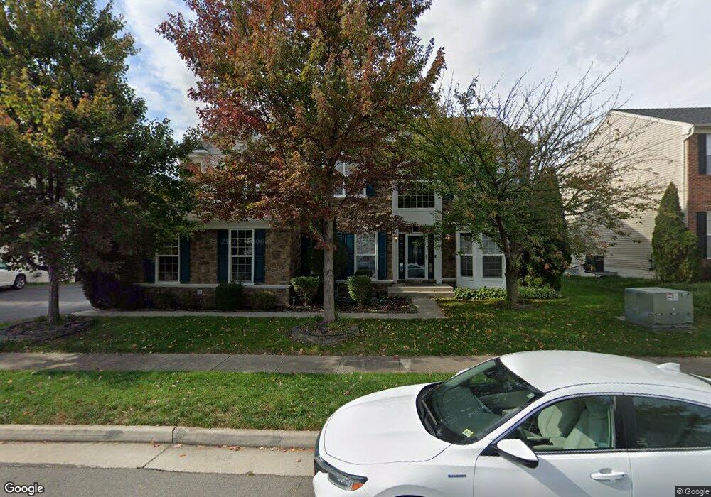
22281 Lost Branch Cir Ashburn, VA 20148
Estimated Value: $1,098,155 - $1,275,000
5
Beds
4
Baths
3,584
Sq Ft
$324/Sq Ft
Est. Value
About This Home
This home is located at 22281 Lost Branch Cir, Ashburn, VA 20148 and is currently estimated at $1,160,789, approximately $323 per square foot. 22281 Lost Branch Cir is a home located in Loudoun County with nearby schools including Moorefield Station Elementary School, Rock Ridge High School, and Golden Pond School - Golden Pond.
Ownership History
Date
Name
Owned For
Owner Type
Purchase Details
Closed on
Sep 12, 2007
Sold by
Richmond American Homes O
Bought by
Parvathaneni Anitharani and Koneru,Madhu
Current Estimated Value
Home Financials for this Owner
Home Financials are based on the most recent Mortgage that was taken out on this home.
Original Mortgage
$417,000
Outstanding Balance
$265,770
Interest Rate
6.7%
Mortgage Type
New Conventional
Estimated Equity
$895,019
Create a Home Valuation Report for This Property
The Home Valuation Report is an in-depth analysis detailing your home's value as well as a comparison with similar homes in the area
Home Values in the Area
Average Home Value in this Area
Purchase History
| Date | Buyer | Sale Price | Title Company |
|---|---|---|---|
| Parvathaneni Anitharani | $672,020 | -- |
Source: Public Records
Mortgage History
| Date | Status | Borrower | Loan Amount |
|---|---|---|---|
| Open | Parvathaneni Anitharani | $417,000 |
Source: Public Records
Tax History Compared to Growth
Tax History
| Year | Tax Paid | Tax Assessment Tax Assessment Total Assessment is a certain percentage of the fair market value that is determined by local assessors to be the total taxable value of land and additions on the property. | Land | Improvement |
|---|---|---|---|---|
| 2025 | $8,980 | $1,115,510 | $322,600 | $792,910 |
| 2024 | $8,844 | $1,022,480 | $307,600 | $714,880 |
| 2023 | $8,442 | $964,800 | $307,600 | $657,200 |
| 2022 | $8,132 | $913,690 | $287,600 | $626,090 |
| 2021 | $7,576 | $773,020 | $242,600 | $530,420 |
| 2020 | $7,516 | $726,170 | $222,600 | $503,570 |
| 2019 | $7,265 | $695,220 | $197,600 | $497,620 |
| 2018 | $7,621 | $702,360 | $177,600 | $524,760 |
| 2017 | $7,334 | $651,910 | $177,600 | $474,310 |
| 2016 | $7,208 | $629,540 | $0 | $0 |
| 2015 | $7,407 | $475,040 | $0 | $475,040 |
| 2014 | $7,346 | $458,450 | $0 | $458,450 |
Source: Public Records
Map
Nearby Homes
- 43157 Clarendon Square
- 22275 Sims Terrace
- 43400 Apple Orchard Square
- 43360 Southland St
- 22613 Naugatuck Square
- 43361 Radford Divide Terrace
- 42904 Bittner Square
- 22317 Seabring Terrace
- 43466 Grandmoore St
- 22477 Foundation Dr
- 22260 Cornerstone Crossing Terrace
- 43437 Monroe Crest Terrace
- 22131 Little Mount Terrace
- 22141 Midmoore Dr
- 22143 Little Mount Terrace
- 22153 Midmoore Dr
- 22116 Little Mount Terrace
- 22122 Little Mount Terrace
- 22133 Little Mount Terrace
- 22130 Little Mount Terrace
- 22277 Lost Branch Cir
- 22285 Lost Branch Cir
- 22280 Lost Branch Cir
- 22284 Lost Branch Cir
- 22257 Allspice Ct
- 22289 Lost Branch Cir
- 43175 Amberleigh Farm Dr
- 43172 Longfeather Way
- 22293 Lost Branch Cir
- 43174 Amberleigh Farm Dr
- 22253 Allspice Ct
- 22292 Lost Branch Cir
- 22252 Allspice Ct
- 22297 Lost Branch Cir
- 43173 Longfeather Way
- 22249 Allspice Ct
- 43178 Amberleigh Farm Dr
- 22304 Lost Branch Cir
- 22241 Fairlawn Dr
- 43177 Longfeather Way