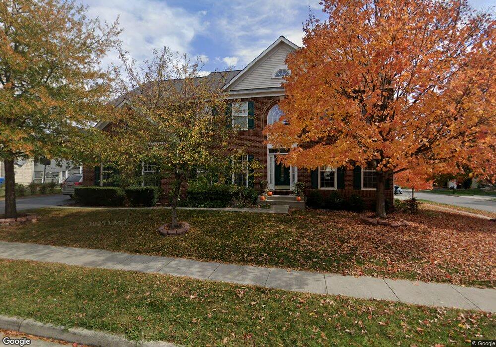
22284 Lost Branch Cir Ashburn, VA 20148
Estimated Value: $1,098,650 - $1,230,000
4
Beds
5
Baths
3,320
Sq Ft
$351/Sq Ft
Est. Value
About This Home
This home is located at 22284 Lost Branch Cir, Ashburn, VA 20148 and is currently estimated at $1,163,663, approximately $350 per square foot. 22284 Lost Branch Cir is a home located in Loudoun County with nearby schools including Moorefield Station Elementary School, Rock Ridge High School, and Golden Pond School - Golden Pond.
Ownership History
Date
Name
Owned For
Owner Type
Purchase Details
Closed on
Jun 29, 2007
Sold by
Richmond American Homes O
Bought by
Sharma Pawan
Current Estimated Value
Home Financials for this Owner
Home Financials are based on the most recent Mortgage that was taken out on this home.
Original Mortgage
$573,288
Outstanding Balance
$353,429
Interest Rate
6.24%
Mortgage Type
New Conventional
Estimated Equity
$810,234
Create a Home Valuation Report for This Property
The Home Valuation Report is an in-depth analysis detailing your home's value as well as a comparison with similar homes in the area
Home Values in the Area
Average Home Value in this Area
Purchase History
| Date | Buyer | Sale Price | Title Company |
|---|---|---|---|
| Sharma Pawan | $716,610 | -- |
Source: Public Records
Mortgage History
| Date | Status | Borrower | Loan Amount |
|---|---|---|---|
| Open | Sharma Pawan | $573,288 |
Source: Public Records
Tax History Compared to Growth
Tax History
| Year | Tax Paid | Tax Assessment Tax Assessment Total Assessment is a certain percentage of the fair market value that is determined by local assessors to be the total taxable value of land and additions on the property. | Land | Improvement |
|---|---|---|---|---|
| 2025 | $8,834 | $1,097,370 | $323,800 | $773,570 |
| 2024 | $8,892 | $1,027,920 | $308,800 | $719,120 |
| 2023 | $8,421 | $962,350 | $308,800 | $653,550 |
| 2022 | $8,026 | $901,770 | $288,800 | $612,970 |
| 2021 | $7,502 | $765,470 | $243,800 | $521,670 |
| 2020 | $7,447 | $719,530 | $223,800 | $495,730 |
| 2019 | $7,198 | $688,830 | $198,800 | $490,030 |
| 2018 | $7,547 | $695,560 | $178,800 | $516,760 |
| 2017 | $7,266 | $645,880 | $178,800 | $467,080 |
| 2016 | $7,143 | $623,850 | $0 | $0 |
| 2015 | $7,452 | $477,780 | $0 | $477,780 |
| 2014 | $7,391 | $461,090 | $0 | $461,090 |
Source: Public Records
Map
Nearby Homes
- 43157 Clarendon Square
- 22275 Sims Terrace
- 43400 Apple Orchard Square
- 43360 Southland St
- 22613 Naugatuck Square
- 43361 Radford Divide Terrace
- 42904 Bittner Square
- 22317 Seabring Terrace
- 43466 Grandmoore St
- 22477 Foundation Dr
- 22260 Cornerstone Crossing Terrace
- 43437 Monroe Crest Terrace
- 22131 Little Mount Terrace
- 22141 Midmoore Dr
- 22143 Little Mount Terrace
- 22153 Midmoore Dr
- 22116 Little Mount Terrace
- 22122 Little Mount Terrace
- 22133 Little Mount Terrace
- 22130 Little Mount Terrace
- 43172 Longfeather Way
- 22280 Lost Branch Cir
- 43175 Amberleigh Farm Dr
- 22285 Lost Branch Cir
- 22292 Lost Branch Cir
- 22281 Lost Branch Cir
- 22289 Lost Branch Cir
- 43173 Longfeather Way
- 22277 Lost Branch Cir
- 22293 Lost Branch Cir
- 43177 Longfeather Way
- 22304 Lost Branch Cir
- 43174 Amberleigh Farm Dr
- 22257 Allspice Ct
- 22297 Lost Branch Cir
- 43178 Amberleigh Farm Dr
- 43181 Longfeather Way
- 22312 Lost Branch Cir
- 22301 Lost Branch Cir
- 22316 Lost Branch Cir