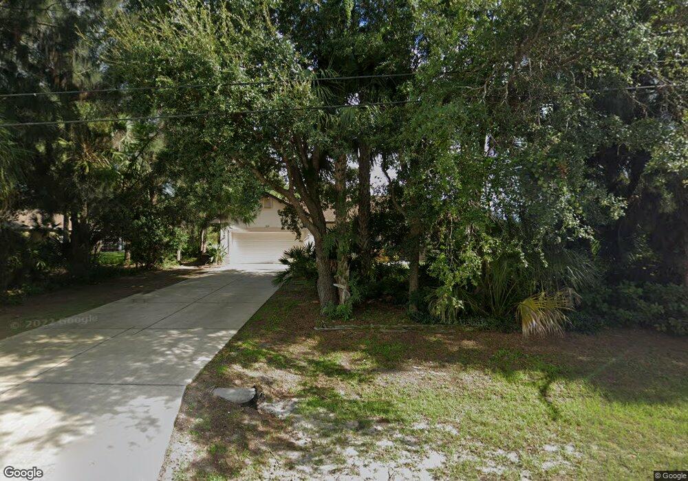
2229 Alliance Ave North Port, FL 34286
Estimated Value: $355,000 - $442,000
3
Beds
2
Baths
1,889
Sq Ft
$219/Sq Ft
Est. Value
About This Home
This home is located at 2229 Alliance Ave, North Port, FL 34286 and is currently estimated at $414,537, approximately $219 per square foot. 2229 Alliance Ave is a home located in Sarasota County with nearby schools including Toledo Blade Elementary School, North Port High School, and Woodland Middle School.
Ownership History
Date
Name
Owned For
Owner Type
Purchase Details
Closed on
Mar 12, 2004
Sold by
Soper Douglas W and Soper Frances
Bought by
Miller Thomas J and Miller Susan Steele
Current Estimated Value
Purchase Details
Closed on
Feb 21, 2001
Sold by
Wllenmann Werner Max
Bought by
Soper Douglas W and Soper Frances
Purchase Details
Closed on
Mar 9, 2000
Sold by
Wollenmann W Max and Wollenmann Helen L
Bought by
Wollenmann Werner Max
Create a Home Valuation Report for This Property
The Home Valuation Report is an in-depth analysis detailing your home's value as well as a comparison with similar homes in the area
Home Values in the Area
Average Home Value in this Area
Purchase History
| Date | Buyer | Sale Price | Title Company |
|---|---|---|---|
| Miller Thomas J | $25,000 | -- | |
| Miller Thomas J | $25,000 | -- | |
| Soper Douglas W | $7,000 | -- | |
| Soper Douglas W | $7,000 | -- | |
| Wollenmann Werner Max | -- | -- | |
| Wollenmann Werner Max | -- | -- |
Source: Public Records
Tax History Compared to Growth
Tax History
| Year | Tax Paid | Tax Assessment Tax Assessment Total Assessment is a certain percentage of the fair market value that is determined by local assessors to be the total taxable value of land and additions on the property. | Land | Improvement |
|---|---|---|---|---|
| 2024 | $2,742 | $193,347 | -- | -- |
| 2023 | $2,742 | $167,816 | $0 | $0 |
| 2022 | $2,727 | $164,090 | $0 | $0 |
| 2021 | $2,653 | $159,311 | $0 | $0 |
| 2020 | $2,624 | $157,111 | $0 | $0 |
| 2019 | $2,548 | $153,579 | $0 | $0 |
| 2018 | $2,378 | $150,715 | $0 | $0 |
| 2017 | $2,172 | $137,406 | $0 | $0 |
| 2016 | $2,162 | $200,700 | $6,700 | $194,000 |
| 2015 | $2,183 | $172,200 | $8,600 | $163,600 |
| 2014 | $2,160 | $130,624 | $0 | $0 |
Source: Public Records
Map
Nearby Homes
- 2031 Baltimore St
- 2111 Baltimore St
- 0 Ann Arbor Rd Unit A4520722
- 2551 Alhaven Terrace
- Lot 5 Alhaven Terrace
- Lot 32 Baltimore St
- 0 Snover Ave
- 0 Yacolt Ave Unit MFRA4665223
- 2657 Tusket Ave
- 0 Wyola Ave Unit MFRC7507151
- 1956 Snover Ave
- 0 Circleville St Unit MFRC7506886
- 0 Circleville St Unit MFRC7492644
- 0 Circleville St Unit MFRC7492646
- 2468 Burlington St
- LOT 45 Burlington St
- LOT 44 Burlington St
- 2267 Cincinnati St
- 1372 Vendome Terrace
- 0 Alhaven Terrace Unit MFRN6130985
- 2213 Alliance Ave
- 2228 Alliance Ave
- 2257 Alliance Ave
- 2212 Alliance Ave
- 2187 Alliance Ave
- 2198 Alliance Ave
- Baltimore St
- Baltimore St
- Baltimore St
- Baltimore St
- Baltimore
- 2173 Alliance Ave
- 2246 Snover Ave
- 2289 Altitude Ave
- 2268 Snover Ave
- 2031 Baltimore St Unit n/a
- 2268 Avenue
- 2190 Snover Ave
- 2224 Snover Ave
- 2177 Altitude Ave