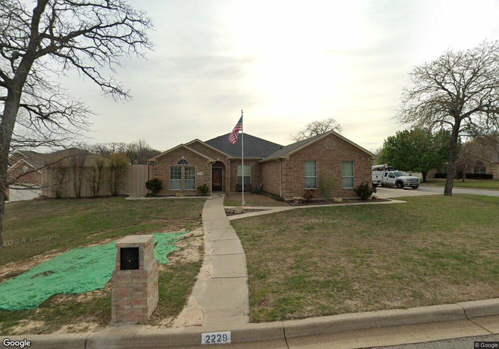
2229 Creek Side Dr Weatherford, TX 76087
Estimated Value: $356,000 - $387,001
3
Beds
3
Baths
2,009
Sq Ft
$186/Sq Ft
Est. Value
About This Home
This home is located at 2229 Creek Side Dr, Weatherford, TX 76087 and is currently estimated at $374,250, approximately $186 per square foot. 2229 Creek Side Dr is a home located in Parker County with nearby schools including Austin Elementary School, Hall Middle School, and Weatherford High School.
Ownership History
Date
Name
Owned For
Owner Type
Purchase Details
Closed on
Aug 23, 2017
Sold by
Walters Mary A
Bought by
Burton Michael David
Current Estimated Value
Home Financials for this Owner
Home Financials are based on the most recent Mortgage that was taken out on this home.
Original Mortgage
$195,350
Outstanding Balance
$163,004
Interest Rate
3.96%
Mortgage Type
New Conventional
Estimated Equity
$211,246
Purchase Details
Closed on
Jun 27, 2005
Sold by
Ssm Investments Inc
Bought by
Choice Homes Inc
Purchase Details
Closed on
Feb 14, 2003
Sold by
Choice Homes Inc
Bought by
Walters Tony Mccarl and Walters Mary A
Purchase Details
Closed on
Nov 5, 2002
Sold by
Ssm Investments Inc
Bought by
Walters Tony Mccarl and Walters Mary A
Create a Home Valuation Report for This Property
The Home Valuation Report is an in-depth analysis detailing your home's value as well as a comparison with similar homes in the area
Home Values in the Area
Average Home Value in this Area
Purchase History
| Date | Buyer | Sale Price | Title Company |
|---|---|---|---|
| Burton Michael David | -- | Alamo Title Company | |
| Choice Homes Inc | -- | Alamo Title Co | |
| Walters Tony Mccarl | -- | -- | |
| Walters Tony Mccarl | -- | -- |
Source: Public Records
Mortgage History
| Date | Status | Borrower | Loan Amount |
|---|---|---|---|
| Open | Burton Michael David | $195,350 |
Source: Public Records
Tax History Compared to Growth
Tax History
| Year | Tax Paid | Tax Assessment Tax Assessment Total Assessment is a certain percentage of the fair market value that is determined by local assessors to be the total taxable value of land and additions on the property. | Land | Improvement |
|---|---|---|---|---|
| 2025 | $4,780 | $331,891 | -- | -- |
| 2024 | $4,780 | $301,719 | -- | -- |
| 2023 | $4,780 | $274,290 | $0 | $0 |
| 2022 | $5,531 | $249,360 | $30,000 | $219,360 |
| 2021 | $5,555 | $249,360 | $30,000 | $219,360 |
| 2020 | $5,081 | $210,280 | $30,000 | $180,280 |
| 2019 | $5,286 | $210,280 | $30,000 | $180,280 |
| 2018 | $4,826 | $188,160 | $30,000 | $158,160 |
| 2017 | $4,898 | $188,160 | $30,000 | $158,160 |
| 2016 | $4,453 | $169,240 | $30,000 | $139,240 |
| 2015 | $2,837 | $169,240 | $30,000 | $139,240 |
| 2014 | $2,973 | $158,410 | $30,000 | $128,410 |
Source: Public Records
Map
Nearby Homes
- 2113 Country Brook Dr
- 104 Carriage Hill Ct
- 2020 Maplewood Dr
- 2102 Clear Creek Dr
- 344 Clear Lake Ln
- 115 Autumn Springs Ct
- 1910 Maplewood Dr
- 221 Arapahoe Ridge
- 2904 E Bankhead Hwy
- 1905 Clear Creek Dr
- 2218 Lake Country Dr
- 2116 Clear Lake Rd
- 2214 Lake Country Dr
- 2202 Lakeforest Dr
- 105 Country Green Ct
- 2001 Santa fe Dr
- 128 Black Forest Dr
- 118 Black Forest Dr
- 101 Black Forest Dr
- 1421 Highlake Ln
- 2213 Creek Unit Dr
- 2225 Creek Side Dr
- 2402 Timber Cove Dr
- 2406 Timber Cove Dr
- 2221 Creek Side Dr
- 2405 Timber Cove Dr
- 2410 Timber Cove Dr
- 2410 Timber Cove Dr Unit DT
- 2322 Timber Cove Dr
- 2222 Creek Side Dr
- 2217 Creek Side Dr
- 2414 Timber Cove Dr
- 2218 Creek Side Dr
- 2318 Timber Cove Dr
- 2409 Timber Cove Dr
- 2214 Creek Side Dr
- 2418 Timber Cove Dr
- 2314 Timber Cove Dr
- 2213 Creek Side Dr
- 2413 Timber Cove Dr