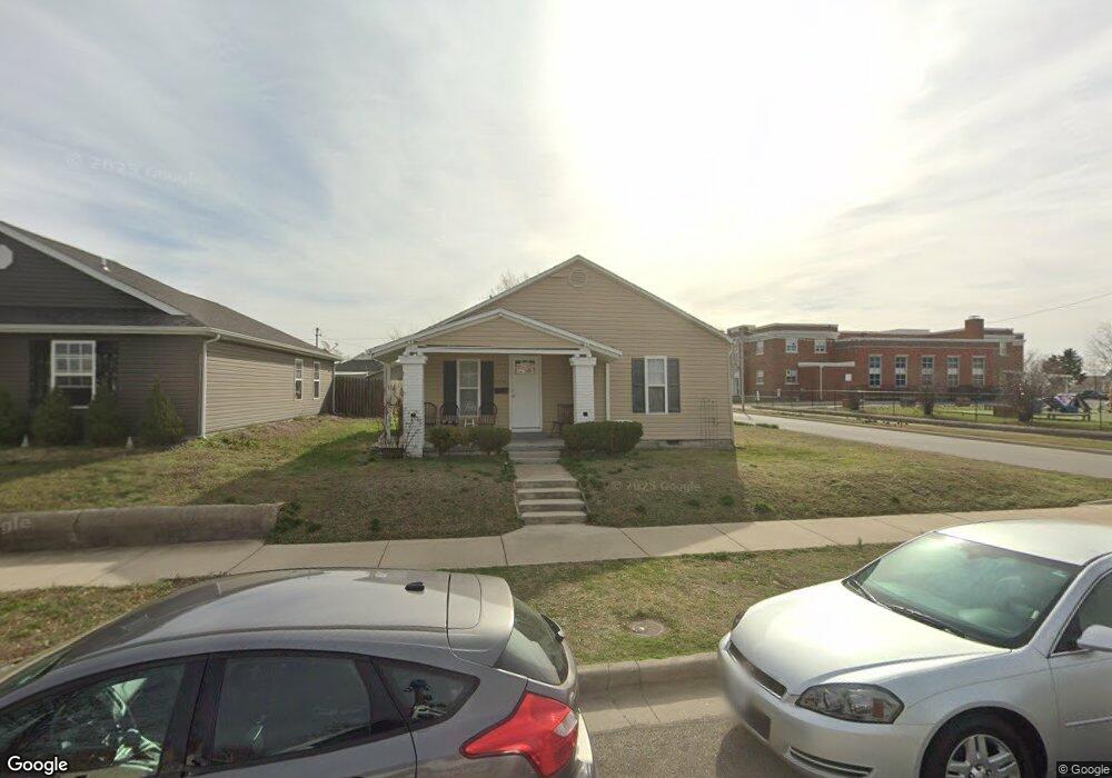
2229 S Porter Ave Joplin, MO 64804
Blendville South NeighborhoodEstimated Value: $81,293 - $107,000
2
Beds
1
Bath
800
Sq Ft
$120/Sq Ft
Est. Value
About This Home
This home is located at 2229 S Porter Ave, Joplin, MO 64804 and is currently estimated at $95,823, approximately $119 per square foot. 2229 S Porter Ave is a home located in Jasper County with nearby schools including Cecil Floyd Elementary School, North Middle School, and Joplin High School.
Ownership History
Date
Name
Owned For
Owner Type
Purchase Details
Closed on
Jan 20, 2011
Sold by
Mahon Haley and Mahon Mark
Bought by
Edwards Philip T
Current Estimated Value
Home Financials for this Owner
Home Financials are based on the most recent Mortgage that was taken out on this home.
Original Mortgage
$28,400
Outstanding Balance
$19,157
Interest Rate
4.56%
Mortgage Type
Future Advance Clause Open End Mortgage
Estimated Equity
$76,666
Purchase Details
Closed on
Oct 5, 2005
Sold by
Martz Kathleen Marie and Martz Kathleen M
Bought by
Murdock Haley
Create a Home Valuation Report for This Property
The Home Valuation Report is an in-depth analysis detailing your home's value as well as a comparison with similar homes in the area
Home Values in the Area
Average Home Value in this Area
Purchase History
| Date | Buyer | Sale Price | Title Company |
|---|---|---|---|
| Edwards Philip T | -- | Fatco | |
| Murdock Haley | -- | -- |
Source: Public Records
Mortgage History
| Date | Status | Borrower | Loan Amount |
|---|---|---|---|
| Open | Edwards Philip T | $28,400 |
Source: Public Records
Tax History Compared to Growth
Tax History
| Year | Tax Paid | Tax Assessment Tax Assessment Total Assessment is a certain percentage of the fair market value that is determined by local assessors to be the total taxable value of land and additions on the property. | Land | Improvement |
|---|---|---|---|---|
| 2024 | $369 | $8,000 | $1,210 | $6,790 |
| 2023 | $369 | $8,000 | $1,210 | $6,790 |
| 2022 | $360 | $7,830 | $1,210 | $6,620 |
| 2021 | $358 | $7,830 | $1,210 | $6,620 |
| 2020 | $369 | $7,900 | $1,210 | $6,690 |
| 2019 | $370 | $7,900 | $1,210 | $6,690 |
| 2018 | $356 | $7,630 | $0 | $0 |
| 2017 | $357 | $7,630 | $0 | $0 |
| 2016 | $352 | $7,630 | $0 | $0 |
| 2015 | $352 | $7,630 | $0 | $0 |
| 2014 | $352 | $7,630 | $0 | $0 |
Source: Public Records
Map
Nearby Homes
- 2201 Annie Baxter Ave
- 2123 S Porter Ave
- 2406 Annie Baxter Ave
- 2306 S Picher Ave
- 2108 S Harlem Ave
- 2021 S Porter Ave
- 1417 W 20th St
- 2118 Bird Ave
- 2501 Murphy Ave
- 2602 Mcclelland Blvd
- 2325 Bird Ave
- 2028 Bird Ave
- 2026 Bird Ave
- 2115 Bird Ave
- 819 S 819 1 2 Connor Ave
- 2216 & 1/2 S Connor Ave
- 1916 S Murphy Ave
- 1815 S Empire Ave
- 1805 S Empire Ave
- 2118 S Jackson Ave
- 2225 S Porter Ave
- 2221 S Porter Ave
- 2230 Annie Baxter Ave
- 2226 Annie Baxter Ave
- 2220 Annie Baxter Ave
- 2228 S Porter Ave
- 2224 S Porter Ave
- 2216 Annie Baxter Ave
- 2302 S Porter Ave
- 2220 S Porter Ave
- 2218 S Porter Ave
- 2306 S Porter Ave
- 2215 S Porter Ave
- 2212 Annie Baxter Ave
- 2210 S Porter Ave
- 2314 S Porter Ave
- 2301 Annie Baxter Ave
- 2205 S Porter Ave
- 2210 Annie Baxter Ave
- 2229 S Harlem Ave