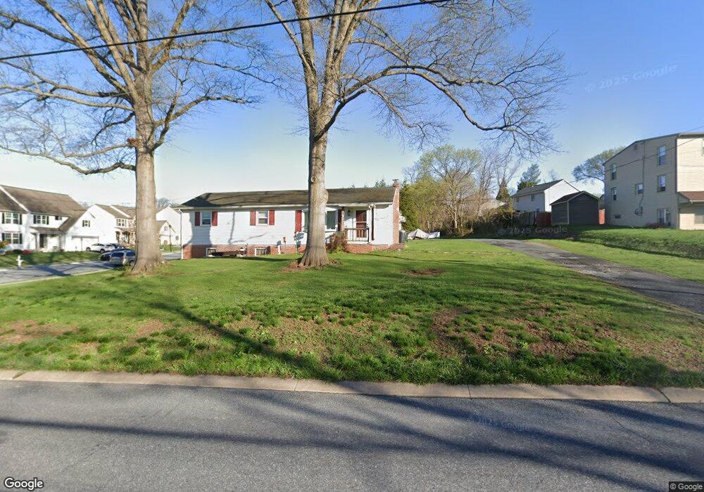
223 Akron Rd Ephrata, PA 17522
Estimated Value: $207,000 - $293,000
3
Beds
1
Bath
1,152
Sq Ft
$233/Sq Ft
Est. Value
About This Home
This home is located at 223 Akron Rd, Ephrata, PA 17522 and is currently estimated at $268,138, approximately $232 per square foot. 223 Akron Rd is a home located in Lancaster County with nearby schools including Fulton El School, Ephrata Intermediate School, and Ephrata Senior High School.
Ownership History
Date
Name
Owned For
Owner Type
Purchase Details
Closed on
Jan 25, 2008
Sold by
Akron Road Llc
Bought by
Bauman Paul Edward and Bauman Beth Ann
Current Estimated Value
Purchase Details
Closed on
Sep 12, 2002
Sold by
Chakara Freeman M and Chakara Beth A
Bought by
Bauman Paul Edward and Bauman Beth Ann
Home Financials for this Owner
Home Financials are based on the most recent Mortgage that was taken out on this home.
Original Mortgage
$102,600
Interest Rate
6.48%
Purchase Details
Closed on
Dec 13, 2000
Sold by
Hoppes Leroy M and Kauffman Elsie
Bought by
Chakara Freeman M and Chakara Beth A
Home Financials for this Owner
Home Financials are based on the most recent Mortgage that was taken out on this home.
Original Mortgage
$45,000
Interest Rate
7.7%
Create a Home Valuation Report for This Property
The Home Valuation Report is an in-depth analysis detailing your home's value as well as a comparison with similar homes in the area
Home Values in the Area
Average Home Value in this Area
Purchase History
| Date | Buyer | Sale Price | Title Company |
|---|---|---|---|
| Bauman Paul Edward | -- | None Available | |
| Bauman Paul Edward | $108,000 | First American Title Ins Co | |
| Chakara Freeman M | $45,000 | -- |
Source: Public Records
Mortgage History
| Date | Status | Borrower | Loan Amount |
|---|---|---|---|
| Previous Owner | Bauman Paul Edward | $102,600 | |
| Previous Owner | Chakara Freeman M | $45,000 |
Source: Public Records
Tax History Compared to Growth
Tax History
| Year | Tax Paid | Tax Assessment Tax Assessment Total Assessment is a certain percentage of the fair market value that is determined by local assessors to be the total taxable value of land and additions on the property. | Land | Improvement |
|---|---|---|---|---|
| 2025 | $3,038 | $132,100 | $50,800 | $81,300 |
| 2024 | $3,038 | $132,100 | $50,800 | $81,300 |
| 2023 | $2,960 | $132,100 | $50,800 | $81,300 |
| 2022 | $2,893 | $132,100 | $50,800 | $81,300 |
| 2021 | $2,818 | $132,100 | $50,800 | $81,300 |
| 2020 | $2,818 | $132,100 | $50,800 | $81,300 |
| 2019 | $2,778 | $132,100 | $50,800 | $81,300 |
| 2018 | $3,308 | $132,100 | $50,800 | $81,300 |
| 2017 | $2,709 | $105,600 | $36,000 | $69,600 |
| 2016 | $2,699 | $105,600 | $36,000 | $69,600 |
| 2015 | $539 | $105,600 | $36,000 | $69,600 |
| 2014 | $1,942 | $105,600 | $36,000 | $69,600 |
Source: Public Records
Map
Nearby Homes
- 215 Mason Dr
- 259 Heatherwood Dr
- 146 Gregg Cir
- 708 Primrose Ln
- 11 E Sunset Ave
- 112 Sycamore Rd
- 538 E Main St
- 124 Washington Ave
- 144 Niss Ave
- 1059 Henn Ave
- 1127 S State St
- 331 Spring Garden St
- 323 Lincoln Ave
- 308 Washington Ave
- 335 Lincoln Ave
- 00 Wyndale Dr
- 992 Hammon Ave
- 111 Ridge Ave
- 35 Hilldale Dr
- 112 N 10th St
- 8 Copperwood Ln Unit 1
- 221 Akron Rd
- 7 Copperwood Ln
- 134 Gery Ct
- 140 Gery Ct
- 10 Copperwood Ln
- 217 Akron Rd
- 3 Copperwood Ln
- 3 Copperwood Ln Unit 11
- 9 Copperwood Ln
- 14 Copperwood Ln
- 215 Akron Rd
- 148 Gery Ct
- 11 Copperwood Ln
- 15 Copperwood Ln
- 222 Akron Rd
- 213 Akron Rd
- 18 Copperwood Ln
- 120 Gery Ct
- 220 Akron Rd