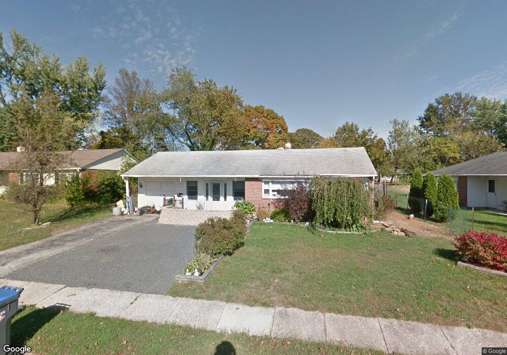
223 Brookside Rd Norristown, PA 19401
East Norriton Township NeighborhoodEstimated Value: $346,000 - $376,000
3
Beds
2
Baths
1,513
Sq Ft
$241/Sq Ft
Est. Value
About This Home
This home is located at 223 Brookside Rd, Norristown, PA 19401 and is currently estimated at $363,891, approximately $240 per square foot. 223 Brookside Rd is a home located in Montgomery County with nearby schools including East Norriton Middle School, Cole Manor Elementary School, and Charles Blockson Middle School.
Ownership History
Date
Name
Owned For
Owner Type
Purchase Details
Closed on
Dec 19, 2002
Sold by
Simon Deborah A and Wallace Deborah A
Bought by
Wallace Deborah A and Wallace Scott J
Current Estimated Value
Purchase Details
Closed on
Dec 28, 2000
Sold by
Price Cheryl D
Bought by
Wallace Scott J and Simon Deborah A
Purchase Details
Closed on
Oct 31, 1996
Sold by
Kopec Michael A and Kopec Dianne M
Bought by
Price Cheryl D
Purchase Details
Closed on
Nov 3, 1995
Sold by
Kopec Michael A and Kopec Michael J
Bought by
Bethel Estates Trust
Create a Home Valuation Report for This Property
The Home Valuation Report is an in-depth analysis detailing your home's value as well as a comparison with similar homes in the area
Home Values in the Area
Average Home Value in this Area
Purchase History
| Date | Buyer | Sale Price | Title Company |
|---|---|---|---|
| Wallace Deborah A | -- | -- | |
| Wallace Scott J | $132,000 | -- | |
| Price Cheryl D | $127,700 | -- | |
| Bethel Estates Trust | -- | -- |
Source: Public Records
Tax History Compared to Growth
Tax History
| Year | Tax Paid | Tax Assessment Tax Assessment Total Assessment is a certain percentage of the fair market value that is determined by local assessors to be the total taxable value of land and additions on the property. | Land | Improvement |
|---|---|---|---|---|
| 2025 | $5,546 | $117,710 | $50,090 | $67,620 |
| 2024 | $5,546 | $117,710 | $50,090 | $67,620 |
| 2023 | $5,481 | $117,710 | $50,090 | $67,620 |
| 2022 | $5,443 | $117,710 | $50,090 | $67,620 |
| 2021 | $5,409 | $117,710 | $50,090 | $67,620 |
| 2020 | $5,241 | $117,710 | $50,090 | $67,620 |
| 2019 | $5,120 | $117,710 | $50,090 | $67,620 |
| 2018 | $5,120 | $117,710 | $50,090 | $67,620 |
| 2017 | $4,822 | $117,710 | $50,090 | $67,620 |
| 2016 | $4,776 | $117,710 | $50,090 | $67,620 |
| 2015 | $4,634 | $117,710 | $50,090 | $67,620 |
| 2014 | $4,526 | $117,710 | $50,090 | $67,620 |
Source: Public Records
Map
Nearby Homes
- 242 Brookside Rd
- 138 Cedar Ct
- 3154 Sycamore Ln
- 5 Patterson Ave
- 401 Stony Way
- 37 Stuart Dr
- 1757 Clearview Ave
- 2937 Keenwood Rd
- 3104 N Wales Rd
- 2551 Hillcrest Ave
- 3004 N Wales Rd
- 603 Donna Dr
- 2413 Sentry Ct
- 2461 Merri Claude Dr
- 1416 Sullivan Dr
- 2300 Sienna Dr
- 2306 Carol Ln
- 2100 3rd St
- 177 Godspeed Ct
- 643 Barbara Dr
- 225 Brookside Rd
- 221 Brookside Rd
- 220 Beechwood Rd
- 227 Brookside Rd
- 218 Beechwood Rd
- 219 Brookside Rd
- 222 Brookside Rd
- 222 Beechwood Rd
- 216 Beechwood Rd
- 229 Brookside Rd
- 220 Brookside Rd
- 217 Brookside Rd
- 224 Beechwood Rd
- 202 Woodlawn Rd
- 202 Woodlawn Rd
- 201 Woodlawn Rd
- 214 Beechwood Rd
- 231 Brookside Rd
- 203 Orchard Ln
- 215 Brookside Rd