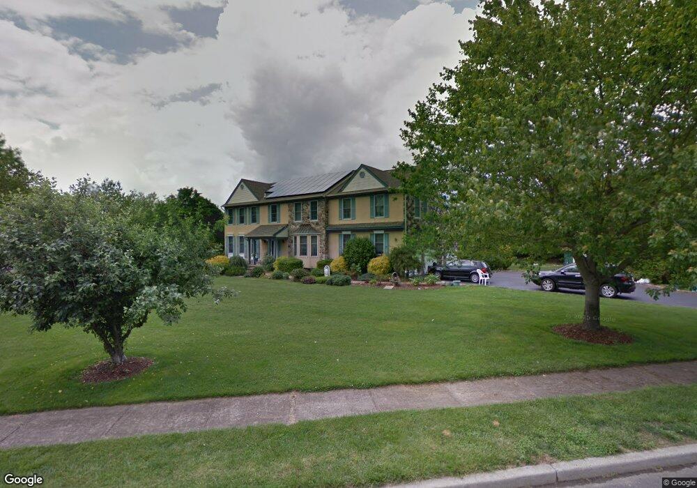
223 Chestnut Dr Wrightstown, NJ 08562
Estimated Value: $690,211 - $784,000
Studio
--
Bath
3,306
Sq Ft
$220/Sq Ft
Est. Value
About This Home
This home is located at 223 Chestnut Dr, Wrightstown, NJ 08562 and is currently estimated at $726,803, approximately $219 per square foot. 223 Chestnut Dr is a home located in Burlington County with nearby schools including C.B. Lamb Elementary School, North Hanover Township Upper Elementary School, and Northern Burlington County Regional Middle School.
Ownership History
Date
Name
Owned For
Owner Type
Purchase Details
Closed on
Aug 19, 1996
Sold by
Warrack Scott W
Bought by
Mannuccia Anthony and Mannuccia Nancylu
Current Estimated Value
Purchase Details
Closed on
Jul 23, 1996
Sold by
Warrack Scott W and Warrack Ann Marie
Bought by
Warrack Scott W
Purchase Details
Closed on
Aug 27, 1993
Sold by
Hanover Pond Dev
Bought by
Warrack Scott and Warrack Ann Marie
Home Financials for this Owner
Home Financials are based on the most recent Mortgage that was taken out on this home.
Original Mortgage
$212,000
Interest Rate
7.16%
Create a Home Valuation Report for This Property
The Home Valuation Report is an in-depth analysis detailing your home's value as well as a comparison with similar homes in the area
Home Values in the Area
Average Home Value in this Area
Purchase History
| Date | Buyer | Sale Price | Title Company |
|---|---|---|---|
| Mannuccia Anthony | $256,500 | Chicago Title Insurance Co | |
| Warrack Scott W | -- | -- | |
| Warrack Scott | $264,000 | -- |
Source: Public Records
Mortgage History
| Date | Status | Borrower | Loan Amount |
|---|---|---|---|
| Previous Owner | Warrack Scott | $212,000 |
Source: Public Records
Tax History
| Year | Tax Paid | Tax Assessment Tax Assessment Total Assessment is a certain percentage of the fair market value that is determined by local assessors to be the total taxable value of land and additions on the property. | Land | Improvement |
|---|---|---|---|---|
| 2025 | $10,424 | $436,900 | $73,900 | $363,000 |
| 2024 | $9,655 | $436,900 | $73,900 | $363,000 |
| 2023 | $9,655 | $436,900 | $73,900 | $363,000 |
| 2022 | $9,695 | $436,900 | $73,900 | $363,000 |
| 2021 | $9,603 | $427,000 | $73,900 | $353,100 |
| 2020 | $9,578 | $427,000 | $73,900 | $353,100 |
| 2019 | $9,496 | $427,000 | $73,900 | $353,100 |
| 2018 | $9,069 | $427,000 | $73,900 | $353,100 |
| 2017 | $8,877 | $427,000 | $73,900 | $353,100 |
| 2016 | $8,852 | $427,000 | $73,900 | $353,100 |
| 2015 | $8,904 | $429,500 | $76,400 | $353,100 |
| 2014 | $8,753 | $448,400 | $85,400 | $363,000 |
Source: Public Records
Map
Nearby Homes
- 194 Jacobstown New Egypt Rd Unit 4
- 194 Jacobstown New Egypt Rd Unit 2
- 194 Jacobstown New Egypt Rd Unit 73
- 194 Jacobstown New Egypt Rd
- 53 Meany Rd
- 301 Meany Rd
- 0 Larrison Rd
- 83 Chesterfield Jacobstown Rd
- 347 Jacobstown Cookstown Rd
- 181 Cookstown New Egypt Rd Unit B37
- XX Cookstown New Egypt Rd
- 6 Mary St
- 10 Mary St
- 20 Belmont Rd
- 114 Cookstown New Egypt Rd Unit C7
- 44 Churchill Blvd
- 71 Jacobstown Rd
- 54 Churchill Blvd
- 18 Emerald Rd
- 23 Gulfstream Rd
Your Personal Tour Guide
Ask me questions while you tour the home.