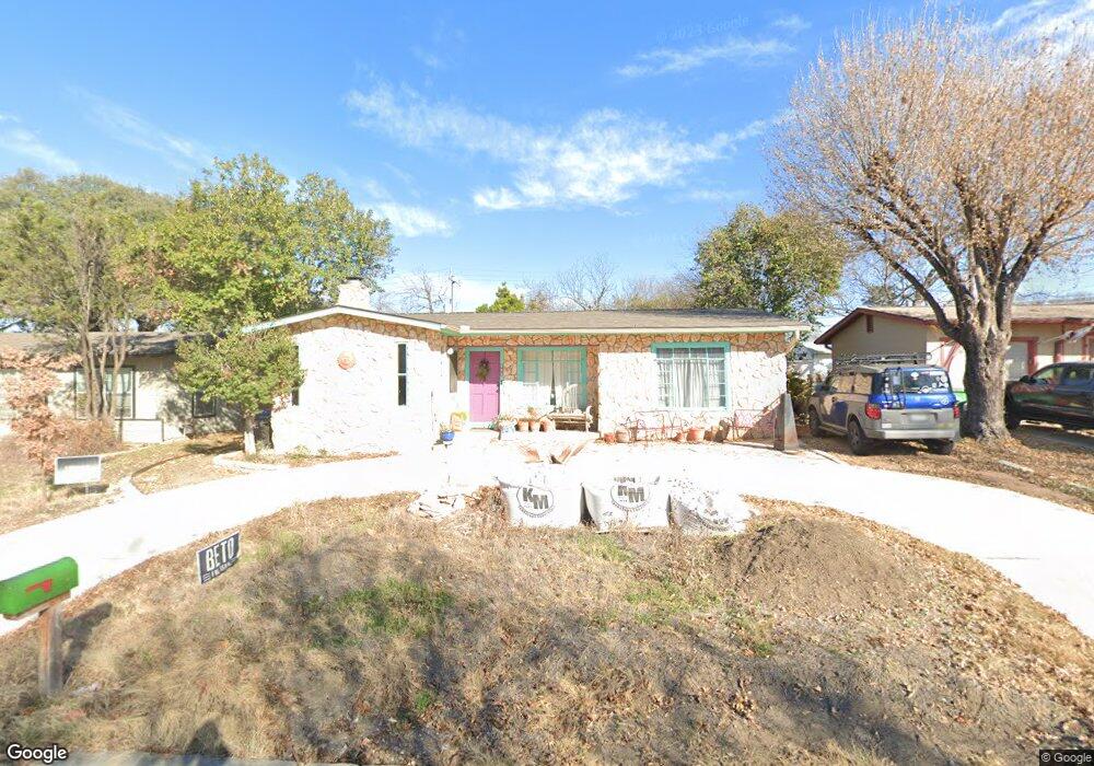
223 Conway Dr San Antonio, TX 78209
Lincoln Heights NeighborhoodEstimated Value: $261,000 - $282,000
2
Beds
1
Bath
1,228
Sq Ft
$218/Sq Ft
Est. Value
About This Home
This home is located at 223 Conway Dr, San Antonio, TX 78209 and is currently estimated at $268,217, approximately $218 per square foot. 223 Conway Dr is a home located in Bexar County with nearby schools including Woodridge Elementary School, Alamo Heights Junior School, and Alamo Heights High School.
Ownership History
Date
Name
Owned For
Owner Type
Purchase Details
Closed on
Nov 25, 2002
Sold by
Salazar Linda M and Estate Of Mary Elizabeth Knowl
Bought by
Feuerbacher Clari A
Current Estimated Value
Home Financials for this Owner
Home Financials are based on the most recent Mortgage that was taken out on this home.
Original Mortgage
$79,500
Outstanding Balance
$33,879
Interest Rate
6.13%
Estimated Equity
$234,338
Purchase Details
Closed on
Mar 8, 1996
Sold by
Staten Gene C and Staten Gene C
Bought by
Knowles Elizabeth Anderson
Create a Home Valuation Report for This Property
The Home Valuation Report is an in-depth analysis detailing your home's value as well as a comparison with similar homes in the area
Home Values in the Area
Average Home Value in this Area
Purchase History
| Date | Buyer | Sale Price | Title Company |
|---|---|---|---|
| Feuerbacher Clari A | -- | Chicago Title | |
| Knowles Elizabeth Anderson | -- | -- |
Source: Public Records
Mortgage History
| Date | Status | Borrower | Loan Amount |
|---|---|---|---|
| Open | Feuerbacher Clari A | $79,500 |
Source: Public Records
Tax History Compared to Growth
Tax History
| Year | Tax Paid | Tax Assessment Tax Assessment Total Assessment is a certain percentage of the fair market value that is determined by local assessors to be the total taxable value of land and additions on the property. | Land | Improvement |
|---|---|---|---|---|
| 2025 | $3,981 | $244,220 | $171,560 | $72,660 |
| 2024 | $3,981 | $246,368 | $171,560 | $91,860 |
| 2023 | $3,981 | $223,971 | $171,560 | $85,690 |
| 2022 | $4,929 | $203,610 | $118,480 | $95,270 |
| 2021 | $4,619 | $185,100 | $103,030 | $82,070 |
| 2020 | $4,458 | $178,421 | $82,980 | $101,150 |
| 2019 | $4,150 | $162,201 | $66,380 | $112,160 |
| 2018 | $3,694 | $147,455 | $66,380 | $100,200 |
| 2017 | $3,358 | $134,050 | $47,380 | $86,670 |
| 2016 | $3,504 | $139,880 | $40,680 | $99,200 |
| 2015 | $3,047 | $140,503 | $40,680 | $100,200 |
| 2014 | $3,047 | $127,730 | $0 | $0 |
Source: Public Records
Map
Nearby Homes
- 222 Conway Dr
- 702 Everest Ave
- 139 Belfast Dr
- 127 Belfast Dr
- 915 Rexford Dr
- 910 Rexford Dr
- 1511 E Sandalwood Ln
- 1531 W Lawndale Dr
- 111 Belfast Dr
- 647 Simple Way
- 206 Ridgecrest Dr
- 8117 Scottshill
- 8109 Scottshill
- 8112 Scottshill
- 1618 W Lawndale Dr
- 1802 Edgehill Dr
- 8058 Broadway Unit 138N
- 8058 Broadway Unit 251U
- 8058 Broadway Unit 247 U
- 8058 Broadway Unit 257T