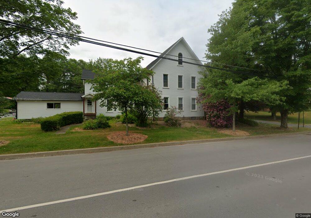
223 Court St Laporte, PA 18626
Estimated Value: $280,000 - $388,000
5
Beds
3
Baths
2,892
Sq Ft
$111/Sq Ft
Est. Value
About This Home
This home is located at 223 Court St, Laporte, PA 18626 and is currently estimated at $320,965, approximately $110 per square foot. 223 Court St is a home with nearby schools including Sullivan County Elementary School and Sullivan County High School.
Ownership History
Date
Name
Owned For
Owner Type
Purchase Details
Closed on
Jul 16, 2024
Sold by
Randall Jeffrey R and Randall Julia A
Bought by
Savage Malachi J and Savage Morgan E
Current Estimated Value
Home Financials for this Owner
Home Financials are based on the most recent Mortgage that was taken out on this home.
Original Mortgage
$175,000
Outstanding Balance
$172,926
Interest Rate
7.03%
Mortgage Type
New Conventional
Estimated Equity
$148,039
Create a Home Valuation Report for This Property
The Home Valuation Report is an in-depth analysis detailing your home's value as well as a comparison with similar homes in the area
Home Values in the Area
Average Home Value in this Area
Purchase History
| Date | Buyer | Sale Price | Title Company |
|---|---|---|---|
| Savage Malachi J | $275,000 | None Listed On Document |
Source: Public Records
Mortgage History
| Date | Status | Borrower | Loan Amount |
|---|---|---|---|
| Open | Savage Malachi J | $175,000 |
Source: Public Records
Tax History Compared to Growth
Tax History
| Year | Tax Paid | Tax Assessment Tax Assessment Total Assessment is a certain percentage of the fair market value that is determined by local assessors to be the total taxable value of land and additions on the property. | Land | Improvement |
|---|---|---|---|---|
| 2025 | $2,755 | $123,300 | $19,800 | $103,500 |
| 2024 | $2,628 | $123,300 | $19,800 | $103,500 |
| 2023 | $2,531 | $123,300 | $19,800 | $103,500 |
| 2022 | $724 | $119,800 | $19,800 | $100,000 |
| 2021 | $724 | $119,800 | $19,800 | $100,000 |
| 2020 | $2,341 | $119,800 | $19,800 | $100,000 |
| 2019 | $2,296 | $119,800 | $19,800 | $100,000 |
| 2017 | $2,230 | $119,800 | $19,800 | $100,000 |
| 2015 | $1,270 | $119,800 | $19,800 | $100,000 |
| 2014 | $1,270 | $119,800 | $19,800 | $100,000 |
| 2012 | $1,270 | $119,800 | $19,800 | $100,000 |
Source: Public Records
Map
Nearby Homes
- Snyder Rd Lot Unit WP001
- 0 Pole Bridge Rd Unit LOT 39 WB-100451
- 0 Pole Bridge Rd Unit LOT 37 WB-100448
- 0 Pole Bridge Rd Unit LOT 38 WB-100450
- 0 Snyder Rd
- 108 Stansfield Rd
- 30 Hemlock Dr
- 113 Swamp Rd
- PARCEL 108.A Mountain Rd
- 2247 Nordmont Rd
- PARCEL 001 Fairman Rd
- 422 Pennsylvania Ave
- 103 Fairman Rd Unit T316
- 375 Allegheny Ave
- 595 Old Bernice Rd
- 0 Old Bernice Rd Unit 31721825
- 1050 Old Bernice Rd
- 4 Huckle St
- 167 Payne Run Ln
- 6765 Route 87