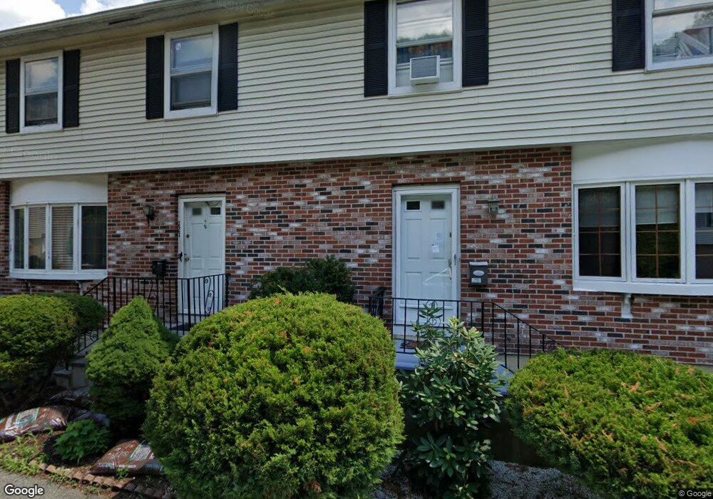
223 Cummins Hwy Unit 223 Boston, MA 02131
Roslindale NeighborhoodEstimated Value: $522,640 - $703,000
3
Beds
2
Baths
1,656
Sq Ft
$347/Sq Ft
Est. Value
About This Home
This home is located at 223 Cummins Hwy Unit 223, Boston, MA 02131 and is currently estimated at $574,160, approximately $346 per square foot. 223 Cummins Hwy Unit 223 is a home located in Suffolk County with nearby schools including Brooke Charter School Roslindale, Sacred Heart STEM School, and St. Clare High School.
Ownership History
Date
Name
Owned For
Owner Type
Purchase Details
Closed on
Jul 25, 2007
Sold by
Mentor Francois
Bought by
Mentor Francois
Current Estimated Value
Purchase Details
Closed on
Dec 5, 2005
Sold by
Butler Andrea R
Bought by
Mentor Francois and Mintor Marie Y
Home Financials for this Owner
Home Financials are based on the most recent Mortgage that was taken out on this home.
Original Mortgage
$282,500
Interest Rate
6.14%
Mortgage Type
Purchase Money Mortgage
Purchase Details
Closed on
Aug 25, 1999
Sold by
Patel Vinu C and Patel Jyotika V
Bought by
Butler Andrea R
Home Financials for this Owner
Home Financials are based on the most recent Mortgage that was taken out on this home.
Original Mortgage
$133,000
Interest Rate
7.53%
Mortgage Type
Purchase Money Mortgage
Create a Home Valuation Report for This Property
The Home Valuation Report is an in-depth analysis detailing your home's value as well as a comparison with similar homes in the area
Home Values in the Area
Average Home Value in this Area
Purchase History
| Date | Buyer | Sale Price | Title Company |
|---|---|---|---|
| Mentor Francois | -- | -- | |
| Mentor Francois | $297,000 | -- | |
| Butler Andrea R | $140,000 | -- |
Source: Public Records
Mortgage History
| Date | Status | Borrower | Loan Amount |
|---|---|---|---|
| Previous Owner | Mentor Francois | $282,500 | |
| Previous Owner | Butler Andrea R | $37,100 | |
| Previous Owner | Butler Andrea R | $133,000 |
Source: Public Records
Tax History Compared to Growth
Tax History
| Year | Tax Paid | Tax Assessment Tax Assessment Total Assessment is a certain percentage of the fair market value that is determined by local assessors to be the total taxable value of land and additions on the property. | Land | Improvement |
|---|---|---|---|---|
| 2025 | $5,137 | $443,600 | $0 | $443,600 |
| 2024 | $3,988 | $365,900 | $0 | $365,900 |
| 2023 | $3,740 | $348,200 | $0 | $348,200 |
| 2022 | $3,540 | $325,400 | $0 | $325,400 |
| 2021 | $3,245 | $304,100 | $0 | $304,100 |
| 2020 | $2,878 | $272,500 | $0 | $272,500 |
| 2019 | $2,734 | $259,400 | $0 | $259,400 |
| 2018 | $2,719 | $259,400 | $0 | $259,400 |
| 2017 | $2,617 | $247,100 | $0 | $247,100 |
| 2016 | $2,471 | $224,600 | $0 | $224,600 |
| 2015 | $2,608 | $215,400 | $0 | $215,400 |
| 2014 | $2,530 | $201,100 | $0 | $201,100 |
Source: Public Records
Map
Nearby Homes
- 16 Hilburn Place
- 4 Rowe Ct
- 543 Hyde Park Ave Unit 1
- 250 Poplar St Unit 1
- 2 Pinedale Rd Unit 3
- 27 Rowe St
- 650 Hyde Park Ave Unit 2
- 61 Whitford St
- 472 Hyde Park Ave Unit 472
- 117 Sycamore St Unit 1
- 41 Hawthorne St Unit 2
- 19-21 Augustus Ave
- 28-30 Mount Hope St
- 67 Cummins Hwy Unit 101
- 67 Cummins Hwy Unit 304
- 886 Canterbury St
- 42 Wilmot St
- 32 Jewett St
- 87 Clare Ave
- 3 Whitford St
- 223 Cummins Hwy
- 221 Cummins Hwy
- 223 Cummins Hwy
- 221 Cummins Hwy Unit 221
- 227 Cummins Hwy
- 225 Cummins Hwy
- 14 Delore Cir
- 11 Delore Cir
- 229 Cummins Hwy
- 10 Delore Cir
- 233 Cummins Hwy
- 237 Cummins Hwy Unit A22
- 237 Cummins Hwy Unit A32
- 237 Cummins Hwy Unit B22
- 7 Delore Cir
- 40 Seymour St
- 40 Seymour St
- 207 Cummins Hwy Unit 3
- 207 Cummins Hwy Unit 2
- 207 Cummins Hwy Unit 1R