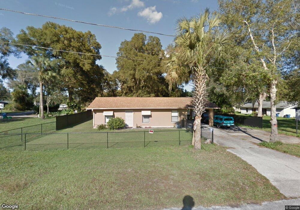
223 E Broderick St de Leon Springs, FL 32130
DeLeon Springs NeighborhoodEstimated Value: $194,000 - $204,762
3
Beds
1
Bath
1,000
Sq Ft
$199/Sq Ft
Est. Value
About This Home
This home is located at 223 E Broderick St, de Leon Springs, FL 32130 and is currently estimated at $198,941, approximately $198 per square foot. 223 E Broderick St is a home located in Volusia County with nearby schools including Louise S. McInnis Elementary School and T. Dewitt Taylor Middle/High School.
Ownership History
Date
Name
Owned For
Owner Type
Purchase Details
Closed on
Nov 23, 1993
Sold by
Mooney William B
Bought by
Mosher Reginal and Mosher Vicky
Current Estimated Value
Home Financials for this Owner
Home Financials are based on the most recent Mortgage that was taken out on this home.
Original Mortgage
$39,354
Interest Rate
6.81%
Purchase Details
Closed on
Aug 15, 1990
Bought by
Mosher Reginal and Mosher Vicky
Purchase Details
Closed on
Aug 15, 1989
Bought by
Mosher Reginal and Mosher Vicky
Create a Home Valuation Report for This Property
The Home Valuation Report is an in-depth analysis detailing your home's value as well as a comparison with similar homes in the area
Home Values in the Area
Average Home Value in this Area
Purchase History
| Date | Buyer | Sale Price | Title Company |
|---|---|---|---|
| Mosher Reginal | $49,900 | -- | |
| Mosher Reginal | $100 | -- | |
| Mosher Reginal | $115,000 | -- |
Source: Public Records
Mortgage History
| Date | Status | Borrower | Loan Amount |
|---|---|---|---|
| Closed | Mosher Reginal | $39,354 |
Source: Public Records
Tax History Compared to Growth
Tax History
| Year | Tax Paid | Tax Assessment Tax Assessment Total Assessment is a certain percentage of the fair market value that is determined by local assessors to be the total taxable value of land and additions on the property. | Land | Improvement |
|---|---|---|---|---|
| 2025 | $593 | $40,525 | -- | -- |
| 2024 | $593 | $39,383 | -- | -- |
| 2023 | $593 | $38,236 | $0 | $0 |
| 2022 | $555 | $37,122 | $0 | $0 |
| 2021 | $552 | $36,041 | $0 | $0 |
| 2020 | $535 | $35,543 | $0 | $0 |
| 2019 | $533 | $34,744 | $0 | $0 |
| 2018 | $507 | $34,096 | $0 | $0 |
| 2017 | $471 | $33,395 | $0 | $0 |
| 2016 | $433 | $32,708 | $0 | $0 |
| 2015 | $433 | $32,481 | $0 | $0 |
| 2014 | $426 | $32,223 | $0 | $0 |
Source: Public Records
Map
Nearby Homes
- 0 E Berlin St
- 290 E Baxter St
- 0 North St
- 1955 Hillcrest Oak Dr
- 0 Philadelphia Ave
- 237 Cortez Ave
- 0 No Name Parcel 05163011380050 Unit V4910400
- 5060 Audubon Ave
- 329 Desoto Ave
- 1909 S Farm Rd
- 30 High Ridge Ave
- 0 Pid# 44 16 29 01 00 1141 Unit MFRV4944345
- 5410 Deleon Springs Ranch Rd
- 0 Reynolds Rd Unit MFRO6225952
- 0 Reynolds Rd Unit MFRO6292104
- 0 Reynolds Rd Unit MFRO6225958
- 0 Reynolds Rd Unit 1219410
- 2 Ponce Deleon Springs Terrace
- 0 Parcel 27 15 30 00 0200 Unit MFRV4941597
- 1056 Reynolds Rd
- 4955 Upson Ave
- 225 E Broderick St
- 4960 Dundee Ave
- 4965 Upson Ave
- 4970 Dundee Ave
- 0 Dundee Ave
- 4980 Dundee Ave
- 4975 Upson Ave
- 0 E Broderick St
- 4961 Dundee Ave
- 209 E Broderick St
- 0 Webb St
- 330 Webb Ave
- 4927 Central Ave
- 4991 Dundee Ave
- 5005 Upson Ave
- 295 Webb St
- 4980 Starkweather Ave
- 245 E Broderick St
- 340 Webb St