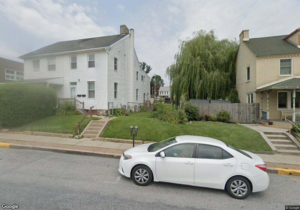
223 E State St Kennett Square, PA 19348
Estimated Value: $319,000 - $416,496
3
Beds
2
Baths
1,504
Sq Ft
$253/Sq Ft
Est. Value
About This Home
This home is located at 223 E State St, Kennett Square, PA 19348 and is currently estimated at $379,874, approximately $252 per square foot. 223 E State St is a home located in Chester County with nearby schools including Kennett Middle School, Kennett High School, and St. Patrick School.
Ownership History
Date
Name
Owned For
Owner Type
Purchase Details
Closed on
Jun 8, 2022
Sold by
Next Ventures State St Llc
Bought by
Norris Gregory and Moreno Anabelle Ornelas
Current Estimated Value
Home Financials for this Owner
Home Financials are based on the most recent Mortgage that was taken out on this home.
Original Mortgage
$168,750
Outstanding Balance
$160,326
Interest Rate
5.1%
Mortgage Type
New Conventional
Estimated Equity
$219,548
Purchase Details
Closed on
Sep 10, 2020
Sold by
Richardson Fresh Ponds Llc
Bought by
Next Ventures State St Llc
Purchase Details
Closed on
Nov 23, 2016
Sold by
Kanofsky Barry R and Kanofsky Rachelle C
Bought by
Richardson Fresh Ponds Ll
Purchase Details
Closed on
Jun 1, 1988
Bought by
Kanofsky Barry R and Kanofsky Rachelle C
Create a Home Valuation Report for This Property
The Home Valuation Report is an in-depth analysis detailing your home's value as well as a comparison with similar homes in the area
Home Values in the Area
Average Home Value in this Area
Purchase History
| Date | Buyer | Sale Price | Title Company |
|---|---|---|---|
| Norris Gregory | $225,000 | -- | |
| Norris Gregory | $225,000 | None Listed On Document | |
| Next Ventures State St Llc | $325,000 | Authentic Land Transfer Llc | |
| Richardson Fresh Ponds Ll | $209,800 | Countywide Abstract | |
| Kanofsky Barry R | $78,300 | -- |
Source: Public Records
Mortgage History
| Date | Status | Borrower | Loan Amount |
|---|---|---|---|
| Open | Norris Gregory | $168,750 | |
| Closed | Norris Gregory | $168,750 |
Source: Public Records
Tax History
| Year | Tax Paid | Tax Assessment Tax Assessment Total Assessment is a certain percentage of the fair market value that is determined by local assessors to be the total taxable value of land and additions on the property. | Land | Improvement |
|---|---|---|---|---|
| 2025 | $5,092 | $104,500 | $32,860 | $71,640 |
| 2024 | $5,092 | $104,500 | $32,860 | $71,640 |
| 2023 | $4,936 | $104,500 | $32,860 | $71,640 |
| 2022 | $4,511 | $104,500 | $32,860 | $71,640 |
| 2021 | $4,471 | $104,500 | $32,860 | $71,640 |
| 2020 | $4,396 | $104,500 | $32,860 | $71,640 |
| 2019 | $4,344 | $104,500 | $32,860 | $71,640 |
| 2018 | $4,242 | $104,500 | $32,860 | $71,640 |
| 2017 | $4,176 | $104,500 | $32,860 | $71,640 |
| 2016 | $414 | $104,500 | $32,860 | $71,640 |
| 2015 | $414 | $104,500 | $32,860 | $71,640 |
| 2014 | $414 | $104,500 | $32,860 | $71,640 |
Source: Public Records
Map
Nearby Homes
- 311 E State St
- 107 W State St
- 118 Austin Dr
- 126 Austin Dr
- 530 Richards Rd
- 535 Kenview Ave
- 602 D St
- 607 W Mulberry St
- 621 Magnolia Ct
- 619 W Mulberry St
- 631 Magnolia Ct
- 10102 Austin Dr
- 10101 Austin Dr
- 629 W Mulberry St
- 10102 Bramble St
- 10101 Bramble St
- 103 Waywood Dr Unit 36
- 103 Waywood Dr
- 105 Waywood Dr
- 10101 Louie Ln
- 221 E State St
- 227 E State St
- 229 E State St
- 211 E State St
- 211 State St
- 227 E Maple St
- 219 E Maple St
- 303 State St Unit 3
- 303 State St Unit 1
- 303 State St Unit G
- 303 State St Unit 2
- 303 State St
- 229 E Maple St
- 223 E Maple St
- 231 E Maple St
- 305 E State St
- 220 E Linden St
- 307 E State St
- 301 E State St
- 309 E State St
Your Personal Tour Guide
Ask me questions while you tour the home.