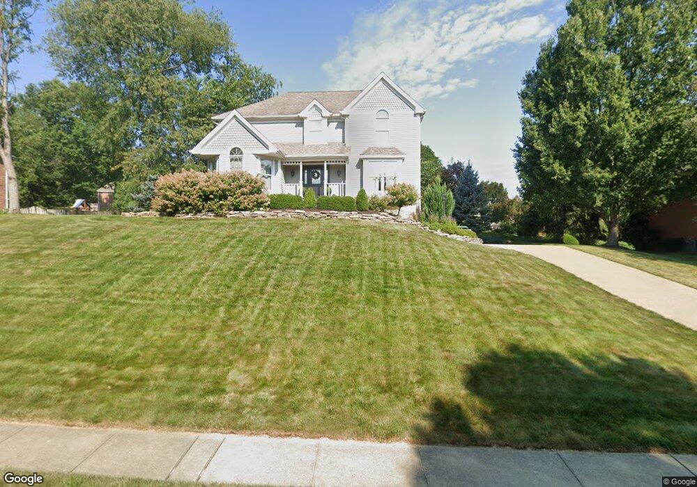
223 Elmhurst Cir Cranberry Township, PA 16066
Estimated Value: $190,473 - $625,000
3
Beds
3
Baths
2,434
Sq Ft
$198/Sq Ft
Est. Value
About This Home
This home is located at 223 Elmhurst Cir, Cranberry Township, PA 16066 and is currently estimated at $481,118, approximately $197 per square foot. 223 Elmhurst Cir is a home located in Butler County with nearby schools including Evans City Middle School, Ryan Gloyer Middle School, and Seneca Valley Senior High School.
Ownership History
Date
Name
Owned For
Owner Type
Purchase Details
Closed on
Dec 29, 2005
Sold by
Trovato Jocelyn A
Bought by
Gewar Peter A
Current Estimated Value
Home Financials for this Owner
Home Financials are based on the most recent Mortgage that was taken out on this home.
Original Mortgage
$125,000
Outstanding Balance
$70,757
Interest Rate
6.39%
Mortgage Type
New Conventional
Estimated Equity
$410,361
Purchase Details
Closed on
Mar 29, 1999
Sold by
Pavia David M
Bought by
Trovato Jocelyn A
Home Financials for this Owner
Home Financials are based on the most recent Mortgage that was taken out on this home.
Original Mortgage
$200,400
Interest Rate
6.78%
Mortgage Type
Purchase Money Mortgage
Create a Home Valuation Report for This Property
The Home Valuation Report is an in-depth analysis detailing your home's value as well as a comparison with similar homes in the area
Home Values in the Area
Average Home Value in this Area
Purchase History
| Date | Buyer | Sale Price | Title Company |
|---|---|---|---|
| Gewar Peter A | $305,000 | -- | |
| Trovato Jocelyn A | $250,500 | -- |
Source: Public Records
Mortgage History
| Date | Status | Borrower | Loan Amount |
|---|---|---|---|
| Open | Gewar Peter A | $125,000 | |
| Previous Owner | Trovato Jocelyn A | $200,400 |
Source: Public Records
Tax History Compared to Growth
Tax History
| Year | Tax Paid | Tax Assessment Tax Assessment Total Assessment is a certain percentage of the fair market value that is determined by local assessors to be the total taxable value of land and additions on the property. | Land | Improvement |
|---|---|---|---|---|
| 2025 | $5,854 | $32,670 | $3,960 | $28,710 |
| 2024 | $5,681 | $32,670 | $3,960 | $28,710 |
| 2023 | $5,597 | $32,670 | $3,960 | $28,710 |
| 2022 | $5,597 | $32,670 | $3,960 | $28,710 |
| 2021 | $5,514 | $32,670 | $0 | $0 |
| 2020 | $5,514 | $32,670 | $3,960 | $28,710 |
| 2019 | $5,452 | $32,670 | $3,960 | $28,710 |
| 2018 | $5,452 | $32,670 | $3,960 | $28,710 |
| 2017 | $5,354 | $32,670 | $3,960 | $28,710 |
| 2016 | $1,469 | $32,670 | $3,960 | $28,710 |
| 2015 | $662 | $32,670 | $3,960 | $28,710 |
| 2014 | $662 | $32,670 | $3,960 | $28,710 |
Source: Public Records
Map
Nearby Homes
- 205 Elmhurst Cir
- 252 Elmhurst Cir
- 170 Pinehurst Dr
- 175 Pinehurst Dr
- 8047 Maureen Dr
- 402 Hidden Meadow Dr
- 8057 Maureen Dr
- 402 Schomburg Ct
- Sedona Plan at Park Meadows
- Nantucket Plan at Park Meadows
- Cambridge Plan at Park Meadows
- Colorado Plan at Park Meadows
- Scottsdale Plan at Park Meadows
- Aspen Plan at Park Meadows
- Carolina Plan at Park Meadows
- Georgetown Plan at Park Meadows
- Austin Plan at Park Meadows
- Napa Plan at Park Meadows
- Portland Plan at Park Meadows
- Arlington Plan at Park Meadows
- 221 Elmhurst Cir
- 225 Elmhurst Cir
- 415 Chestnut Grove
- 417 Chestnut Grove
- 228 Elmhurst Cir
- 230 Elmhurst Cir
- 226 Elmhurst Cir
- 413 Chestnut Grove
- 219 Elmhurst Cir
- 227 Elmhurst Cir
- 232 Elmhurst Cir
- 416 Chestnut Grove
- 224 Elmhurst Cir
- 217 Elmhurst Cir
- 234 Elmhurst Cir
- 414 Chestnut Grove
- 222 Elmhurst Cir
- 411 Chestnut Grove
- 412 Chestnut Grove
- 229 Elmhurst Cir