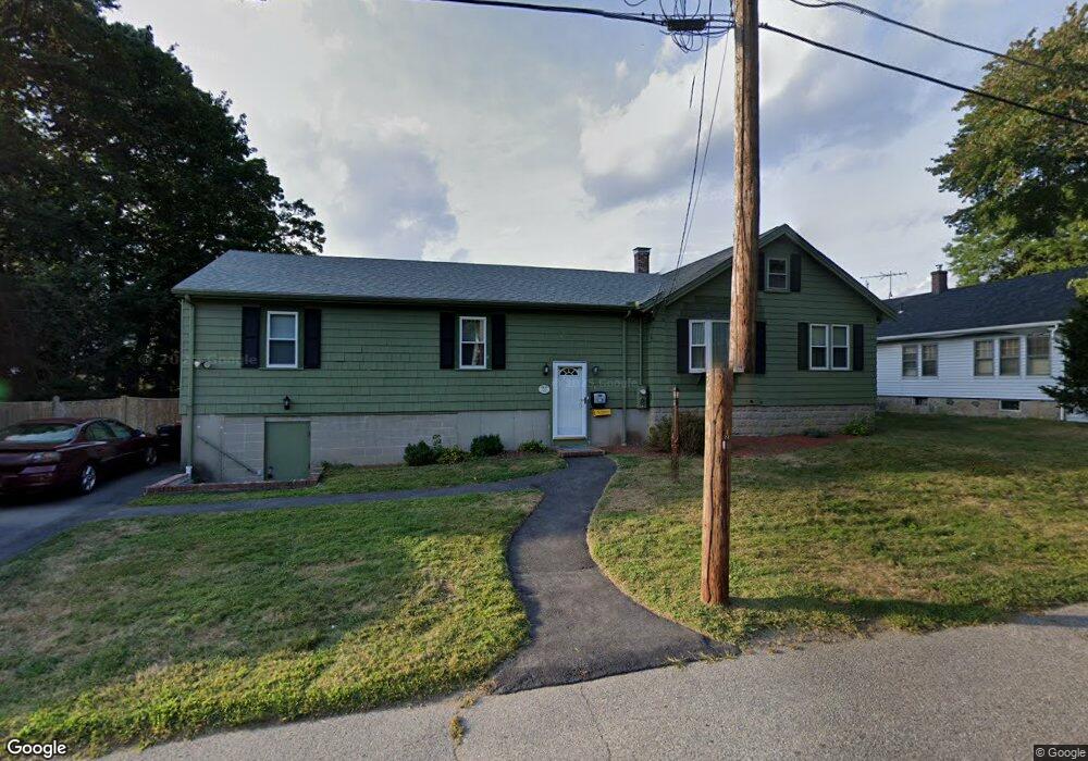
223 Keith Avenue Extension Brockton, MA 02301
Clifton Heights NeighborhoodEstimated Value: $510,000 - $528,000
4
Beds
2
Baths
1,852
Sq Ft
$279/Sq Ft
Est. Value
About This Home
This home is located at 223 Keith Avenue Extension, Brockton, MA 02301 and is currently estimated at $517,106, approximately $279 per square foot. 223 Keith Avenue Extension is a home located in Plymouth County with nearby schools including John F. Kennedy Elementary School, Davis K-8 School, and South Middle School.
Ownership History
Date
Name
Owned For
Owner Type
Purchase Details
Closed on
Mar 6, 2024
Sold by
Chaplic Cathy A Est and Williams
Bought by
Marissa Anne Pitts Irt and Williams
Current Estimated Value
Purchase Details
Closed on
Nov 10, 2011
Sold by
Vandeusen Fred G and Vandeusen Cynthia J
Bought by
Chaplic Cathy A and Chaplic Patricia M
Create a Home Valuation Report for This Property
The Home Valuation Report is an in-depth analysis detailing your home's value as well as a comparison with similar homes in the area
Home Values in the Area
Average Home Value in this Area
Purchase History
| Date | Buyer | Sale Price | Title Company |
|---|---|---|---|
| Marissa Anne Pitts Irt | -- | None Available | |
| Marissa Anne Pitts Irt | -- | None Available | |
| Chaplic Cathy A | -- | -- | |
| Chaplic Cathy A | -- | -- |
Source: Public Records
Mortgage History
| Date | Status | Borrower | Loan Amount |
|---|---|---|---|
| Previous Owner | Chaplic Cathy A | $50,000 | |
| Previous Owner | Chaplic Cathy A | $50,000 |
Source: Public Records
Tax History Compared to Growth
Tax History
| Year | Tax Paid | Tax Assessment Tax Assessment Total Assessment is a certain percentage of the fair market value that is determined by local assessors to be the total taxable value of land and additions on the property. | Land | Improvement |
|---|---|---|---|---|
| 2025 | $4,718 | $389,600 | $141,000 | $248,600 |
| 2024 | $4,431 | $368,600 | $141,000 | $227,600 |
| 2023 | $4,695 | $361,700 | $108,800 | $252,900 |
| 2022 | $4,480 | $320,700 | $99,000 | $221,700 |
| 2021 | $3,840 | $264,800 | $83,200 | $181,600 |
| 2020 | $4,118 | $271,800 | $77,000 | $194,800 |
| 2019 | $3,818 | $245,700 | $74,800 | $170,900 |
| 2018 | $3,485 | $217,000 | $74,800 | $142,200 |
| 2017 | $3,241 | $201,300 | $74,800 | $126,500 |
| 2016 | $3,330 | $191,800 | $72,800 | $119,000 |
| 2015 | $2,839 | $156,400 | $72,800 | $83,600 |
| 2014 | $2,865 | $158,000 | $72,800 | $85,200 |
Source: Public Records
Map
Nearby Homes
- 115 Leach Ave
- 57 Copeland St
- 115 Market St
- 47 Southworth St
- 137 Channing Ave
- 176 Ettrick St
- 65 Tremont St
- 37 Menlo Ave
- 153 Bouve Ave
- 977 Warren Ave
- 56 Cottage Grove Ave
- 58 Calmar St
- 115 Ettrick St
- 936 Warren Ave
- 1036 Ash St
- 20 Custer St
- 184 Myrtle St
- 35 Longworth Ave Unit 17
- 223 Clinton St Unit 10
- 223 Clinton St Unit 3
- 235 Keith Avenue Extension
- 221 Keith Avenue Extension
- 154 Leach Ave
- 166 Leach Ave
- 243 Keith Avenue Extension
- 224 Keith Avenue Extension
- 170 Leach Ave
- 60 Davis Ave
- 142 Leach Ave
- 236 Keith Avenue Extension
- 211 Keith Avenue Extension
- 230 Keith Avenue Extension
- 5 Hoover Ave
- 138 Leach Ave
- 249 Keith Avenue Extension
- 207 Keith Avenue Extension
- 159 Leach Ave
- 18 Davis Ave
- 153 Leach Ave
- 176 Leach Ave