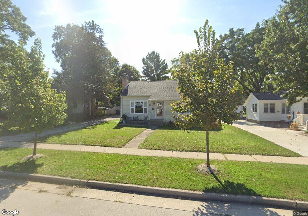
223 Lincoln Ave Mukwonago, WI 53149
Estimated Value: $325,286 - $394,000
3
Beds
1
Bath
--
Sq Ft
0.3
Acres
About This Home
This home is located at 223 Lincoln Ave, Mukwonago, WI 53149 and is currently estimated at $344,072. 223 Lincoln Ave is a home located in Waukesha County with nearby schools including Clarendon Avenue Elementary School, Park View Middle School, and Mukwonago High School.
Ownership History
Date
Name
Owned For
Owner Type
Purchase Details
Closed on
Jan 21, 2025
Sold by
Jay Deborah G and Solgon Deborah G
Bought by
Demski Kelly F and Demski Jesse M
Current Estimated Value
Home Financials for this Owner
Home Financials are based on the most recent Mortgage that was taken out on this home.
Original Mortgage
$158,115
Outstanding Balance
$156,998
Interest Rate
6.72%
Mortgage Type
New Conventional
Estimated Equity
$187,074
Purchase Details
Closed on
Oct 13, 2023
Sold by
Jay Byron R
Bought by
Demski Kelly F
Create a Home Valuation Report for This Property
The Home Valuation Report is an in-depth analysis detailing your home's value as well as a comparison with similar homes in the area
Home Values in the Area
Average Home Value in this Area
Purchase History
| Date | Buyer | Sale Price | Title Company |
|---|---|---|---|
| Demski Kelly F | -- | None Listed On Document | |
| Demski Kelly F | -- | None Listed On Document |
Source: Public Records
Mortgage History
| Date | Status | Borrower | Loan Amount |
|---|---|---|---|
| Open | Demski Kelly F | $158,115 |
Source: Public Records
Tax History Compared to Growth
Tax History
| Year | Tax Paid | Tax Assessment Tax Assessment Total Assessment is a certain percentage of the fair market value that is determined by local assessors to be the total taxable value of land and additions on the property. | Land | Improvement |
|---|---|---|---|---|
| 2024 | $2,919 | $262,900 | $84,500 | $178,400 |
| 2023 | $2,563 | $158,000 | $42,500 | $115,500 |
| 2022 | $2,545 | $158,000 | $42,500 | $115,500 |
| 2021 | $2,363 | $158,000 | $42,500 | $115,500 |
| 2020 | $2,460 | $158,000 | $42,500 | $115,500 |
| 2019 | $2,328 | $158,000 | $42,500 | $115,500 |
| 2018 | $2,313 | $158,000 | $42,500 | $115,500 |
| 2017 | $2,449 | $143,300 | $40,200 | $103,100 |
| 2016 | $2,527 | $143,300 | $40,200 | $103,100 |
| 2015 | $2,469 | $143,300 | $40,200 | $103,100 |
| 2014 | $2,567 | $143,300 | $40,200 | $103,100 |
| 2013 | $2,567 | $143,300 | $40,200 | $103,100 |
Source: Public Records
Map
Nearby Homes
- 210 Oakland Ave
- 420 E Veterans Way Unit 8
- 331 Westside Ave Unit 1
- 417 Atkinson St
- 126 Plank Ct
- 501 Main St
- 1041 Sundown Ct
- 614 Stoecker Farm Ave
- 780 Eagle Lake Ave
- 1544 Sandhill Ln Unit 902
- 1548 Sandhill Ln Unit 901
- 1522 Sandhill Ln Unit 802
- 1526 Sandhill Ln Unit 801
- 1505 Sandhill Ln Unit 2202
- 1521 Sandhill Ln Unit 2101
- 1525 Sandhill Ln Unit 2102
- 1564 Fairwinds Blvd
- 1584 Fairwinds Blvd
- 1624 Fairwinds Blvd
- 1534 Fairwinds Blvd
- 229 Lincoln Ave
- 233 Lincoln Ave
- 215 Lincoln Ave
- 211 Lincoln Ave
- 301 Lincoln Ave
- 222 Lincoln Ave
- 207 Lincoln Ave
- 307 Lincoln Ave
- 208 Oakland Ave
- 204 Oakland Ave
- 228 Lincoln Ave
- 218 Lincoln Ave
- 232 Lincoln Ave
- 214 Lincoln Ave
- 722 Bryant St
- 210 Lincoln Ave
- 311 Lincoln Ave
- 726 Bryant St
- 729 Bryant St
- 304 Lincoln Ave