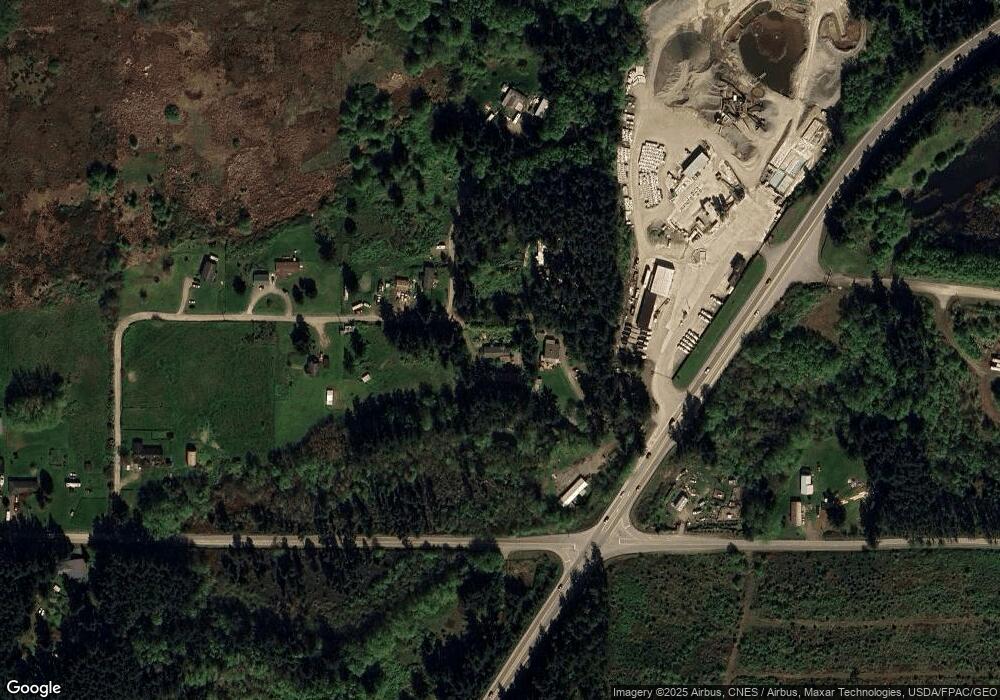
223 Moonstone Place Oak Harbor, WA 98277
Estimated Value: $435,000 - $540,000
2
Beds
2
Baths
1,512
Sq Ft
$331/Sq Ft
Est. Value
About This Home
This home is located at 223 Moonstone Place, Oak Harbor, WA 98277 and is currently estimated at $500,927, approximately $331 per square foot. 223 Moonstone Place is a home located in Island County with nearby schools including Hillcrest Elementary School, Oak Harbor Middle School, and Oak Harbor High School.
Ownership History
Date
Name
Owned For
Owner Type
Purchase Details
Closed on
May 18, 2012
Sold by
Jessup John A
Bought by
Jessup John A and Narwell Luningning L
Current Estimated Value
Purchase Details
Closed on
Mar 17, 2012
Sold by
Gwartney Thomas B and Gwartney Esther R
Bought by
Jessup John A
Home Financials for this Owner
Home Financials are based on the most recent Mortgage that was taken out on this home.
Original Mortgage
$157,722
Outstanding Balance
$107,744
Interest Rate
3.83%
Mortgage Type
New Conventional
Estimated Equity
$393,183
Create a Home Valuation Report for This Property
The Home Valuation Report is an in-depth analysis detailing your home's value as well as a comparison with similar homes in the area
Home Values in the Area
Average Home Value in this Area
Purchase History
| Date | Buyer | Sale Price | Title Company |
|---|---|---|---|
| Jessup John A | -- | None Available | |
| Jessup John A | $155,280 | Chicago Title Company |
Source: Public Records
Mortgage History
| Date | Status | Borrower | Loan Amount |
|---|---|---|---|
| Open | Jessup John A | $157,722 |
Source: Public Records
Tax History Compared to Growth
Tax History
| Year | Tax Paid | Tax Assessment Tax Assessment Total Assessment is a certain percentage of the fair market value that is determined by local assessors to be the total taxable value of land and additions on the property. | Land | Improvement |
|---|---|---|---|---|
| 2025 | $3,280 | $476,425 | $250,000 | $226,425 |
| 2024 | $3,215 | $459,791 | $230,000 | $229,791 |
| 2023 | $3,215 | $453,158 | $220,000 | $233,158 |
| 2022 | $3,389 | $397,225 | $210,000 | $187,225 |
| 2021 | $3,044 | $325,222 | $160,000 | $165,222 |
| 2020 | $3,065 | $291,281 | $130,000 | $161,281 |
| 2019 | $2,719 | $295,722 | $180,000 | $115,722 |
| 2018 | $2,868 | $286,134 | $170,000 | $116,134 |
| 2017 | $2,183 | $266,959 | $150,000 | $116,959 |
| 2016 | $2,073 | $216,019 | $120,000 | $96,019 |
| 2015 | -- | $197,568 | $100,000 | $97,568 |
| 2013 | -- | $175,665 | $75,000 | $100,665 |
Source: Public Records
Map
Nearby Homes
- 222 Moonstone Place
- 0 W Frostad Rd
- 140 W Green Valley Rd
- 0 Monkey Hill Rd
- 238 W Green Valley Rd
- 201 Sunset Dr
- 514 Lot A W Sullivan Rd
- 514 Lot D W Sullivan Rd
- 288 Torrence Ln
- 0 W Henni Rd
- 3167 Hunt Rd
- 486 W Henni Rd
- 685 Tidewater Rd
- 342 Frost Ln
- 480 Hazelwood Dr
- 4261 Northgate Dr
- 2995 Hunt Rd
- 900 NE 24th Ln
- 4281 Northgate Dr
- 4340 Hamilton Dr
- 35627 State Route 20
- 211 Moonstone Place
- 251 Moonstone Place
- 262 Moonstone Place
- 35619 Sr 20
- 232 Moonstone Place
- 186 W Sleeper Rd
- 290 Moonstone Place
- 331 Moonstone Place
- 313 W Sleeper Rd
- 316 W Sleeper Rd
- 326 W Sleeper Rd
- 340 W Sleeper Rd
- 379 W Sleeper Rd
- 70 W Sleeper Rd
- 3696 N Hoffman Rd
- 333 W Sleeper Rd
- 225 W Frostad Rd
