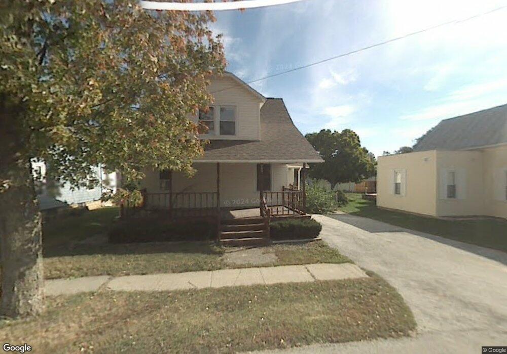
223 N Liberty St McComb, OH 45858
McComb NeighborhoodEstimated Value: $130,000 - $146,000
3
Beds
3
Baths
966
Sq Ft
$143/Sq Ft
Est. Value
About This Home
This home is located at 223 N Liberty St, McComb, OH 45858 and is currently estimated at $138,254, approximately $143 per square foot. 223 N Liberty St is a home located in Hancock County with nearby schools including McComb Elementary School, McComb Middle School, and Mccomb Local High School.
Ownership History
Date
Name
Owned For
Owner Type
Purchase Details
Closed on
Jun 1, 2021
Sold by
Rosebrook Daniel V and Rosebrook Misti
Bought by
Schoenauer Mark
Current Estimated Value
Purchase Details
Closed on
May 20, 2021
Sold by
Estate Of Donald H Rosenbrook
Bought by
Rosebrook Bonnie S
Purchase Details
Closed on
Aug 27, 2011
Sold by
Rosebrook Dani J and Rosebrook Daniel V
Bought by
Rosebrook Daniel V and Rosebrook Dani J
Purchase Details
Closed on
Jan 8, 2010
Sold by
Rosebrook Donald and Rosebrook Bonnie
Bought by
Rosebrook Donald and Rosebrook Bonnie
Purchase Details
Closed on
Jan 15, 2008
Sold by
Wells Fargo Bank Na
Bought by
Rosebrook Donald and Rosebrook Bonnie
Purchase Details
Closed on
Oct 26, 2007
Sold by
Weller Timothy R and Weller Angelita
Bought by
Wells Fargo Bank Na and Abfc 2004-Opt 4 Trust Abfc Backed Certif
Purchase Details
Closed on
Oct 24, 1991
Bought by
Hosler Ronnie L and Hosler Patricia
Create a Home Valuation Report for This Property
The Home Valuation Report is an in-depth analysis detailing your home's value as well as a comparison with similar homes in the area
Home Values in the Area
Average Home Value in this Area
Purchase History
| Date | Buyer | Sale Price | Title Company |
|---|---|---|---|
| Schoenauer Mark | $10,000 | None Available | |
| Rosebrook Bonnie S | -- | None Available | |
| Rosebrook Daniel V | -- | None Available | |
| Rosebrook Donald | -- | Attorney | |
| Rosebrook Donald | $32,000 | Accutitle Agency Inc | |
| Wells Fargo Bank Na | $40,000 | None Available | |
| Hosler Ronnie L | $36,900 | -- |
Source: Public Records
Tax History Compared to Growth
Tax History
| Year | Tax Paid | Tax Assessment Tax Assessment Total Assessment is a certain percentage of the fair market value that is determined by local assessors to be the total taxable value of land and additions on the property. | Land | Improvement |
|---|---|---|---|---|
| 2024 | $1,171 | $34,460 | $3,610 | $30,850 |
| 2023 | $1,130 | $33,470 | $3,610 | $29,860 |
| 2022 | $1,346 | $33,470 | $3,610 | $29,860 |
| 2021 | $1,245 | $25,230 | $3,620 | $21,610 |
| 2020 | $982 | $25,230 | $3,620 | $21,610 |
| 2019 | $1,076 | $25,230 | $3,620 | $21,610 |
| 2018 | $965 | $23,680 | $2,070 | $21,610 |
| 2017 | $971 | $23,680 | $2,070 | $21,610 |
| 2016 | $873 | $23,680 | $2,070 | $21,610 |
| 2015 | $650 | $16,740 | $1,720 | $15,020 |
| 2014 | $607 | $15,390 | $1,720 | $13,670 |
| 2012 | $870 | $18,190 | $1,720 | $16,470 |
Source: Public Records
Map
Nearby Homes
- 223 N Church St
- 223 Cherry St
- 0 Joshua Rd Unit 6126475
- 102 Meadowshire Dr
- 3699 State Route 613
- 3019 Ohio 235
- 5330 State Route 186
- 4134 County Road 203
- 687 State Route 235
- 358 State Route 613
- 8922 Township Road 94
- 1381 County Road 5
- 7780 Township Road 89
- 0 Rock Candy Rd Unit Lot 159
- 0 Rock Candy Rd Unit Lot 170
- 0 Rock Candy Rd Unit Lot 172 206819
- 0 Rock Candy Rd Unit Lot 162
- 0 Rock Candy Rd Unit Lot 171
- 0 Rock Candy Rd Unit Lot 168
- 0 Rock Candy Rd Or Bushwillow Dr Unit Lot 173
- 223 N Liberty St
- 227 N Liberty St
- 219 N Liberty St
- 245 N Liberty St
- 217 N Liberty St
- 224 N Liberty St
- 228 N Liberty St
- 211 N Liberty St
- 220 N Liberty St
- 235 N Liberty St
- 212 N Liberty St
- 107 E Cooper St
- 207 N Liberty St
- 0 N Liberty St Unit H131109
- 0 N Liberty St Unit H131113
- 0 N Liberty St Unit H131300
- 203 N Liberty St
- 312 N Liberty St
- 135 Pearl St
- 208 N Liberty St