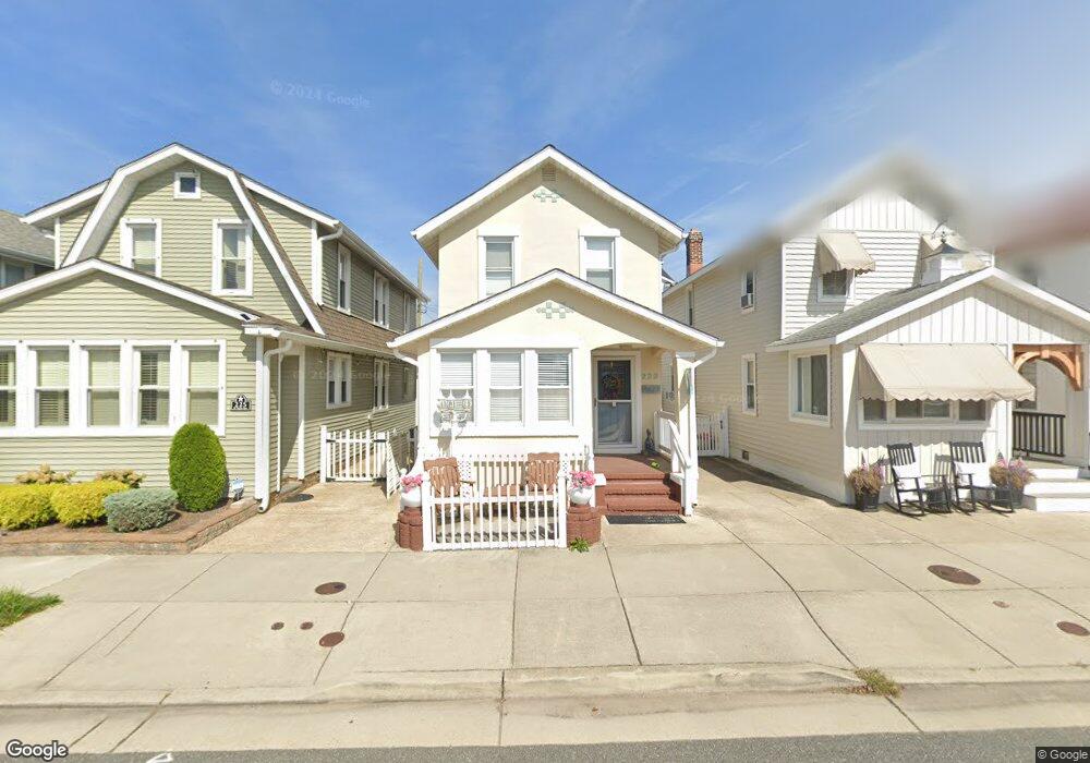
223 N Union Ave Margate City, NJ 08402
Estimated Value: $608,000 - $1,043,000
--
Bed
--
Bath
1,352
Sq Ft
$602/Sq Ft
Est. Value
About This Home
This home is located at 223 N Union Ave, Margate City, NJ 08402 and is currently estimated at $813,806, approximately $601 per square foot. 223 N Union Ave is a home located in Atlantic County with nearby schools including William H. Ross III Intermediate School, Eugene A. Tighe Middle School, and Blessed Sacrament Regional School.
Ownership History
Date
Name
Owned For
Owner Type
Purchase Details
Closed on
Jul 16, 2024
Sold by
Hionis Jerry and Hionis Effie
Bought by
Hionis Holdings Of New Jersey Llc
Current Estimated Value
Purchase Details
Closed on
Jun 30, 2003
Sold by
Francis Fathi
Bought by
Hionis Jerry and Hionis Effie
Home Financials for this Owner
Home Financials are based on the most recent Mortgage that was taken out on this home.
Original Mortgage
$150,000
Interest Rate
4.62%
Mortgage Type
Purchase Money Mortgage
Purchase Details
Closed on
May 27, 1997
Sold by
Francis Laila S
Bought by
Francis Fathi
Create a Home Valuation Report for This Property
The Home Valuation Report is an in-depth analysis detailing your home's value as well as a comparison with similar homes in the area
Home Values in the Area
Average Home Value in this Area
Purchase History
| Date | Buyer | Sale Price | Title Company |
|---|---|---|---|
| Hionis Holdings Of New Jersey Llc | -- | None Listed On Document | |
| Hionis Jerry | $230,000 | -- | |
| Hionis Jerry | $230,000 | -- | |
| Francis Fathi | -- | -- | |
| Francis Fathi F | $86,000 | -- |
Source: Public Records
Mortgage History
| Date | Status | Borrower | Loan Amount |
|---|---|---|---|
| Previous Owner | Hionis Jerry | $150,000 |
Source: Public Records
Tax History Compared to Growth
Tax History
| Year | Tax Paid | Tax Assessment Tax Assessment Total Assessment is a certain percentage of the fair market value that is determined by local assessors to be the total taxable value of land and additions on the property. | Land | Improvement |
|---|---|---|---|---|
| 2025 | $4,670 | $273,400 | $189,800 | $83,600 |
| 2024 | $4,670 | $273,400 | $189,800 | $83,600 |
| 2023 | $4,314 | $273,400 | $189,800 | $83,600 |
| 2022 | $4,314 | $273,400 | $189,800 | $83,600 |
| 2021 | $4,254 | $273,400 | $189,800 | $83,600 |
| 2020 | $4,232 | $273,400 | $189,800 | $83,600 |
| 2019 | $4,216 | $273,400 | $189,800 | $83,600 |
| 2018 | $4,273 | $273,400 | $189,800 | $83,600 |
| 2017 | $4,279 | $273,400 | $189,800 | $83,600 |
| 2016 | $4,134 | $273,400 | $189,800 | $83,600 |
| 2015 | $4,068 | $273,400 | $189,800 | $83,600 |
| 2014 | $3,992 | $273,400 | $189,800 | $83,600 |
Source: Public Records
Map
Nearby Homes
- 304 N Thurlow Ave
- 316 N Thurlow Ave
- 9007 Fremont Ave
- 116 N Wilson Ave Unit A
- 202 N Harding Ave
- 121 N Quincy Ave
- 215 N Decatur Ave
- 13 N Vendome Ave
- 437 N Rumson Ave
- 437 N Thurlow Ave
- 215 N Nassau Ave
- 201 N Washington Ave Unit 1
- 201 N Washington Ave Unit 3
- 201 N Washington Ave Unit 5
- 201 N Washington Ave Unit 2
- 201 N Washington Ave Unit 6
- 201 N Washington Ave Unit 4
- 302 N Mansfield Ave
- 9009 Ventnor Ave
- 2 N Pembroke Ave
- 221 N Union Ave
- 225 N Union Ave
- 227 N Union Ave
- 216 N Thurlow Ave
- 8906 Amherst Ave
- 220 N Thurlow Ave
- 207 N Union Ave
- 214 N Thurlow Ave
- 8904 Amherst Ave
- 212 N Thurlow Ave
- 216 N Union Ave
- 214 N Union Ave
- 218 N Union Ave
- 205 N Union Ave
- 210 N Thurlow Ave
- 9000 Amherst Ave
- 210 N Union Ave
- 8907 Amherst Ave
- 208 N Thurlow Ave
- 208 N Union Ave