Estimated Value: $626,000 - $901,000
3
Beds
2
Baths
1,344
Sq Ft
$547/Sq Ft
Est. Value
About This Home
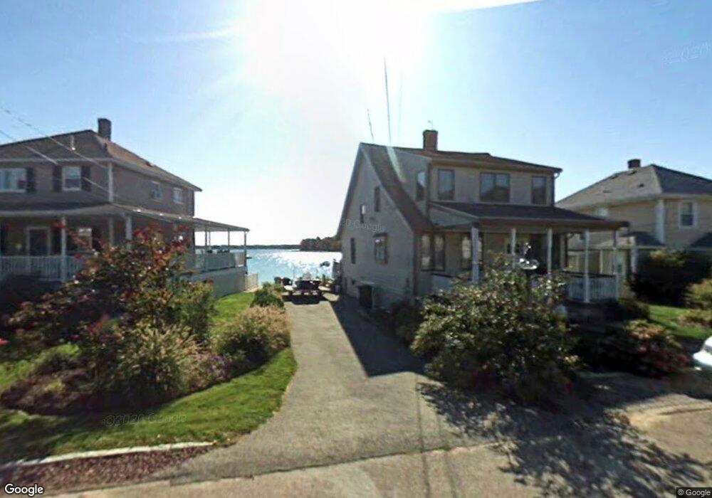
This home is located at 223 Nantasket Rd, Hull, MA 02045 and is currently estimated at $734,898, approximately $546 per square foot. 223 Nantasket Rd is a home located in Plymouth County with nearby schools including Lillian M. Jacobs Elementary School, Memorial Middle School, and Hull High School.
Ownership History
Date
Name
Owned For
Owner Type
Purchase Details
Closed on
Sep 1, 2015
Sold by
Cannon Patrick F and Cannon Gail E
Bought by
Cannon Gail E
Current Estimated Value
Purchase Details
Closed on
Sep 14, 1979
Bought by
Cannon Gail E
Create a Home Valuation Report for This Property
The Home Valuation Report is an in-depth analysis detailing your home's value as well as a comparison with similar homes in the area
Home Values in the Area
Average Home Value in this Area
Purchase History
| Date | Buyer | Sale Price | Title Company |
|---|---|---|---|
| Cannon Gail E | -- | -- | |
| Cannon Gail E | $35,000 | -- |
Source: Public Records
Mortgage History
| Date | Status | Borrower | Loan Amount |
|---|---|---|---|
| Previous Owner | Cannon Gail E | $50,000 | |
| Previous Owner | Cannon Gail E | $103,000 | |
| Previous Owner | Cannon Gail E | $50,000 |
Source: Public Records
Tax History Compared to Growth
Tax History
| Year | Tax Paid | Tax Assessment Tax Assessment Total Assessment is a certain percentage of the fair market value that is determined by local assessors to be the total taxable value of land and additions on the property. | Land | Improvement |
|---|---|---|---|---|
| 2025 | $8,345 | $745,100 | $402,200 | $342,900 |
| 2024 | $8,255 | $708,600 | $379,100 | $329,500 |
| 2023 | $7,971 | $655,000 | $346,700 | $308,300 |
| 2022 | $7,706 | $614,500 | $323,600 | $290,900 |
| 2021 | $6,698 | $528,200 | $268,200 | $260,000 |
| 2020 | $6,138 | $478,800 | $247,500 | $231,300 |
| 2019 | $14,608 | $465,300 | $247,500 | $217,800 |
| 2018 | $5,923 | $445,100 | $247,500 | $197,600 |
| 2017 | $14,298 | $431,700 | $247,500 | $184,200 |
| 2016 | $5,819 | $431,700 | $247,500 | $184,200 |
| 2015 | $5,788 | $415,200 | $231,000 | $184,200 |
| 2014 | $5,759 | $415,200 | $231,000 | $184,200 |
Source: Public Records
Map
Nearby Homes
- 221 Nantasket Rd
- 221 Nantasket Rd Unit 999
- 221 Nantasket Rd Unit 221
- 225 Nantasket Rd
- 225 Nantasket Rd
- 29 Clifton Ave
- 27 Clifton Ave
- 228 Nantasket Rd
- 25 Clifton Ave
- 220 Nantasket Rd
- 23 Clifton Ave
- 36 Clifton Ave
- 36 Clifton Ave Unit 1
- 36 Clifton Ave Unit House
- 36 Clifton Ave Unit 36
- 36 Clifton Ave Unit SF
- 36 Clifton Ave Unit single fami
- 218 Nantasket Rd
- 236 Nantasket Rd
- 216 Nantasket Rd Waterfrnt