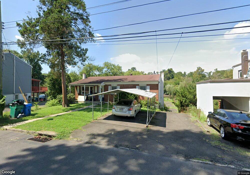
223 Neshaminy Rd Croydon, PA 19021
Estimated Value: $220,000 - $544,000
Studio
--
Bath
--
Sq Ft
4,792
Sq Ft Lot
About This Home
This home is located at 223 Neshaminy Rd, Croydon, PA 19021 and is currently estimated at $434,000. 223 Neshaminy Rd is a home located in Bucks County with nearby schools including Truman Senior High School, School Lane Charter School, and St Charles Borromeo School.
Ownership History
Date
Name
Owned For
Owner Type
Purchase Details
Closed on
Mar 15, 1995
Sold by
Marcinkowski Denise L
Bought by
Marcinkowski Denise and Lake Raymond
Current Estimated Value
Home Financials for this Owner
Home Financials are based on the most recent Mortgage that was taken out on this home.
Original Mortgage
$72,100
Interest Rate
5%
Purchase Details
Closed on
Dec 11, 1990
Bought by
Marcinkowski Bruno S and Marcinkowski Denise L
Create a Home Valuation Report for This Property
The Home Valuation Report is an in-depth analysis detailing your home's value as well as a comparison with similar homes in the area
Home Values in the Area
Average Home Value in this Area
Purchase History
| Date | Buyer | Sale Price | Title Company |
|---|---|---|---|
| Marcinkowski Denise | $53,000 | -- | |
| Marcinkowski Bruno S | -- | -- |
Source: Public Records
Mortgage History
| Date | Status | Borrower | Loan Amount |
|---|---|---|---|
| Closed | Marcinkowski Denise | $72,100 |
Source: Public Records
Tax History
| Year | Tax Paid | Tax Assessment Tax Assessment Total Assessment is a certain percentage of the fair market value that is determined by local assessors to be the total taxable value of land and additions on the property. | Land | Improvement |
|---|---|---|---|---|
| 2025 | $674 | $2,480 | $2,480 | -- |
| 2024 | $674 | $2,480 | $2,480 | $0 |
| 2023 | $669 | $2,480 | $2,480 | $0 |
| 2022 | $669 | $2,480 | $2,480 | $0 |
| 2021 | $669 | $2,480 | $2,480 | $0 |
| 2020 | $669 | $2,480 | $2,480 | $0 |
| 2019 | $666 | $2,480 | $2,480 | $0 |
| 2018 | $655 | $2,480 | $2,480 | $0 |
| 2017 | $645 | $2,480 | $2,480 | $0 |
| 2016 | $645 | $2,480 | $2,480 | $0 |
| 2015 | $500 | $2,480 | $2,480 | $0 |
| 2014 | $500 | $2,480 | $2,480 | $0 |
Source: Public Records
Map
Nearby Homes
- 208 Neshaminy Rd
- 311 Neshaminy Rd
- 0 Neshaminy St Unit PABU2089046
- 1051 Maple Ave
- 4517 E Yates Rd
- 4387 Bensalem Blvd
- 535 Princess Ave
- 1000 Stephen Ave
- 0 Allen Ave
- 910 Magnolia Ave
- 530 Main Ave
- 601 Fourth Ave
- 3933 Wrexham Ct
- 1004 Weybridge Ct
- 619 First Ave
- 618 Cedar Ave
- 200 Janet Ave
- 716 Rosa Ave
- 1706 Spencer Dr
- 813 Fifth Ave
- 227 Neshaminy Rd
- 221 Neshaminy Rd
- 231 Neshaminy Rd
- 219 Neshaminy Rd
- 235 Neshaminy Rd
- 215 Neshaminy Rd
- 239 Neshaminy Rd
- 218 Neshaminy Rd
- 209 Neshaminy Rd
- 228 Neshaminy Rd
- 205 Neshaminy Rd
- 212 Neshaminy Rd
- 243 Neshaminy Rd
- 219 Clover Ave
- 225 Clover Ave
- 217 Clover Ave
- 203 Neshaminy Rd
- 215 Clover Ave
- 202 Neshaminy Rd
- 153 Neshaminy Rd
Your Personal Tour Guide
Ask me questions while you tour the home.