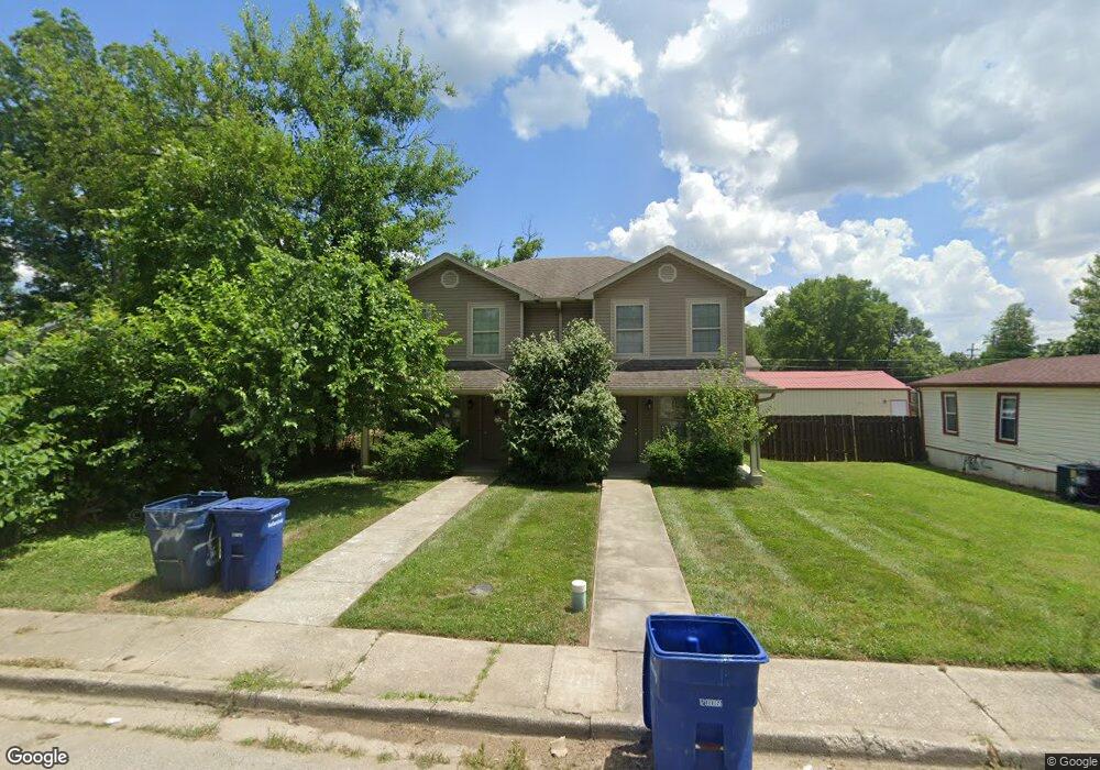
223 Popp Ave Sellersburg, IN 47172
Estimated Value: $217,000 - $261,000
4
Beds
2
Baths
964
Sq Ft
$251/Sq Ft
Est. Value
About This Home
This home is located at 223 Popp Ave, Sellersburg, IN 47172 and is currently estimated at $241,971, approximately $251 per square foot. 223 Popp Ave is a home located in Clark County with nearby schools including Rock Creek Community Academy and St. John Paul II Catholic School.
Ownership History
Date
Name
Owned For
Owner Type
Purchase Details
Closed on
Feb 20, 2024
Sold by
Agc Ventures Llc
Bought by
Sellersburg Commons Llc
Current Estimated Value
Purchase Details
Closed on
Oct 15, 2019
Sold by
Newburg Ventures Llc
Bought by
Jfn Llc
Purchase Details
Closed on
Sep 26, 2008
Sold by
First Savings Bank
Bought by
Newburg Ventures Llc
Create a Home Valuation Report for This Property
The Home Valuation Report is an in-depth analysis detailing your home's value as well as a comparison with similar homes in the area
Home Values in the Area
Average Home Value in this Area
Purchase History
| Date | Buyer | Sale Price | Title Company |
|---|---|---|---|
| Sellersburg Commons Llc | $243,000 | Agency Title | |
| Jfn Llc | -- | -- | |
| Newburg Ventures Llc | $23,077 | Mull & Heinz Llc |
Source: Public Records
Mortgage History
| Date | Status | Borrower | Loan Amount |
|---|---|---|---|
| Closed | Newburg Ventures Llc | $0 |
Source: Public Records
Tax History Compared to Growth
Tax History
| Year | Tax Paid | Tax Assessment Tax Assessment Total Assessment is a certain percentage of the fair market value that is determined by local assessors to be the total taxable value of land and additions on the property. | Land | Improvement |
|---|---|---|---|---|
| 2024 | $4,494 | $221,300 | $24,300 | $197,000 |
| 2023 | $4,504 | $221,800 | $21,900 | $199,900 |
| 2022 | $3,657 | $202,800 | $18,200 | $184,600 |
| 2021 | $2,900 | $148,700 | $13,800 | $134,900 |
| 2020 | $2,924 | $146,500 | $10,200 | $136,300 |
| 2019 | $3,028 | $148,000 | $10,200 | $137,800 |
| 2018 | $3,026 | $147,900 | $10,200 | $137,700 |
| 2017 | $3,018 | $147,500 | $10,200 | $137,300 |
| 2016 | $2,958 | $144,500 | $10,200 | $134,300 |
| 2014 | $3,004 | $200,700 | $10,200 | $190,500 |
| 2013 | -- | $178,900 | $10,200 | $168,700 |
Source: Public Records
Map
Nearby Homes
- 704 E Utica St Unit A
- 702 E Utica St Unit A&B
- 702 E Utica St Unit A
- 616 E Utica St
- 320 Kahl Ct
- 318 Villa Dr
- 819 E Utica St
- 332 Linnwood Ave
- 117 Allhands Ave
- 119 N Indiana Ave
- 407 N Indiana Ave
- 129 Haas Ln
- 450 N Indiana Ave
- 221 Indianola St
- 4217 Silver Glade Trail
- 4205 Miners Way
- 645 Hampton Ct
- 0 Highway 60 Unit 202509809
- 7307 Highway 311
- 627 Lane Ave