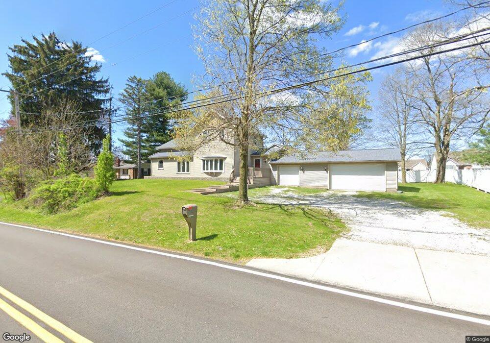
223 Randolph Rd Mogadore, OH 44260
Estimated Value: $275,816 - $318,000
4
Beds
2
Baths
2,348
Sq Ft
$123/Sq Ft
Est. Value
About This Home
This home is located at 223 Randolph Rd, Mogadore, OH 44260 and is currently estimated at $287,954, approximately $122 per square foot. 223 Randolph Rd is a home located in Portage County with nearby schools including O.H. Somers Elementary School, Mogadore High School, and Summit Academy Akron Elementary School.
Ownership History
Date
Name
Owned For
Owner Type
Purchase Details
Closed on
Jan 27, 2026
Sold by
Sampsel Lucas
Bought by
Lucas A Sampsel Revocable Trust and Sampsel
Current Estimated Value
Purchase Details
Closed on
Mar 24, 2022
Sold by
Lindsey Roger N
Bought by
Sampsel Lucas
Home Financials for this Owner
Home Financials are based on the most recent Mortgage that was taken out on this home.
Original Mortgage
$213,186
Interest Rate
4.42%
Mortgage Type
FHA
Purchase Details
Closed on
Jun 29, 1998
Sold by
Lindsey Kimberly A
Bought by
Lindsey Roger N
Home Financials for this Owner
Home Financials are based on the most recent Mortgage that was taken out on this home.
Original Mortgage
$76,000
Interest Rate
7.27%
Mortgage Type
New Conventional
Create a Home Valuation Report for This Property
The Home Valuation Report is an in-depth analysis detailing your home's value as well as a comparison with similar homes in the area
Home Values in the Area
Average Home Value in this Area
Purchase History
| Date | Buyer | Sale Price | Title Company |
|---|---|---|---|
| Lucas A Sampsel Revocable Trust | -- | None Listed On Document | |
| Sampsel Lucas | $125 | Law Offices Of Robert E Soles | |
| Lindsey Roger N | $80,000 | -- |
Source: Public Records
Mortgage History
| Date | Status | Borrower | Loan Amount |
|---|---|---|---|
| Previous Owner | Sampsel Lucas | $213,186 | |
| Previous Owner | Lindsey Roger N | $76,000 |
Source: Public Records
Tax History
| Year | Tax Paid | Tax Assessment Tax Assessment Total Assessment is a certain percentage of the fair market value that is determined by local assessors to be the total taxable value of land and additions on the property. | Land | Improvement |
|---|---|---|---|---|
| 2024 | $3,829 | $83,690 | $7,490 | $76,200 |
| 2023 | $3,279 | $64,370 | $5,810 | $58,560 |
| 2022 | $3,652 | $64,370 | $5,810 | $58,560 |
| 2021 | $3,559 | $64,370 | $5,810 | $58,560 |
| 2020 | $3,233 | $54,220 | $5,810 | $48,410 |
| 2019 | $3,378 | $54,220 | $5,810 | $48,410 |
| 2018 | $2,744 | $42,910 | $6,370 | $36,540 |
| 2017 | $2,744 | $42,910 | $6,370 | $36,540 |
| 2016 | $2,830 | $42,910 | $6,370 | $36,540 |
| 2015 | $2,893 | $42,910 | $6,370 | $36,540 |
| 2014 | $2,539 | $42,910 | $6,370 | $36,540 |
| 2013 | $2,558 | $42,910 | $6,370 | $36,540 |
Source: Public Records
Map
Nearby Homes
- 4165 Ledgewater Dr
- 2355 Martin Rd
- 38 Walnut Ct
- 3935 Virgil St
- 3755 Louise St
- 2671 Spring Valley Blvd
- 3774 Argonne St
- 360 James Ave
- 432 Edith Ave
- V/L Southeast Ave
- 553 Celia Ave
- 233 Marion Ave
- 3228 Carper Ave
- 99 Meadowridge Rd
- 151 Meadowridge Rd
- 117 Wilpark Dr
- 3189-3197 Albrecht Ave
- 40 Hyland Dr
- 81 Hyland Dr
- 3192 Mogadore Rd
- 32 Stonecreek Dr
- 213 Randolph Rd
- 4152 Millstone Ln
- 232 Randolph Rd
- 38 Stonecreek Dr
- 238 Randolph Rd
- 244 Randolph Rd
- 4149 Millstone Ln
- 60 Stonecreek Dr
- 212 Randolph Rd
- 52 Stonecreek Dr
- 4158 Millstone Ln
- 44 Stonecreek Dr
- 4155 Millstone Ln
- 24 Wynstone Dr
- 28 Wynstone Dr
- 4161 Millstone Ln
- 32 Wynstone Dr
- 220 Randolph Rd
- 40 Wynstone Dr
Your Personal Tour Guide
Ask me questions while you tour the home.