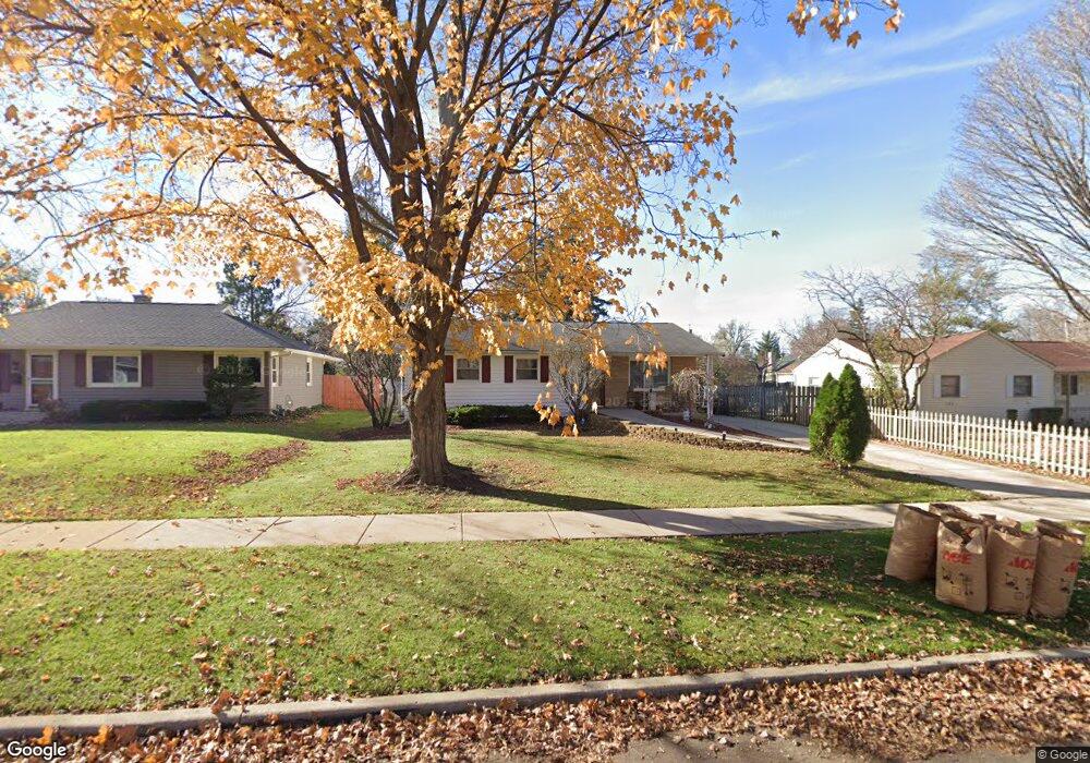
223 S Randall Rd Aurora, IL 60506
University Neighbors NeighborhoodEstimated Value: $294,915 - $323,000
3
Beds
2
Baths
1,272
Sq Ft
$242/Sq Ft
Est. Value
About This Home
This home is located at 223 S Randall Rd, Aurora, IL 60506 and is currently estimated at $307,729, approximately $241 per square foot. 223 S Randall Rd is a home located in Kane County with nearby schools including Freeman Elementary School, Washington Middle School, and West Aurora High School.
Ownership History
Date
Name
Owned For
Owner Type
Purchase Details
Closed on
Jul 18, 2014
Sold by
The Northern Trust Company
Bought by
The Northern Trust Company and Xzavier Guerrero Special Needs Trust
Current Estimated Value
Purchase Details
Closed on
Jun 13, 2007
Sold by
Colyer Jill A
Bought by
The Northern Trust Co and Estate Of Xzavier Guerrero
Purchase Details
Closed on
Mar 2, 2007
Sold by
Morrison John K
Bought by
Colyer Jill A
Purchase Details
Closed on
Nov 20, 2003
Sold by
Ward Michael K and Ward Joy L
Bought by
Colyer Jill A
Home Financials for this Owner
Home Financials are based on the most recent Mortgage that was taken out on this home.
Original Mortgage
$166,250
Interest Rate
7.45%
Mortgage Type
Unknown
Create a Home Valuation Report for This Property
The Home Valuation Report is an in-depth analysis detailing your home's value as well as a comparison with similar homes in the area
Home Values in the Area
Average Home Value in this Area
Purchase History
| Date | Buyer | Sale Price | Title Company |
|---|---|---|---|
| The Northern Trust Company | -- | None Available | |
| The Northern Trust Co | $210,000 | Chicago Title Insurance Co | |
| Colyer Jill A | -- | None Available | |
| Colyer Jill A | $175,000 | Chicago Title Insurance Comp |
Source: Public Records
Mortgage History
| Date | Status | Borrower | Loan Amount |
|---|---|---|---|
| Previous Owner | Colyer Jill A | $166,250 |
Source: Public Records
Tax History Compared to Growth
Tax History
| Year | Tax Paid | Tax Assessment Tax Assessment Total Assessment is a certain percentage of the fair market value that is determined by local assessors to be the total taxable value of land and additions on the property. | Land | Improvement |
|---|---|---|---|---|
| 2024 | $5,762 | $80,767 | $17,951 | $62,816 |
| 2023 | $5,496 | $72,165 | $16,039 | $56,126 |
| 2022 | $5,297 | $65,844 | $14,634 | $51,210 |
| 2021 | $5,053 | $61,301 | $13,624 | $47,677 |
| 2020 | $4,769 | $56,940 | $12,655 | $44,285 |
| 2019 | $4,572 | $52,756 | $11,725 | $41,031 |
| 2018 | $4,596 | $52,035 | $10,845 | $41,190 |
| 2017 | $4,862 | $53,239 | $9,993 | $43,246 |
| 2016 | $4,680 | $50,050 | $8,994 | $41,056 |
| 2015 | -- | $44,229 | $7,734 | $36,495 |
| 2014 | -- | $41,284 | $7,108 | $34,176 |
| 2013 | -- | $41,749 | $7,149 | $34,600 |
Source: Public Records
Map
Nearby Homes
- 203 S Calumet Ave
- 164 S Calumet Ave
- 149 S Gladstone Ave
- 231 W Downer Place
- 237 Ingleside Ave
- 425 Ingleside Ave
- 1143 Ridgeway Ave
- 537 Hartford Ave
- 175 S Harrison Ave
- 115 Hillwood Place Unit 4B
- 1730 W Galena Blvd Unit 402E
- 113 Stonewood Place Unit 6D
- 931 W Downer Place
- 930 W New York St Unit 932
- 850 W Galena Blvd
- 823 Lenwood Ct
- 1735 Greene Ct
- 1751 Greene Ct
- 652 Hartford Ave
- 522 Kingsway Dr W
- 227 S Randall Rd
- 215 S Randall Rd
- 233 S Randall Rd
- 211 S Randall Rd
- 222 S Glenwood Place
- 220 S Glenwood Place
- 226 S Glenwood Place
- 207 S Randall Rd
- 210 S Glenwood Place
- 230 S Glenwood Place
- 243 S Randall Rd
- 222 S Randall Rd
- 226 S Randall Rd
- 218 S Randall Rd
- 208 S Glenwood Place
- 214 S Randall Rd
- 1404 Kensington Place
- 238 S Glenwood Place
- 210 S Randall Rd
- 204 S Glenwood Place