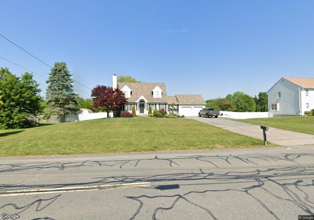
223 Scadding St Taunton, MA 02780
Prospect Hill NeighborhoodEstimated Value: $574,000 - $580,000
3
Beds
2
Baths
1,783
Sq Ft
$324/Sq Ft
Est. Value
About This Home
This home is located at 223 Scadding St, Taunton, MA 02780 and is currently estimated at $577,942, approximately $324 per square foot. 223 Scadding St is a home located in Bristol County with nearby schools including Benjamin Friedman Middle School, Joseph C. Chamberlain Elementary School, and Taunton High School.
Ownership History
Date
Name
Owned For
Owner Type
Purchase Details
Closed on
Dec 11, 2024
Sold by
Gulan John W and Gulan Paige M
Bought by
Gulan Ft and Gulan
Current Estimated Value
Purchase Details
Closed on
Jul 27, 2015
Sold by
Gulan John W
Bought by
Gulan John W and Anreau Paige M
Create a Home Valuation Report for This Property
The Home Valuation Report is an in-depth analysis detailing your home's value as well as a comparison with similar homes in the area
Home Values in the Area
Average Home Value in this Area
Purchase History
| Date | Buyer | Sale Price | Title Company |
|---|---|---|---|
| Gulan Ft | -- | None Available | |
| Gulan Ft | -- | None Available | |
| Gulan John W | -- | -- | |
| Gulan John W | -- | -- |
Source: Public Records
Tax History
| Year | Tax Paid | Tax Assessment Tax Assessment Total Assessment is a certain percentage of the fair market value that is determined by local assessors to be the total taxable value of land and additions on the property. | Land | Improvement |
|---|---|---|---|---|
| 2025 | $5,796 | $529,800 | $141,200 | $388,600 |
| 2024 | $5,348 | $477,900 | $141,200 | $336,700 |
| 2023 | $5,288 | $438,800 | $147,600 | $291,200 |
| 2022 | $4,861 | $368,800 | $114,400 | $254,400 |
| 2021 | $968 | $338,900 | $104,000 | $234,900 |
| 2020 | $4,586 | $308,600 | $104,000 | $204,600 |
| 2019 | $4,544 | $297,700 | $104,000 | $193,700 |
| 2018 | $4,468 | $284,200 | $105,100 | $179,100 |
| 2017 | $4,321 | $270,000 | $99,600 | $170,400 |
| 2016 | $4,078 | $260,100 | $96,700 | $163,400 |
| 2015 | $4,057 | $270,300 | $99,700 | $170,600 |
| 2014 | -- | $262,900 | $99,700 | $163,200 |
Source: Public Records
Map
Nearby Homes
- 170 Lake Ridge Dr
- 9 Musket Rd
- 6 John Alden Rd
- 9 Valley Forge Rd
- 11 Settlers Rd
- 13 Daisy Ave
- 41 Scadding St
- 146 Field St
- 68 Sabbatia Ln
- 930 Bay St
- 191 Red Oak Terrace
- 19 Abbey Ln
- 0 Montclair Ave Unit 72130752
- 109 Partridge Cir
- 750 Whittenton St Unit 221
- 634 Broadway
- 646 Broadway
- 314 Britton St
- 138 Carver St
- 563 Whittenton St
- 219 Scadding St
- 227 Scadding St
- 215 Scadding St
- 15 Lake Ridge Dr
- 10 Lake Ridge Dr
- 231 Scadding St
- 230 Scadding St
- 214 Scadding St
- 211 Scadding St
- 24 Lake Ridge Dr
- 233 Scadding St
- 232 Scadding St
- 15 W Lake Dr
- 212 Scadding St
- 209 Scadding St
- 40 Lake Ridge Dr
- 210 Scadding St
- 12 W Lake Dr
- 35 W Lake Dr
- 208 Scadding St
Your Personal Tour Guide
Ask me questions while you tour the home.