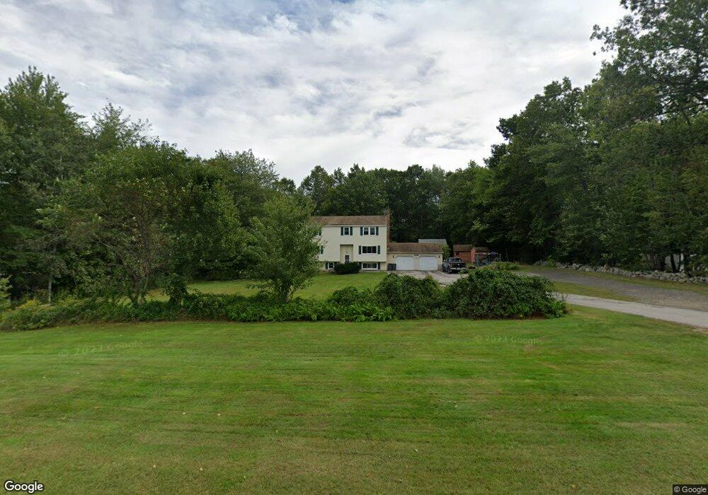
223 Whitehall Rd Hooksett, NH 03106
Estimated Value: $624,595 - $708,000
3
Beds
3
Baths
2,100
Sq Ft
$320/Sq Ft
Est. Value
About This Home
This home is located at 223 Whitehall Rd, Hooksett, NH 03106 and is currently estimated at $672,149, approximately $320 per square foot. 223 Whitehall Rd is a home located in Merrimack County with nearby schools including Fred C. Underhill School, Hooksett Memorial School, and David R. Cawley Middle School.
Ownership History
Date
Name
Owned For
Owner Type
Purchase Details
Closed on
May 21, 2021
Sold by
Wright Elizabeth A and Wright Steven D
Bought by
Wright Elizabeth A and Wright Steven D
Current Estimated Value
Home Financials for this Owner
Home Financials are based on the most recent Mortgage that was taken out on this home.
Original Mortgage
$185,750
Interest Rate
2.9%
Mortgage Type
Stand Alone Refi Refinance Of Original Loan
Purchase Details
Closed on
Jul 3, 2001
Sold by
Cote Arthur and Cote Joan
Bought by
Wright Steven D and Wright Elizabeth S
Create a Home Valuation Report for This Property
The Home Valuation Report is an in-depth analysis detailing your home's value as well as a comparison with similar homes in the area
Home Values in the Area
Average Home Value in this Area
Purchase History
We collect this data history from publicly available records. To have your information removed, we recommend requesting removal directly through your county’s website.
| Date | Buyer | Sale Price | Title Company |
|---|---|---|---|
| Wright Elizabeth A | -- | None Available | |
| Wright Elizabeth A | -- | None Available | |
| Wright Steven D | $210,600 | -- | |
| Wright Steven D | $210,600 | -- |
Source: Public Records
Mortgage History
We collect this data history from publicly available records. To have your information removed, we recommend requesting removal directly through your county’s website.
| Date | Status | Borrower | Loan Amount |
|---|---|---|---|
| Previous Owner | Wright Elizabeth A | $185,750 | |
| Previous Owner | Wright Steven D | $232,000 | |
| Previous Owner | Wright Steven D | $232,000 | |
| Previous Owner | Wright Steven D | $232,000 |
Source: Public Records
Tax History
| Year | Tax Paid | Tax Assessment Tax Assessment Total Assessment is a certain percentage of the fair market value that is determined by local assessors to be the total taxable value of land and additions on the property. | Land | Improvement |
|---|---|---|---|---|
| 2025 | $9,295 | $540,700 | $131,000 | $409,700 |
| 2024 | $9,170 | $540,700 | $131,000 | $409,700 |
| 2023 | $8,640 | $540,700 | $128,000 | $412,700 |
| 2022 | $7,732 | $321,500 | $87,700 | $233,800 |
| 2021 | $7,144 | $321,500 | $87,700 | $233,800 |
| 2020 | $7,237 | $321,500 | $87,700 | $233,800 |
| 2019 | $6,928 | $321,500 | $87,700 | $233,800 |
| 2018 | $4,311 | $321,500 | $87,700 | $233,800 |
| 2017 | $6,955 | $260,100 | $86,600 | $173,500 |
| 2016 | $6,864 | $260,100 | $86,600 | $173,500 |
| 2015 | $6,430 | $260,100 | $86,600 | $173,500 |
| 2014 | $6,458 | $260,100 | $86,600 | $173,500 |
| 2013 | $6,107 | $260,100 | $86,600 | $173,500 |
Source: Public Records
Map
Nearby Homes
- 199 Whitehall Rd
- 197-199 Whitehall Rd
- 110 Laurel Rd Unit 31
- 347 and 26 Whitehall Road and Chester Turnpike
- 2 Strawberry Ln
- 63 Chester Turnpike
- 9 Whitehall Terrace
- 11 Whitehall Terrace
- 6 Nancy Ln
- 375 Whitehall Rd
- 10 Virginia Ct
- 71 Auburn Rd
- 267 Londonderry Turnpike
- 8 Lincoln Dr Unit B
- 3 Kerri Ln Unit A
- 21 Harvest Dr
- 192 Londonderry Turnpike
- 885 High St
- 757 Hooksett Rd
- 6 High St
- 219 Whitehall Rd
- 227 Whitehall Rd
- 215 Whitehall Rd
- 213 Whitehall Rd
- 231 Whitehall Rd
- 230 Whitehall Rd
- 210 Whitehall Rd
- 222 Whitehall Rd
- 220 Whitehall Rd
- 3 Craneway
- 235 Whitehall Rd
- 207 Whitehall Rd
- 208A Whitehall Rd
- 239 Whitehall Rd
- 208 Whitehall Rd
- 4 Farrwood Dr
- 1 Farrwood Dr
- 205 Whitehall Rd
- 347 Whitehall Rd
- 241 Whitehall Rd
Your Personal Tour Guide
Ask me questions while you tour the home.