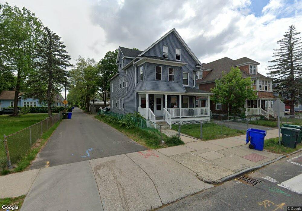
223 Wilbraham Rd Springfield, MA 01109
Upper Hill NeighborhoodEstimated Value: $296,590 - $404,000
10
Beds
3
Baths
3,476
Sq Ft
$104/Sq Ft
Est. Value
About This Home
This home is located at 223 Wilbraham Rd, Springfield, MA 01109 and is currently estimated at $362,648, approximately $104 per square foot. 223 Wilbraham Rd is a home located in Hampden County with nearby schools including M Marcus Kiley Middle, Springfield High School of Science and Technology, and Roger L. Putnam Vocational Technical Academy.
Ownership History
Date
Name
Owned For
Owner Type
Purchase Details
Closed on
Apr 28, 2014
Sold by
Linear Mortgage Llc
Bought by
Solis Dannys
Current Estimated Value
Purchase Details
Closed on
Nov 9, 2004
Sold by
Cotti Martina A and Cotti Paul M
Bought by
Icart Carlo and Icart Mitchell
Create a Home Valuation Report for This Property
The Home Valuation Report is an in-depth analysis detailing your home's value as well as a comparison with similar homes in the area
Home Values in the Area
Average Home Value in this Area
Purchase History
| Date | Buyer | Sale Price | Title Company |
|---|---|---|---|
| Solis Dannys | $57,000 | -- | |
| Linear Mortgage Llc | $107,341 | -- | |
| Icart Carlo | $116,000 | -- | |
| Icart Carlo | $116,000 | -- |
Source: Public Records
Tax History Compared to Growth
Tax History
| Year | Tax Paid | Tax Assessment Tax Assessment Total Assessment is a certain percentage of the fair market value that is determined by local assessors to be the total taxable value of land and additions on the property. | Land | Improvement |
|---|---|---|---|---|
| 2025 | $3,586 | $228,700 | $30,000 | $198,700 |
| 2024 | $2,256 | $140,500 | $30,000 | $110,500 |
| 2023 | $2,389 | $140,100 | $27,300 | $112,800 |
| 2022 | $2,708 | $143,900 | $25,500 | $118,400 |
| 2021 | $2,109 | $111,600 | $18,100 | $93,500 |
| 2020 | $2,187 | $112,000 | $18,100 | $93,900 |
| 2019 | $2,029 | $103,100 | $15,400 | $87,700 |
| 2018 | $2,029 | $103,100 | $15,400 | $87,700 |
| 2017 | $1,866 | $94,900 | $14,500 | $80,400 |
| 2016 | $1,587 | $80,700 | $14,500 | $66,200 |
| 2015 | $1,556 | $79,100 | $14,500 | $64,600 |
Source: Public Records
Map
Nearby Homes
- 19 Westford Ave
- 88 Dunmoreland St
- 62-64 Bristol St
- 43 Colonial Ave
- 124-126 Westford Cir
- 58 Willard Ave
- 135-137 Suffolk St
- 21 Westford Cir
- 179 Albemarle St
- 65 Montrose St
- 111 Marlborough St
- 140 Northampton Ave
- 15 Kenyon St
- 162 Northampton Ave
- 52-56 Andrew St
- 158 Norfolk St
- 67 Carlisle St
- 192-194 Westford Ave
- 81 Hayden Ave
- 290 Quincy St
- 227 Wilbraham Rd
- 221 Wilbraham Rd
- 225 Wilbraham Rd
- 211 Wilbraham Rd
- 11 Albemarle St
- 229 Wilbraham Rd
- 207 Wilbraham Rd
- 19 Albemarle St
- 19 Albemarle St Unit 3
- 241 Wilbraham Rd
- 203 Wilbraham Rd
- 16 Albemarle St
- 19 Villa Pkwy
- 201 Wilbraham Rd
- 14 Rochelle St Unit 16
- 243 Wilbraham Rd Unit 245
- 27 Albemarle St
- 23 Villa Pkwy
- 22 Albemarle St Unit 24
- 20 Rochelle St