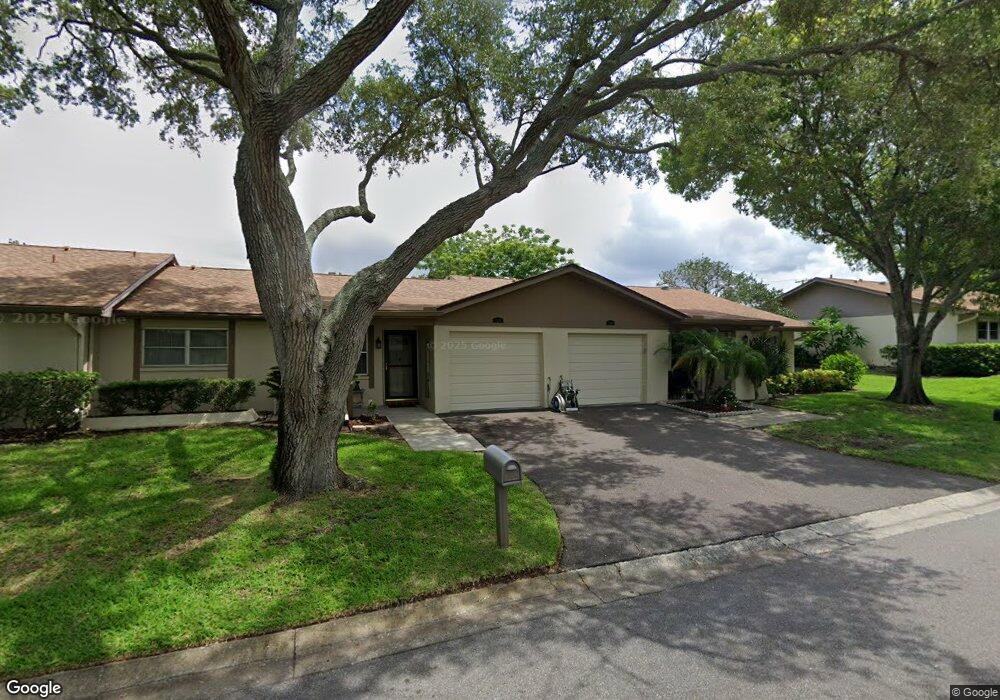
2230 Marshall Dr Unit 2230 Dunedin, FL 34698
Estimated Value: $170,492 - $302,000
--
Bed
--
Bath
1,040
Sq Ft
$228/Sq Ft
Est. Value
About This Home
This home is located at 2230 Marshall Dr Unit 2230, Dunedin, FL 34698 and is currently estimated at $237,373, approximately $228 per square foot. 2230 Marshall Dr Unit 2230 is a home located in Pinellas County with nearby schools including Garrison-Jones Elementary School, Dunedin Highland Middle School, and Dunedin High School.
Ownership History
Date
Name
Owned For
Owner Type
Purchase Details
Closed on
Apr 17, 2006
Sold by
Murray Donald G and Murray Rita J
Bought by
Carr Charles H and Carr Patricia E
Current Estimated Value
Home Financials for this Owner
Home Financials are based on the most recent Mortgage that was taken out on this home.
Original Mortgage
$135,200
Outstanding Balance
$77,470
Interest Rate
6.31%
Mortgage Type
Fannie Mae Freddie Mac
Estimated Equity
$159,903
Purchase Details
Closed on
Dec 12, 2002
Sold by
Bowen Mary C
Bought by
Murray Donald G and Murray Rita J
Create a Home Valuation Report for This Property
The Home Valuation Report is an in-depth analysis detailing your home's value as well as a comparison with similar homes in the area
Home Values in the Area
Average Home Value in this Area
Purchase History
| Date | Buyer | Sale Price | Title Company |
|---|---|---|---|
| Carr Charles H | $169,000 | Security First Title Partner | |
| Murray Donald G | $62,000 | -- |
Source: Public Records
Mortgage History
| Date | Status | Borrower | Loan Amount |
|---|---|---|---|
| Open | Carr Charles H | $135,200 |
Source: Public Records
Tax History Compared to Growth
Tax History
| Year | Tax Paid | Tax Assessment Tax Assessment Total Assessment is a certain percentage of the fair market value that is determined by local assessors to be the total taxable value of land and additions on the property. | Land | Improvement |
|---|---|---|---|---|
| 2024 | $2,400 | $185,205 | -- | $185,205 |
| 2023 | $2,400 | $163,016 | $0 | $163,016 |
| 2022 | $2,152 | $140,882 | $0 | $140,882 |
| 2021 | $1,932 | $108,845 | $0 | $0 |
| 2020 | $1,804 | $102,441 | $0 | $0 |
| 2019 | $1,625 | $88,534 | $0 | $88,534 |
| 2018 | $1,465 | $76,709 | $0 | $0 |
| 2017 | $1,437 | $74,070 | $0 | $0 |
| 2016 | $1,448 | $75,854 | $0 | $0 |
| 2015 | $1,383 | $73,549 | $0 | $0 |
| 2014 | $1,248 | $67,994 | $0 | $0 |
Source: Public Records
Map
Nearby Homes
- 2200 Marshall Dr
- 17 Sophie Ave
- 1497 Heather Ridge Blvd
- 1556 Lynda Ln
- 10 Sophie Ave Unit 10
- 6 Sophie Ave
- 65 Lone Pine Ave
- 1291 Stony Brook Ln
- 1450 Heather Ridge Blvd Unit 307
- 1450 Heather Ridge Blvd Unit 305
- 1450 Heather Ridge Blvd Unit 107
- 96 Fred Ave
- 2198 Andrews Ct
- 80 John F. Kennedy St Unit 80
- 1844 Teakwood Ln
- 106 Diogenes St Unit 106
- 2188 Elm St Unit 1107
- 2119 Elm St Unit 103
- 2119 Elm St Unit 101
- 1127 King Arthur Ct Unit 308
- 2228 Marshall Dr
- 2248 Marshall Dr
- 2250 Marshall Dr Unit 2250
- 2210 Marshall Dr Unit 2210
- 2207 Marshall Dr
- 2204 Marshall Dr
- 2258 Marshall Dr
- 2196 Marshall Dr
- 2218 Marshall Dr
- 2191 Marshall Dr
- 2210 Nimitz Dr
- 2201 Marshall Dr Unit 2201
- 2201 Marshall Dr
- 2188 Nimitz Dr
- 2194 Nimitz Dr
- 2197 Marshall Dr
- 2188 Nimitz Dr Unit 2188
- 2194 Nimitz Dr Unit 2194
- 2238 Marshall Dr